Now That’s What I Call a Cold Front
Some cold fronts sweep through virtually unnoticed. Others crash through with the ugly blow of someone ripping the covers off of you in the morning. That is to say, rude.
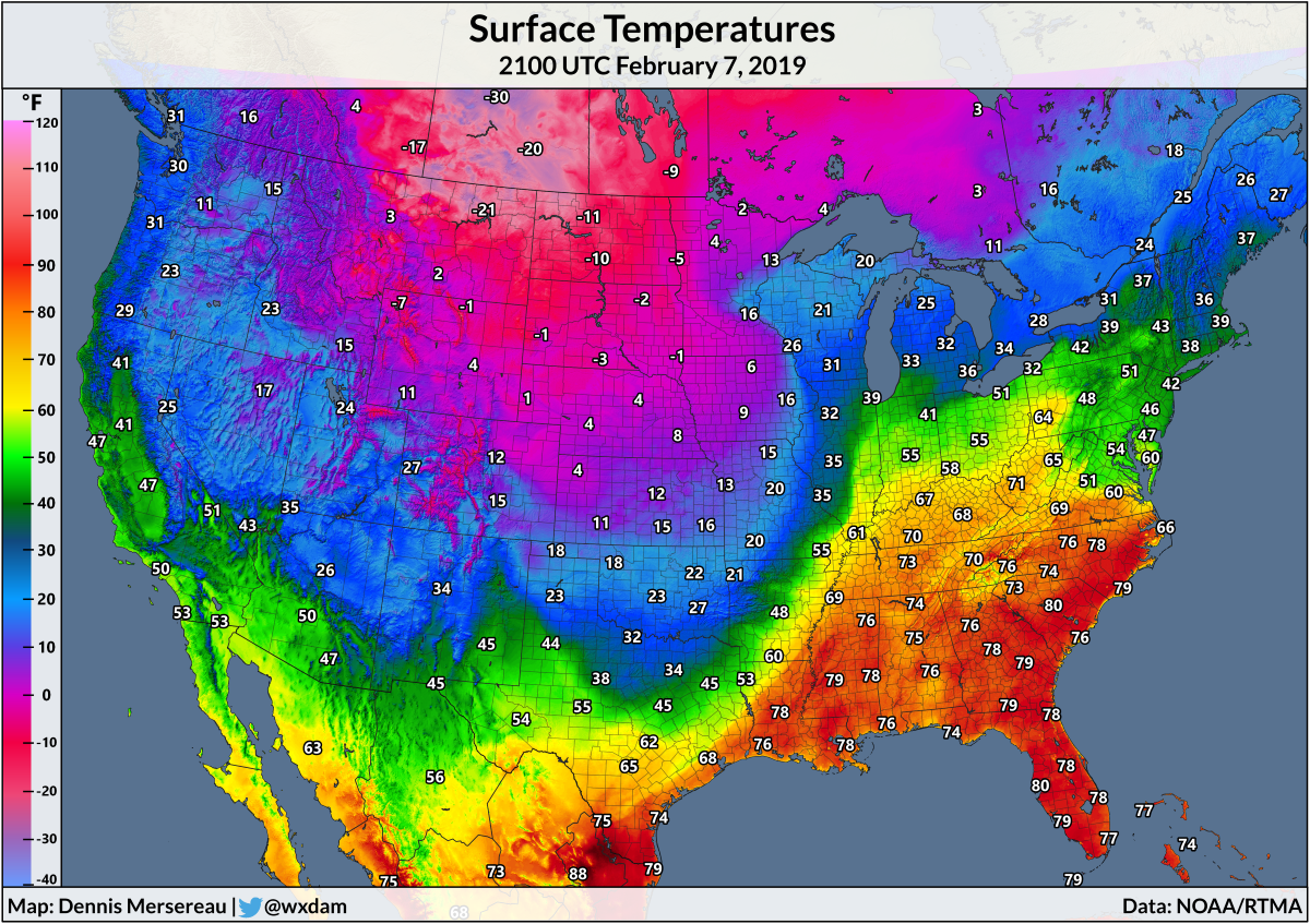
Winds swirling around a low pressure system up near the Arctic Circle and a broad area of high pressure near the Rockies on the international border are forcing (relatively) frigid air from Canada to filter south across the western and central United States. The cold front is moving slowly and it’s one of those fronts that has an incredible gradient over very short distances—at 8:00 PM CST, it was 68°F in Dallas and just 39°F in Oklahoma City. When it passes through, you know it passed through.
These dramatic fronts often have severe weather along the leading edge, as the powerful lifting created by the cold air colliding with the warm, moist air is usually enough to trigger an intense line of thunderstorms, but we don’t have that today. The front is moving slow enough that a broader area of heavy rain and thunderstorms has set up along the boundary, and even without destructive winds or photogenic tornadoes, it’s creating some pretty big issues on the Plains this holiday weekend.
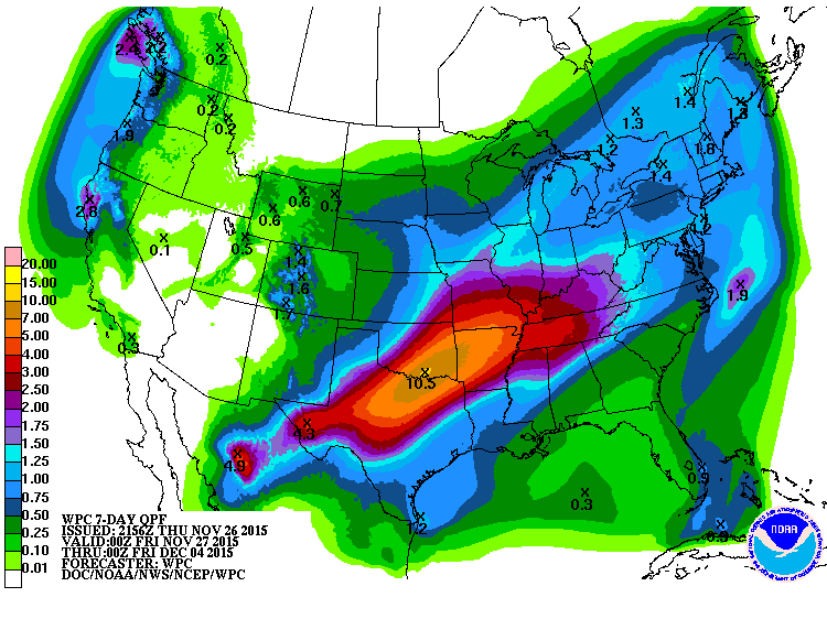
On the warm side of the front, folks are dealing with very heavy rainfall that will almost certainly lead to flooding issues under the heaviest precipitation. Thursday night’s forecast from the Weather Prediction Center showed a huge area of more than half a foot of rain falling on the southern Plains and portions of the Deep South, with the heaviest rain concentrated over Texas and Oklahoma.
A few hundred miles deeper into the cold air, though, it’s a wintry disaster. The cold air is dense and hugging the ground, so it’s undercutting the warmer air as it slides south and east. A few thousand feet above the ground, it’s not raining, it’s snowing! As the snowflakes fall into the warmer air, however, they start to melt. If the layer of warm air is thick enough, the snowflake will completely melt into a liquid raindrop before falling back into sub-freezing air.
This newly-formed liquid raindrop falls into the air that’s below 32°F, causing it to cool down to freezing. Since it doesn’t have a nucleus around which it can refreeze, the temperature of the water continues to drop below freezing, becoming a supercooled liquid. Once this supercooled drop hits just about any exposed surface—trees, roads, sidewalks, railings, cars, lights, gutters—it instantly freezes into a layer of ice.
It usually takes about 0.25″ of ice accretion to start causing damage in the form of downed branches, limbs, and power lines. Accretions greater than one-quarter of an inch can cause even greater damage, and once you get above half an inch, it can turn into a disaster. Significant damage to trees, power lines, and even large structures like transmission towers can snap or crumple under the immense weight of the ice, affecting the area for weeks (or even months) after the ice storm.
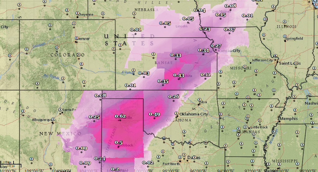
As of late Thursday night, local National Weather Service offices predicted more than a half an inch of ice across the Texas Panhandle and western Oklahoma, and more than a quarter of an inch of ice from eastern New Mexico through northwestern Missouri.
This is bad news any day of the year, but especially so during the extremely busy Thanksgiving travel period. It’s possible (to an extent) to drive on snow, but even the most experienced drivers driving the most well-equipped car can’t drive on roads encased in solid ice. We’re going to see widespread power outages just about anywhere the freezing rain falls, and if people don’t heed the days of advanced warning they’ve had, we’ll see large numbers of car accidents.
It’s just the start of what could be an active winter. It should be a fun one.
[Temp. Map: Author | Rain Forecast: WPC | Ice Forecast: NWS EDD]

