
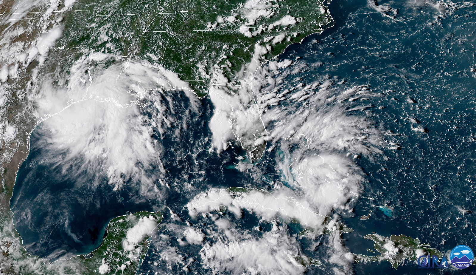
Appearances aren’t everything. The satellite image at the top of this post shows two interesting features approaching the United States. The system that looks most like a tropical cyclone isn’t, while the system that looks less impressive is the feature that’s expected to become Tropical Storm Gordon in a couple of days. Both systems will bring heavy rain to the Gulf Coast through the middle of the week.

Potential Tropical Cyclone Seven over The Bahamas isn’t yet a tropical depression or tropical storm, but it’s expected to become one soon. The National Hurricane Center calls systems “potential tropical cyclones” if they’re developing near land and forecasters need to issue watches and warnings before the storm has officially formed. This gives people enough advanced notice to prepare without getting lost in the technical weeds.

The latest NHC forecast shows that possible-Gordon could pack winds of 60 MPH when it approaches landfall on the southeastern Louisiana coast on Tuesday. While Gordon’s biggest threat is heavy rainfall, winds that strong could bring down trees and power lines, especially on soggy ground.
Several inches of rain are likely along the path of this storm as well as the disturbance currently drenching parts of Texas and Louisiana. The tropical system’s forward speed—it’s expected to keep moving!—should limit excessive rainfall totals, but there’s a widespread potential for 3-6″ of rain where the storm makes landfall, and even higher totals in areas stuck under training thunderstorms. Any slowdown in the storm’s motion could result in heavier rain than anticipated.
We have several tropical interests in the Atlantic right now. The peak of the season is next week and it sure shows—Tropical Storm Florence is out in the middle of the ocean and there’s another wave coming off Africa behind it. Conditions are favorable for systems to develop in the Atlantic, so we’ll have to keep an eye on what’s behind possible-Gordon over the next week or two.
[Satellite: RAMMB/CIRA]
Please consider subscribing to my Patreon. Reader-funded news is more important than ever and your support helps fund engaging, hype-free weather coverage.