

The growing heat wave in the Pacific Northwest could be the worst in living memory as predicted highs would shatter all-time temperature records across the region. This part of the country is not equipped to handle a long-duration extreme heat event like this. Daytime high temperatures will soar well above 100°F in many areas, scorching communities where most homes do not have air conditioning. Please treat this heat wave as the weather emergency it is. It’s no joke.
All-Time Temperature Records Might Fall

I combed through xmACIS2—a fantastic resource if you’re looking for historical weather data—and put together a map of all-time record high temperatures across the areas expecting extreme heat.
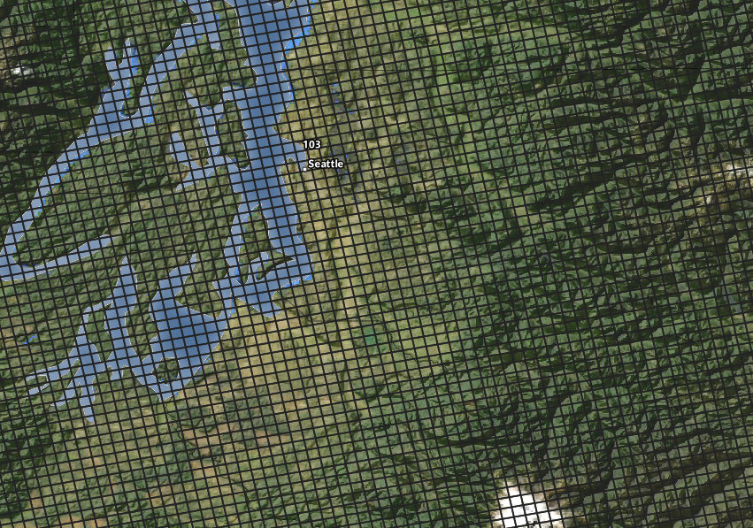
- The hottest temperature on record in Seattle, Washington, was a 103°F reading on July 29, 2009.
- The hottest temperature on record in Portland, Oregon, was 107°F, a temperature the site has achieved on three separate days since 1938. The most recent 107°F reading was on August 10, 1981.
- The hottest temperature on record in Spokane, Washington, was 108°F, most recently set on August 4, 1961—to put that in perspective, that’s the day Barack Obama was born.
- The hottest temperature on record in Yakima, Washington, was 110°F, achieved on August 10, 1971.
All four of those all-time highs could fall in the coming days, and it’s a similar story in smaller communities around the region.
Extreme heat is likely across the border in British Columbia, as well, where Canada’s all-time high temperature record of 45°C/113°F is at risk of toppling (again, that’s the hottest temperature on record for the entire country).
Predicted Highs
Here are some predicted high temperatures from the National Weather Service:

It’s easy to see that we have two concurrent stories here, including that
1) this is a historic heat wave, and
2) the heat wave is going to last much longer inland (Spokane and Boise) than it will closer to the coast (Seattle and Portland).
Here’s a loop of the NWS’s predicted high temperatures between Saturday, June 26, and Friday, July 2:

The animation does a pretty good job highlighting how the heat will creep away from the coast after this weekend and park itself inland through the balance of next week. Eastern Washington will be hotter than the desert Southwest for a couple of days. There’s a decent chance we’re still talking about the unrelenting heat around this time next week. For reference, the longest streak of 100°+ days on record in Spokane was six days in July 1928, and they’re well positioned to blow past that record.
(If you’re curious, see the note at the bottom of this post for why the temperatures on my map don’t line up perfectly with the chart above.)
Why It’s So Hot
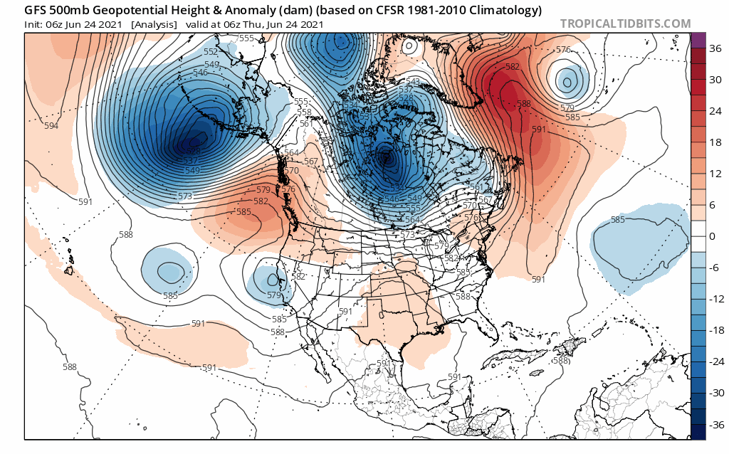 |
| Source: Tropical Tidbits |
A significant ridge of high pressure is building over the western United States and Canada today. The ridge is pinched between two troughs that are serving to block the ridge from simply fading away in a day or two. This pattern will force the ridge to sit and intensify, forcing the heat to build on itself for days at a time.
Air sinks beneath ridges. This sinking air compresses as it descends toward the ground, causing the air to heat up and dry out as it approaches the surface. Clear skies will allow the bright early summer sunshine to heat both the atmosphere and the ground, leading to extreme temperatures for as long as the ridge remains in place.
The drought isn’t helping matters much, either. As I explained during last week’s heat wave, one reason it usually doesn’t get this blazingly hot outside of the deserts is that high soil moisture acts like a thermostat that regulates air temperatures. Since water heats up more slowly than air, humidity added to the air by moist soil prevents temperatures from climbing as high as they could on a dreadful summer day.
Take away that soil moisture and you’ve removed a key regulator on the air temperature. Not only that, but the parched soils will be able to absorb and release more heat into the air, allowing temperatures to grow hotter than they would under “normal” conditions.
 |
| Source: NOAA |
Climate change is an undeniable factor in this latest episode of an unrelenting barrage of heat waves in recent years. Global temperatures have steadily risen over the past century and that uptick has accelerated in recent decades.
NOAA’s new climate averages, the 30-year period between 1991 and 2020 that will serve as our frame of reference for “normal weather” over the next ten years, showed that average temperatures have risen across almost the entire United States. This higher temperature baseline, combined with more frequent weather extremes, will provide the opportunity for more precedent-busting heat waves like the one we’re staring down this weekend.
Please Take It Easy
It’s common for people in warmer climates to scoff at hot weather in northern or coastal climates. “It’s only going up to 105°F in Seattle? Gee, you should visit Macon sometime! Our heat index is 105°F all summer. Ha!“
Extreme heat is a matter of what you’re used to and what you’re equipped to handle. Most homes in the Pacific Northwest don’t have air conditioning. Only about 41 percent of homes in the Seattle metro area are air conditioned. Try going through 100-degree heat for days on end without any relief at night and no cooling in your house. Not even a southerner would be able to tolerate that for very long, let alone folks who live in a cooler climate.
Humidity makes the south’s heat feel awful, of course, because your body relies on sweat to stay cool. You sweat, the sweat evaporates, the evaporation cools your skin, and your body temperature comes down. High moisture in the air disrupts that process and keeps your sweat from evaporating, preventing you from cooling off properly.
That’s why we have the heat index to tell us how the combination of heat and humidity affects our body the same way a higher temperature would. A heat index of 105°F means your body has to work as hard as it would if the actual air temperature were 105°F.
The actual air temperature during this heat wave in the Pacific Northwest will be as hot as the heat index on a gross summer day in the south. The only difference is that it’s worse for the Seattleite because they’re not used to it and they have limited options to cool down.
Heat Is Deadly
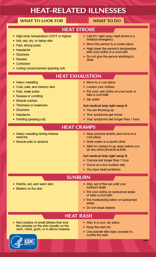 |
| Source: CDC |
This is the kind of heat wave that could take an awful toll on vulnerable communities such as the elderly, folks who are low-income, and those who suffer from medical conditions that make them more susceptible to heat-related illnesses. There are probably going to be healthy folks who die because of overexertion. It doesn’t matter how fit you are or how young you are, the heat can take a toll and its effects can set in quickly. Similar heat waves in Europe, where home air conditioning is rare, have claimed hundreds of lives.
The intensity of an extended heat wave compounds on itself the longer the event drags on. One day’s heat settles into a putrid night. Homes won’t have the opportunity to cool off much at night, either. It’s not out of the question that the air temperature in homes and apartments could reach 90°F or hotter after a few days. This is going to be really rough on a lot of people.
Don’t fool around with the heat. If you don’t have air conditioning, try to access an air conditioned space several times a day so you have a chance to cool off and recover. Keep fans on and circulate the air as much as possible if you don’t have air conditioning at home. Moving air is better than nothing at all. Drink lots of water, too—it seems silly to say that to adults, but dehydration sets in fast and it can sneak up on you.
Behind The Scenes Note
I make my temperature maps using data from the National Weather Service. The NWS issues most of its forecast products on a grid made up of boxes that each cover 2.5 square kilometers of land. There are more than a million of these boxes covering the United States.
I tell my mapping software to select a handful of these grids to represent temperatures in major cities such as Seattle and Portland. The box I select for my maps isn’t always the box you’ll land on if you use the NWS website’s point-and-click forecast. The temperatures I pulled for my chart in this post are for the major airport in each city—Seattle-Tacoma Airport, the city’s official observing station, is many miles away from downtown Seattle, so the temperatures don’t exactly line up.
You can follow me on Twitter or send me an email.
Please consider subscribing to my Patreon. Your support helps me write engaging, hype-free weather coverage—no fretting over ad revenue, no chasing viral clicks. Just the weather.