
Today is likely going to go down as one of those memorable days in weather history across the central United States as an intense low-pressure system sweeps from Colorado to northern Ontario. Downsloping winds behind the system have already gusted to 100+ mph in Colorado's Front Range, and damaging winds will spread into the Upper Midwest through the evening hours.
Just as serious, however, is the threat for severe weather that will target the Midwest late Wednesday afternoon into Wednesday night.
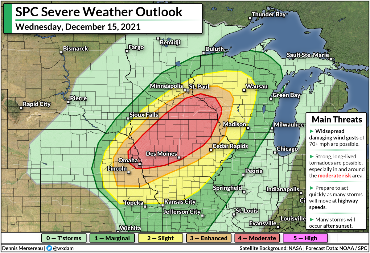
The Storm Prediction Center issued a moderate risk for severe weather, a four out of five on the scale measuring the threat for severe storms, which is unprecedented in this part of the country for this late in the year.
This event is unsettling not only for the severe weather potential itself, but because it's unfolding across an area not accustomed to this magnitude of threat just a week-and-a-half before Christmas.
A warm and unstable airmass is in place across the Midwest. Des Moines, Iowa, broke its all-time December temperature record this morning with a reading of 71°F, and the temperature will likely climb higher before the storms arrive.
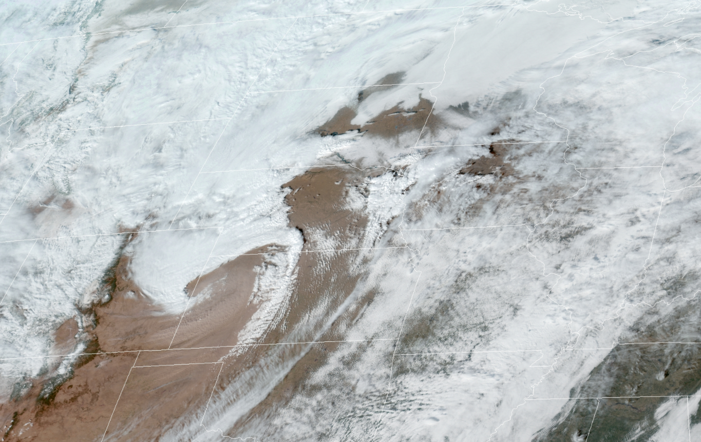
The storms are going to fire up and move very quickly. You can already see the beginnings of the squall line in central Kansas on the satellite image above, snagged around 1:15 p.m. CST.
Thunderstorms will develop along and ahead of the cold front sweeping along the southern half of the low. This squall line will have no trouble mixing intense winds down to the surface, potentially leading to widespread reports of 70+ mph wind gusts as it passes through.
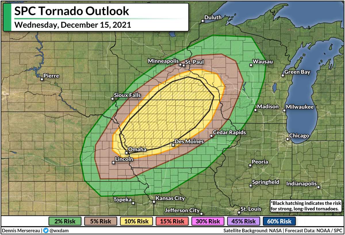
There's enough wind shear present that discrete thunderstorms, as well as the squall line itself, will likely produce at least a couple of tornadoes, especially across parts of Iowa and Minnesota. A few tornadoes could be strong or long-lived, which is a terrifying prospect because much of the activity will unfold after sunset.
Make sure you have a way to receive warnings the moment they're issued. Check your smartphone and ensure that wireless emergency alerts are activated for tornado warnings. Those alerts are proven life-savers and they're programmed to alert you the moment your location goes under a tornado warning.
Try to stay awake tonight if you're under the threat for severe weather. Don't go to bed until you're in the all-clear. If you have no choice but to go to bed before the storm threat is over (or if you just happen to doze off or not pay attention), make sure you've got a way to receive warnings when they're issued. Keep your phone by your bed. Check your weather radio and ensure that it's working. Keep a local news channel on high volume. Task a friend or relative with calling you if a warning is issued. Just make sure you've got a way to get to safety in a hurry if necessary.
Also, if you have tall trees or large tree limbs hanging near or over your home, consider avoiding those rooms during the gusty winds or severe thunderstorms. Trees falling into homes are the leading cause of wind-related injuries in a setup like this.
Stay safe.
[Satellite: NOAA]
You can follow me on Twitter or send me an email.
Please consider subscribing to my Patreon. Your support helps me write engaging, hype-free weather coverage—no fretting over ad revenue, no chasing viral clicks. Just the weather.
Please consider subscribing to my Patreon. Your support helps me write engaging, hype-free weather coverage—no fretting over ad revenue, no chasing viral clicks. Just the weather.


0 comments: