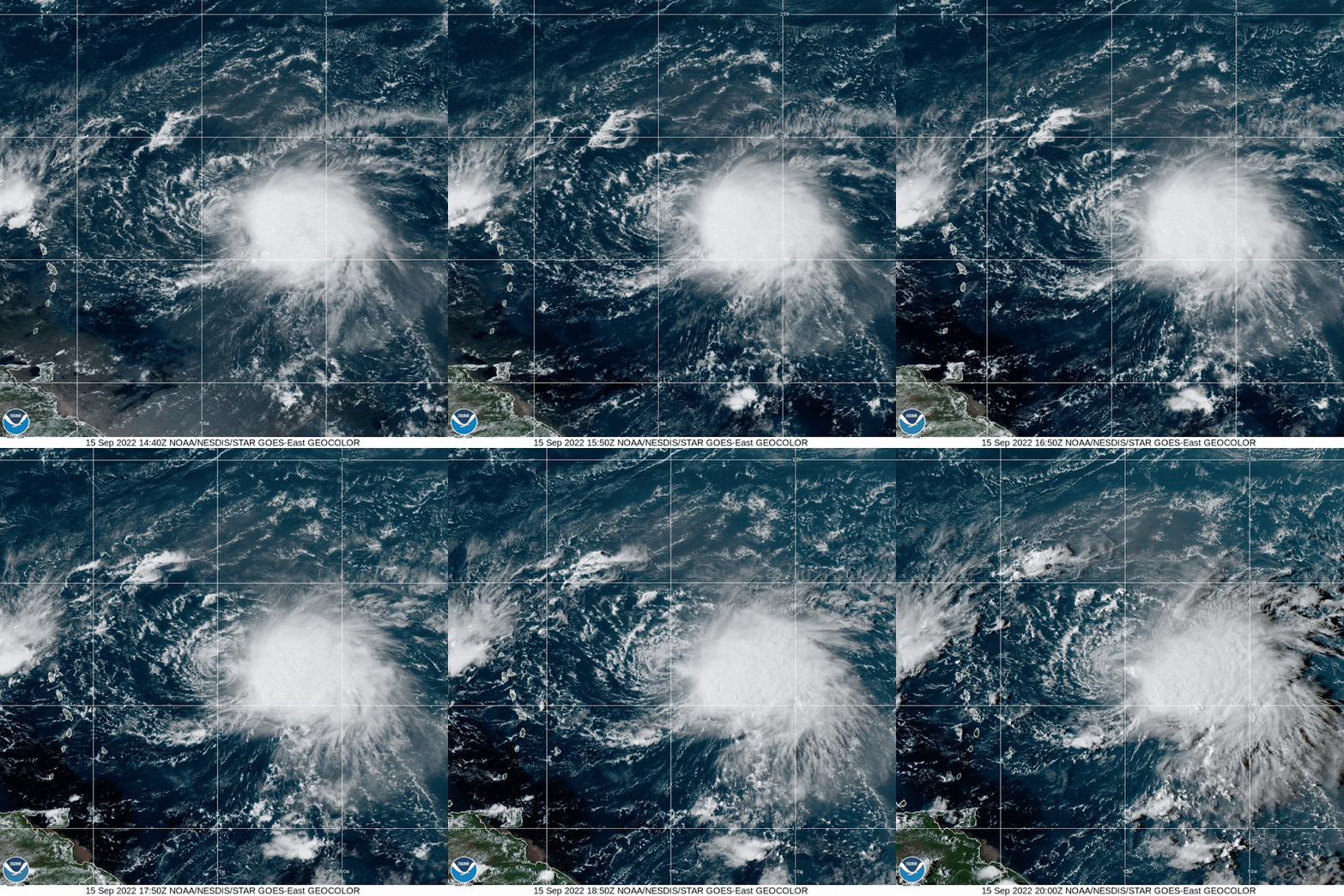
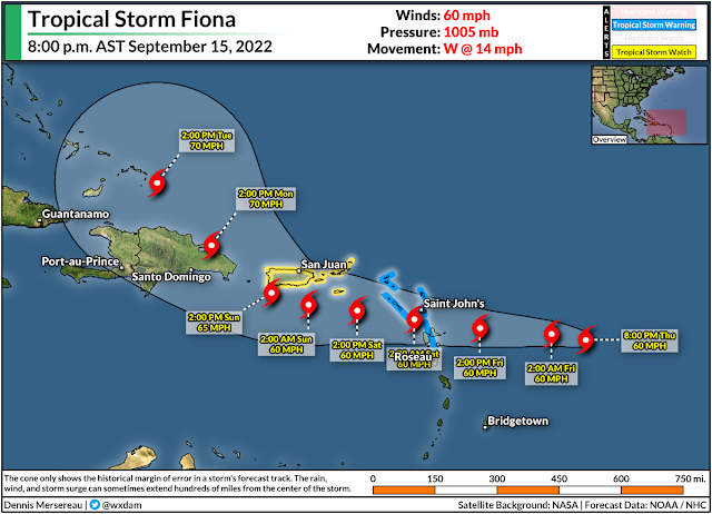
Fiona isn't the healthiest tropical storm despite the bite of its 60 mph winds. The system has a strong center of circulation at the surface, and we know that because the center is completely exposed thanks to westerly wind shear. The naked li'l swirl is flanked by decent thunderstorms on the eastern side of the storm.
The tropical storm will struggle a bit as long as westerly wind shear forces it to run around like an atmospheric nudist. However, disheveled storms can be deceiving, and Fiona will pose a significant risk for flooding and mudslides across portions of the Greater Antilles through the weekend.
Tropical storm watches and warnings are in effect for these islands ahead of Fiona's arrival. The risk for gusty winds will take a backseat to the risk for flooding as the system passes through the region.
Puerto Rico and the Dominican Republic are in line for particularly heavy rains, which could amount to 6-12+ inches in spots by the time the storm turns north and pulls away from the region early next week. It doesn't take much heavy rain to cause problems in this part of the world, and a slow-moving drencher of a tropical storm will easily lead to widespread flash flooding and mudslides.
Things get a little fuzzy once the storm curves northward. The most likely scenario is that Fiona, like most storms that follow its general track, will recurve out to sea and only threaten Bermuda. However, weather models are hinting at the possibility that a ridge of high pressure over the eastern United States or western Atlantic will prevent the storm from performing a clean recurve.
Fiona's future track seems to rely heavily on its intensity. We often see this in storms that approach the Caribbean during the peak of the season. A weaker storm is driven by winds lower in the atmosphere, which allows easterly winds to force the storm west toward land. A stronger storm can capture winds through a deeper slice of the atmosphere, usually pushing the storm north and curving it out to sea.
It's wayyyy too early for details—and chuck tomatoes at anyone pretending otherwise—but it's wise for folks across the East Coast to keep this storm on their radar and make sure their plans and supplies are up to speed in case this storm starts trending westward.
[Satellite imagery via NOAA]
You can follow me on Twitter or send me an email.
Please consider subscribing to my Patreon. Your support helps me write engaging, hype-free weather coverage—no fretting over ad revenue, no chasing viral clicks. Just the weather.
Please consider subscribing to my Patreon. Your support helps me write engaging, hype-free weather coverage—no fretting over ad revenue, no chasing viral clicks. Just the weather.


Wild to see most of the storms stripped away from the low-level circulation like that. Is that common, or at least "not exceedingly rare"?
ReplyDelete