Dreaded Polar Vortex Drags Intense Freeze Over New England To End The Week
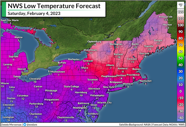
The much-maligned polar vortex will live up to its reputation over the next couple of days as some of the coldest temperatures on the planet dive south over New England on Friday and Saturday.
The polar vortex is a large-scale circulation that wraps around the Arctic Circle. It’s strongest in the winter months, when it acts like a moat keeping the winter’s coldest air confined to the far northern latitudes.
Every once and a while, this circulation will become unstable, creating troughs and upper-level lows that break off and head south. When this happens, it drags that bitterly cold air south right along with it.
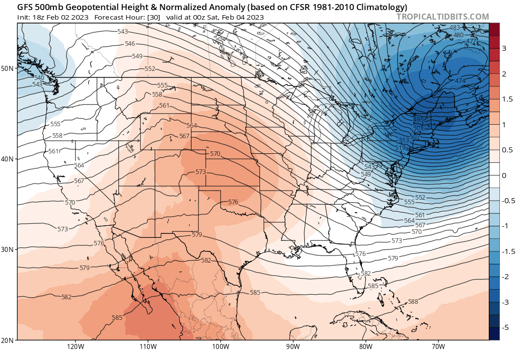 |
| A model image showing the upper-level pattern responsible for New England’s deep freeze on Friday and Saturday. (Tropical Tidbits) |
A fast-moving upper-level low—once part of the polar vortex circulation—swooping over eastern Canada is responsible for this impending blast of very cold air sagging into New England.
Temperatures will dive well below zero for many areas, with wind chill values in the double-digits below zero. The wind chill in Boston will dip below -30°F on Saturday morning, with wind chill values reaching the -40s in western Massachusetts. The National Weather Service predicts wind chill values all the way into the -60s for northern parts of New Hampshire and Maine.
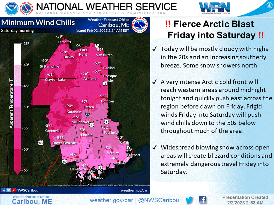 |
| (NWS Caribou) |
Don’t underestimate the risk posed by such low temperatures. This is dangerous cold, the kind that can cause serious injury in just a couple of minutes. Frostbite can develop on unprotected skin in as fast as two minutes with temperatures and wind chill values this cold.

It’s not going to last long, thankfully.
The pattern is pretty progressive, so the upper-level low responsible for the extreme cold will move along in a hurry. A ridge will build in behind it, allowing temperatures to rebound to above-normal territory in time for next week.


