Tropical Storm Nestor Set To Hit Florida Saturday With Heavy Rain, Gusty Winds

Tropical Storm Nestor is hauling tail toward Florida’s Gulf Coast this evening. The lopsided storm should make landfall near Apalachicola, Florida, sometime early Saturday morning, bringing much-needed rain to the southeast over the next couple of days. The storm’s winds could lead to power outages and potentially a life-threatening storm surge along parts of the Florida coast.
 |
| Nestor around midnight on October 19, 2019. || College of DuPage |
Nestor isn’t exactly a “classic” tropical storm. The system is lopsided, for one, and it’s right on the line between tropical and extratropical, or the more common type of low-pressure system that’s powered by upper-level lift. This is one of those cases where we have to focus on the storm’s impacts rather than the storm itself.
Rain

We won’t see a ton of rain from Nestor, but the southeastern United States is mired in a growing drought and any little bit of rain will help.
The latest forecast from the Weather Prediction Center shows the potential for a couple of inches of rain across most of the southeast over the next week, with the heaviest totals expected around Tallahassee where Nestor’s core comes ashore. Some areas in the Florida Panhandle could see 5 or more inches of rain, which could lead to flash flooding in vulnerable areas.
Storm Surge
The unique shape and composition of the coast along Florida’s Big Bend can expose coastal communities to a potentially life-threatening storm surge as Tropical Storm Nestor comes ashore. If the storm remains at its predicted strength on its predicted track into Florida, the latest advisory from the National Hurricane Center shows the potential for:
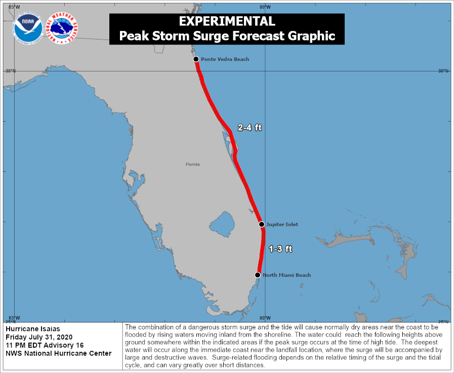
—a storm surge of 3 to 5 feet above ground level is possible from Indian Pass to Chassahowitzka
—a storm surge of 2 to 4 feet above ground level between Chassahowitzka to Clearwater Beach
—a storm surge of 1 to 3 feet above ground level in Tampa Bay.
I’ve highlighted the NHC’s maximum surge potential on the map above, even though we all obviously know where Chassahowitzka is, right?
Wind
Power outages are likely along and to the east of Nestor’s point of landfall as strong winds knock down trees and power lines. Sustained winds of 60 MPH winds don’t sound like much, but keep in mind that severe thunderstorm warnings are issued for thunderstorm wind gusts of 60 MPH.
Tropical storm watches and warnings don’t extend inland since the storm is expected to lose its tropical characteristics not long after landfall. However, wind advisories are in place for much of Georgia as gusts as high as 50 MPH could accompany the storm as it moves through on Saturday.
Make sure you keep your phone on the charger tonight, and keep a flashlight—a real flashlight, not your cell phone’s flashlight—handy in case you lose power in the middle of the night.
Tornadoes
 |
| Radar image of a tornado northeast of Tampa, Florida, on October 18, 2019. || Gibson Ridge |
Tornadoes are in progress across the Florida peninsula as I publish this article. Conditions are usually favorable for tornadoes to develop in thunderstorms embedded on the eastern side of landfalling tropical systems. Some of the tornadoes can be rather strong; we’ve already seen one classic supercellular tornado between Tampa and Orlando, complete with a well-defined hook echo and strong debris signature on radar (shown above).
The threat for tornadoes will continue across Florida through Nestor’s landfall on Saturday morning, with the threat following the storm into Georgia and South Carolina through Saturday.
Please consider subscribing to my Patreon. Your support helps me write engaging, hype-free weather coverage—no fretting over ad revenue, no chasing viral clicks. Just the weather.

