

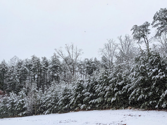
Monday marks the end of climatological winter, an arbitrary turning point that signals the end of winter and beginning of spring. We're all starting to get spring fever, especially folks up north who've dealt with endless snow and cold over the past few months.
While we're starting to get tastes and teases of springtime weather, March is often a snowy and icy month across the country.
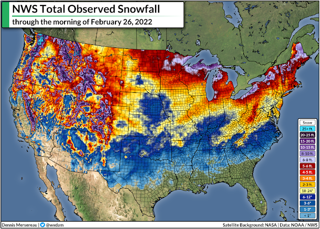
It's been a decently snowy year across much of the country. Washington, Greensboro, Buffalo, Chicago, and Kansas City have all recorded close to their average snowfall totals by the end of February. The arrival of an average winter is welcome news for snow weenies on the East Coast who've been pining for good storms for a couple of years now.
Here's a look at the country's seasonal snowfall through Saturday morning:
The bulk of the winter is behind us, sure, but the snow, ice, and cold temperatures aren't anywhere close to finished with us in March.
History is littered with plenty of memorable March winter storms, not the least of which is the 1993 "superstorm" that plastered the eastern U.S. from Alabama to Maine with more than a foot of snow. I flew home to central N.C. for spring break in March 2014 and we had several snow and ice storms during my short week back in the state.
How does history stack up, though?
Take a look at historical averages for the cities I mentioned above, covering the snow we've seen so far this season, the snow we typically see by March 1st, and how much snow we historically see after March 1st.
| City | Snow This Season | Avg Snow By March 1st | Avg Snow After March 1st |
|---|---|---|---|
| Washington | 12.3" | 11.8" | 1.9" |
| New York City | 17.5" | 24.7" | 5.1" |
| Greensboro | 8.2" | 6.3" | 0.8" |
| Buffalo | 82.9" | 79.4" | 16.0" |
| Chicago | 28.6" | 31.9" | 6.5" |
| Kansas City | 15.4" | 16.3" | 1.9" |
| Dallas | 1.7" | 1.3" | 0.3" |
On average, we still see a few more inches of snow across most major cities in the eastern and central part of the country...outside of the south, anyway. (Sorry Dallas.) Buffalo is the major winner here, of course, because their lake-effect snow ramps back up as the ice melts and the lake starts warming up again.
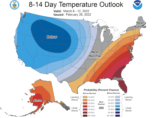
We're entering a pattern where it might be hard to get much snow through at least the first half of March. The Climate Prediction Center's latest 8-14 day outlook, which covers March 6-12, calls for decent odds of above-normal temperatures across a wide swath of the eastern states.
This kind of pattern will favour a more westerly track for storms, largely keeping the eastern states on the warmer side of any storms that move through. It only takes one storm slipping through an otherwise unfavorable pattern to bring us a memorable and unwelcome bout of March ice and snow.
You can follow me on Twitter or send me an email.
Please consider subscribing to my Patreon. Your support helps me write engaging, hype-free weather coverage—no fretting over ad revenue, no chasing viral clicks. Just the weather.
Please consider subscribing to my Patreon. Your support helps me write engaging, hype-free weather coverage—no fretting over ad revenue, no chasing viral clicks. Just the weather.


0 comments: