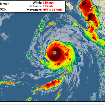
Hurricane Genevieve becomes eastern Pacific’s 28th Category 5 hurricane
Hurricane Genevieve rapidly intensified into a scale-topping storm in the eastern Pacific during the overnight hours.
Read More
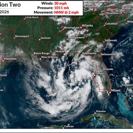
Gulf tropical depression forms; N.C. flooding possible this week
A new tropical depression is churning in the Gulf of Mexico. Meanwhile, very heavy rain is on the way this week for the eastern Carolinas and Mid-Atlantic.
Read More
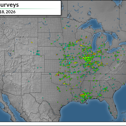
U.S. tornadoes remain ahead of pace as we cross summer’s midpoint
Tornado activity across the U.S. remains above average so far this year, with nearly 1,000 twisters confirmed throughout the country as of July 17.
Read More
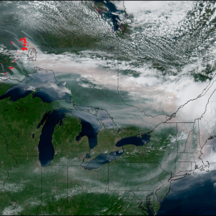
Intense smoke expected for Midwest, East Coast after days of record heat
Thick smoke could lead to extremely hazardous air quality for parts of the Upper Midwest and East Coast in the next few days.
Read More
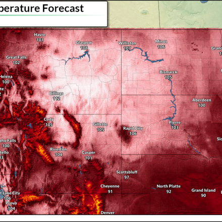
All-time record of 112°F possible as heat dome builds
Much of the U.S. can expect above-average temperatures through the upcoming week and beyond, making the hottest stretch of the year feel particularly unpleasant.
Read More
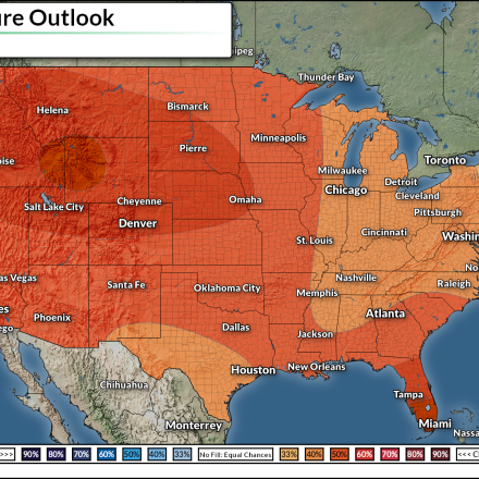
Extreme heat set to build across western U.S. into mid-July
Just as the east's heat wave wanes, we're on the cusp of a significant spell of extreme heat building across the western half of the United States.
Read More
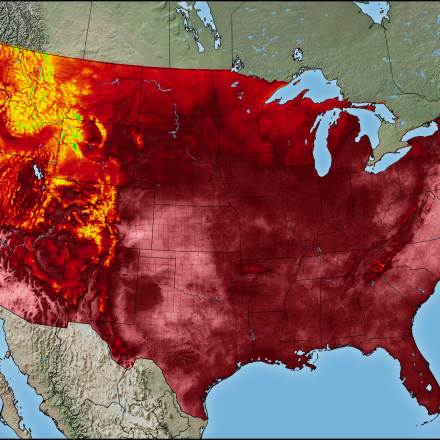
Dangerous heat wave underway across central, eastern U.S.
Many communities throughout the eastern U.S. will face dangerously hot days with no meaningful overnight relief into this weekend.
Read More
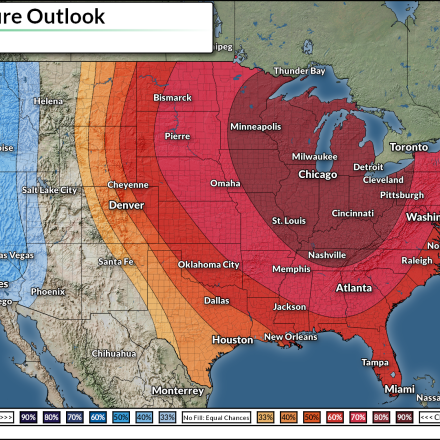
Major heat wave set to build across eastern U.S.
An extreme heat wave is set to build across the eastern U.S. heading into next week, with widespread highs in the 90s and 100s likely.
Read More
Illinois hit hard as U.S. nears 900 tornadoes so far in 2026
The national tornado count sits at 877 with more surveys underway. Illinois accounts for a significant percentage of this year's twisters.
Read More