Relief On The Way As Blissful Cold Front Briefly Kicks East Coast Humidity
Ahhh. While there’s nothing better than the first cold front of fall, a cold front that scours away the humidity for a few days in the middle of August has to be a close runner up. A push of cooler, drier air working its way down from Canada will sweep over much of the Northeast and Mid-Atlantic through the weekend, bringing a few days of much-deserved gorgeous conditions.
A Sticky Summer So Far
It’s been a relentlessly gross summer so far, with hot temperatures every day and sticky humidity to match. Take a look at these daily high dew point values for the past couple of months here in Greensboro, North Carolina.
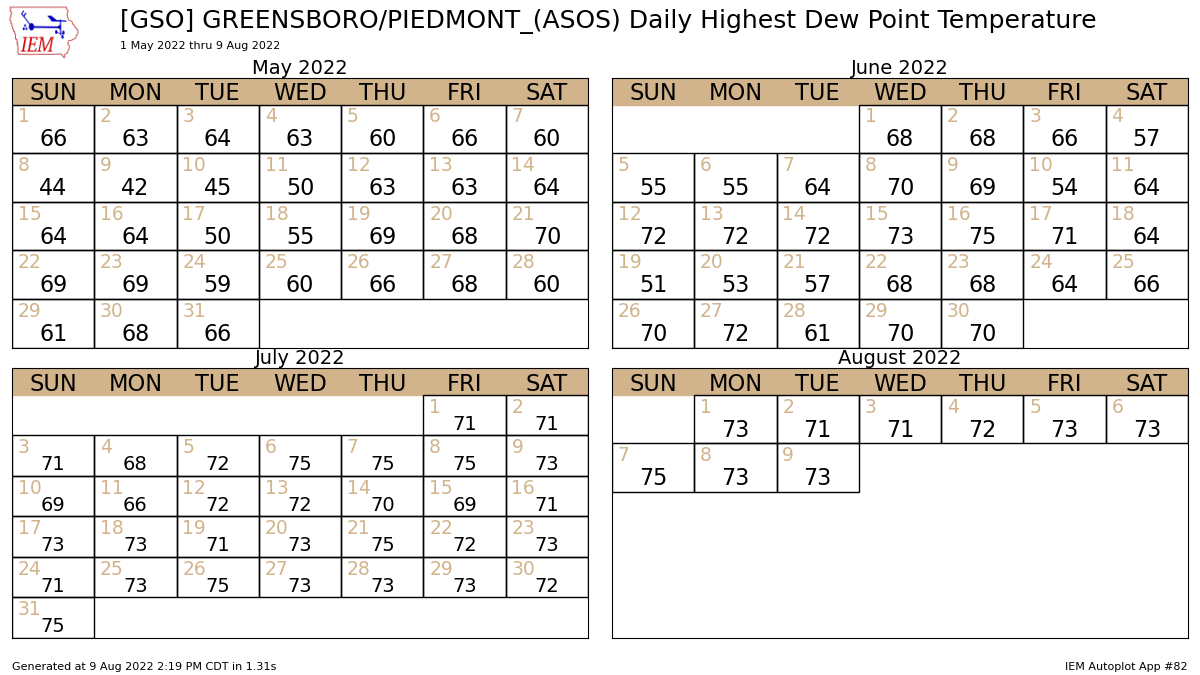 |
| Data plot generated using this awesome tool from the Iowa Environmental Mesonet. |
The dew point is the best way to measure how muggy or dry the air feels. The air is fully saturated (or 100% relative humidity) when the air temperature meets the dew point temperature.
Dew points below 60°F are comfortable. The air starts to feel muggy between 60-65°F, it’s noticeably humid above 65°F, and conditions are downright soupy and tropical once the dew point climbs above 70°F.
It’s not just a case of “North Carolina being North Carolina in the summer,” either. Here’s a look at the same chart for Philadelphia, Pennsylvania:
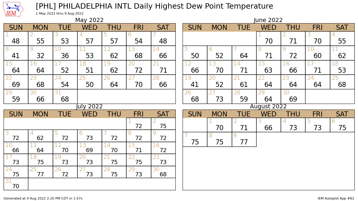 |
| Source: IEM |
Yuck. This year’s mugginess even stands out compared to other years through the beginning of August. This is a look at how many hours Philadelphia’s dew point came in at 60°F or higher between January 1st and August 9th of each year since 1941.
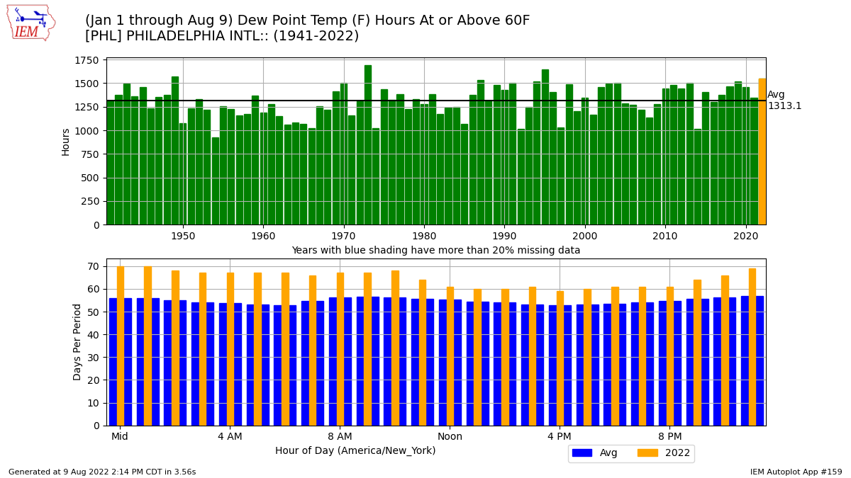 |
| Source: IEM |
This summer-to-date ranks as the fourth-muggiest on record in Philadelphia, and the unusually high moisture levels this season is a repeating story up and down the eastern seaboard.
Thankfully, some short-lived relief is on the way.
Here Comes A Cold Front
A sharp upper-level trough swooping over eastern Canada will bring a cold front sweeping across the region over the next couple of days.
This front will send a flood of cooler, less humid air sweeping over the Northeast and Mid-Atlantic states through the weekend.
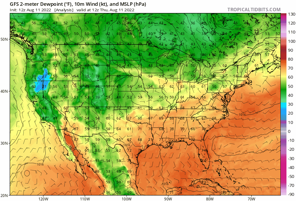 |
| Source: Tropical Tidbits |
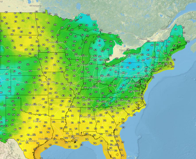
Dew points will fall into the 50s as far south as Georgia and South Carolina, with even drier air likely to spread over the Great Lakes and New England through Sunday.
This is going to feel faaantastic. My goodness. You’ll be able to open the windows after dark and air out the house for the first time in months. It’ll be gorgeous weather for a nice walk around the neighborhood or a long lounge outside with a refreshing beverage and nothing but the breeze on your face and bugs chirping away.
Enjoy it while it lasts, though. It looks like a storm system will form behind that trough, bringing several days of clouds and rain to the Mid-Atlantic and Northeast heading into early next week.
After that…well, it’s still summer, after all. Heat and humidity will start to build back. But the next couple of days will be a nice reminder that we’re past the halfway point in this hot summer and fall is on the way.
[Top Image: National Weather Service]
You can follow me on Twitter or send me an email.
Please consider subscribing to my Patreon. Your support helps me write engaging, hype-free weather coverage—no fretting over ad revenue, no chasing viral clicks. Just the weather.


