

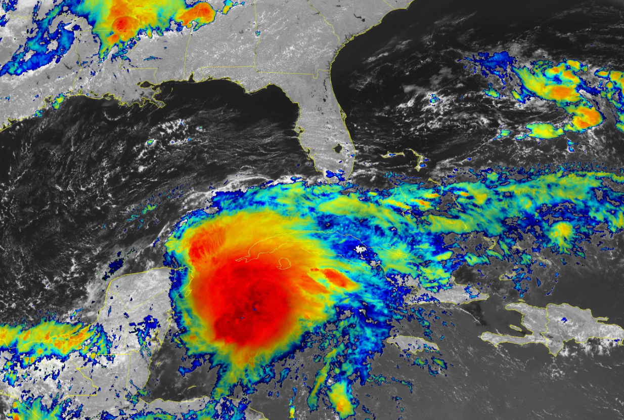
The first storm of the 2022 Atlantic hurricane season seems like it's a lock this afternoon as a robust tropical disturbance—the remnants of Hurricane Agatha from the Pacific—grows more organized in the western Caribbean Sea. Whether or not it fully develops, the system is mighty moisture-packed and it's going to bring a ton of rain to south Florida through the weekend.
The National Hurricane Center gives this disturbance an 80 percent chance of development in the next couple of days. The disturbance is developing an intense core of thunderstorms near the center of the system, and just by the way it looks on satellite, it probably doesn't have far to go before it grows into a tropical depression or a tropical storm.
This system, which would be named Alex if it becomes a tropical storm, is on track to pass over southern Florida on Friday and Saturday, with rain likely lingering into Sunday morning for portions of the Atlantic coast.

Regardless of development, it's going to bring a ton of rain to the region. The Weather Prediction Center's latest outlook calls for 5-10+ inches of rain falling across south Florida through the weekend. This much rain falling this quickly could easily lead to flash flooding, especially in urban areas and spots with poor drainage.
Folks around here probably don't need the reminder, but the majority of deaths associated with tropical systems occurs as a result of drowning from flash flooding. Never cross a flooded roadway. It's impossible to tell how deep the water is until it's too late, and it only takes a few inches of moving water to lift up a vehicle and carry it downstream.
As with any landfalling tropical system or disturbance, developed or not, gusty winds could lead to downed trees and power lines. The low-level wind shear associated with systems like this will also likely lead to a risk for tornadoes, especially on the eastern side of the system. Make sure you've got a way to receive tornado warnings the moment they're issued. Check your phone and ensure that wireless emergency alerts are turned on.
[Satellite Image: NOAA]
You can follow me on Twitter or send me an email.
Please consider subscribing to my Patreon. Your support helps me write engaging, hype-free weather coverage—no fretting over ad revenue, no chasing viral clicks. Just the weather.
Please consider subscribing to my Patreon. Your support helps me write engaging, hype-free weather coverage—no fretting over ad revenue, no chasing viral clicks. Just the weather.


0 comments: