Widespread severe thunderstorms expected overnight into Tuesday
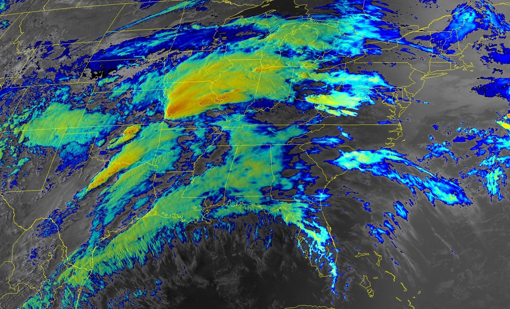
We’re in the midst of the first widespread severe weather outbreak of the season across a large swath of the central United States as a feisty low-pressure system cuts across the region.
The Storm Prediction Center issued a moderate risk—a 4 out of 5 on the scale measuring the risk for severe weather—for Oklahoma on Monday and again for much of Ohio on Tuesday. These are the first moderate risks issued anywhere in the U.S. since August 7 of last year.
All modes of severe weather are likely with the storms that fire up over the next couple of days. We’ve already seen multiple severe thunderstorms roll across the southern Plains and the Midwest on Monday, with plenty of large hail and a few reported wind gusts of 70+ mph.
The Setup
The hubbub is the result of a low-pressure system trucking across the central Plains tonight. This low will continue strengthening as it heads toward the Great Lakes into Tuesday.
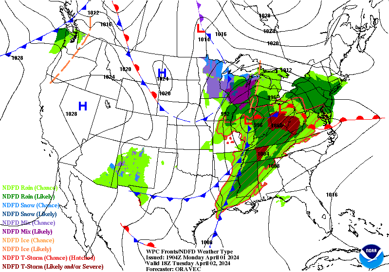 |
| The Weather Prediction Center‘s surface forecast for Tuesday afternoon. |
It’s the classic springtime severe weather setup. A steady stream of warm, humid air flowing out of the Gulf will provide ample fuel for thunderstorms to flourish as this system moves through the region.
Upper-level winds are favorable for thunderstorms to quickly turn severe, growing into both supercell thunderstorms and robust squall lines.
Safety Tips
This is our first widespread severe weather outbreak in a while. Anxiety is high, made worse by social media storm enthusiasts who treat it like an adrenaline sport.
Not everyone under the risk for severe weather will get hit by severe weather. Keep an eye on the radar, look out for severe weather alerts, and have a plan ready to take shelter from bad storms whether you’re at home, work, school, or even the grocery store.
Strong winds are the single greatest threat to safety during severe weather—almost entirely due to trees blowing into homes and vehicles. If you live in an area at risk for overnight severe weather, please consider sleeping in a room where trees or tree limbs don’t loom outside.
Make sure you have a way to receive severe weather alerts when you’re asleep, and ensure that emergency alerts for tornado warnings are activated on your smartphone. These noisy push alerts can provide critical moments of heads-up before bad weather arrives.
Round One: Monday Night into Tuesday

Our first round of storms was already in progress by the time this post went live around 8:30 p.m. Eastern on Monday.
Multiple supercells in Texas, Oklahoma, and Kansas left behind large hail and wind damage in their wake. Supercells are thunderstorms with rotating updrafts, a feature that makes these storms resilient and capable of producing more intense severe weather.
As we so often see during these outbreaks, these supercell thunderstorms will eventually merge into a long, broken squall line that’ll chug east through the overnight hours.
Forecasters expect these storms to continue producing widespread severe weather across Missouri, Arkansas, and Illinois overnight Monday and into early Tuesday morning.
 |
| A model image showing a potentially severe squall line around 2:00 a.m. CDT on Tuesday. (WSV3) |
The main threat with the overnight squall lines will be damaging straight-line winds, with many of the storms capable of producing significant wind gusts of 75+ mph. These storms will push east through early Tuesday morning, likely reaching Indiana and Ohio in time for the morning commute.
There’s also a risk for tornadoes embedded in these squall lines—you’ll sometimes hear them called “QLCS tornadoes,” taking their name from the technical term for a squall line. These tornadoes happen quickly and often with reduced tornado warning lead time.
Round Two: Tuesday

We’ll see the low-pressure system moving into the lower Great Lakes during the day Tuesday, dragging a cold front into a vast plume of warm, humid air parked over the region.
Forecasters expect the atmosphere to recover from Tuesday morning’s storms in time for a fresh round of severe thunderstorms to build over the Ohio Valley and Mid-South by the afternoon hours.
 |
| A model image showing the general areas where we might see severe storms around 5:00 p.m. EDT Tuesday. (WSV3) |
The strongest thunderstorms are likely over eastern Indiana and much of Ohio covered by the moderate risk. Dynamics here are favorable for supercells that would be capable of producing tornadoes—some of which could be strong and long-lived—as well as hail larger than golf balls and damaging wind gusts.
Farther south, storms are likely to form into one or more squall lines as they push through Kentucky, Tennessee, and northern Alabama. Damaging winds and embedded tornadoes would be the predominant threats with these storms.
The risk for severe weather will continue pushing east overnight Tuesday into Wednesday, with severe storms possibly crossing the Appalachians and heading into the Virginias and Carolinas. Damaging winds and an isolated tornado would be the main threat with these remaining storms.
[Satellite image via NOAA]


