Tropical Storm Watches Issued For North Carolina Coast As Depression Forms In Atlantic
Tropical Depression One formed off the Florida coast on Saturday afternoon, starting this year’s hurricane season early for an unprecedented sixth year in a row. Forecasters expect the system to strengthen into Tropical Storm Arthur by early next week as it brushes the North Carolina coast. Heavy rain, rough seas, and gusty winds are likely as the system approaches land.
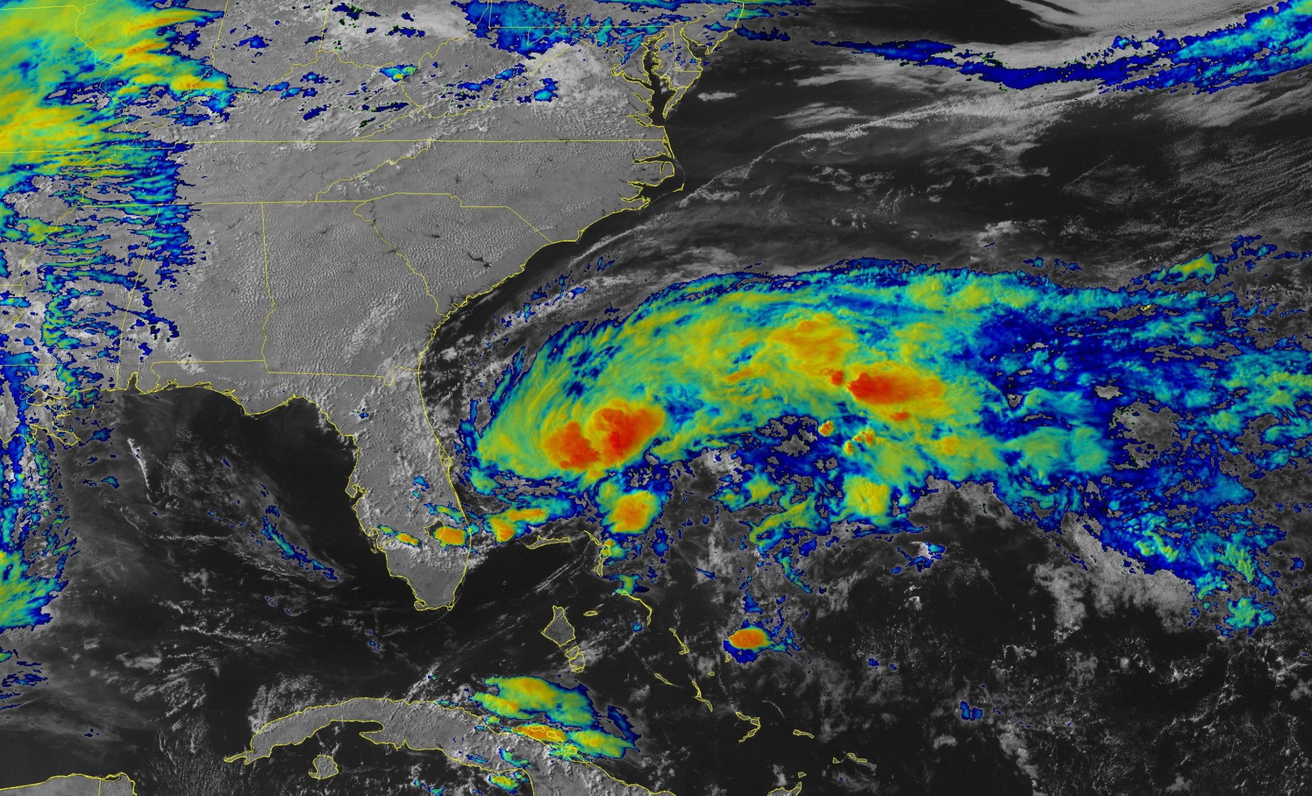
We’ve been watching this tropical disturbance for the past couple of days as it slowly moved out of the Caribbean into the southwestern Atlantic. A cluster of heavy showers and thunderstorms persisted long enough for the disturbance to root itself at the surface with a closed low-level circulation. It’s easy to see the tight swirl of the circulation on radar out of Melbourne, Florida, this afternoon.

Environmental conditions are favorable—and its access to the Gulf Stream sufficient enough—that the National Hurricane Center expects the depression to strengthen into Tropical Storm Arthur overnight Saturday into Sunday. It should follow a general north-northeasterly track over the next couple of days, with the center of the storm passing quite close to North Carolina’s Outer Banks on Monday.
There are several large-scale features pushing and pulling on the system that will guide its ultimate path. A ridge of high pressure over the western Atlantic will keep it from simply jogging out to sea, while an approaching trough should eventually weaken the ridge and allow the system to curve away from land. The strength of each feature and the timing of the trough’s approach are both critical in the exact path of the storm.
A tropical storm watch is in effect for many of North Carolina’s coastal counties given the projected path of the storm. It wouldn’t take much of a westward deviation from the forecast track to bring the core of the storm closer to the coast. We’re probably not looking at too many impacts either way—minor flooding from heavy rain and scattered power outages from gusty winds would be the biggest threat to most folks on land. Rough surf and rip currents will pose a threat to anyone at southeastern or Mid-Atlantic beaches through early next week.
Remember that the cone of uncertainty is the average margin of error in the National Hurricane Center’s forecast track during previous hurricane seasons. The center of the storm stays within that cone about 66% of the time.
The National Hurricane Center issues advisories on storms every six hours—at 5:00 AM/PM and 11:00 AM/PM EDT—with updates every three hours in between when watches and warnings are in effect.
[Satellite Pic: NOAA]
You can follow me on Twitter or send me an email.
Please consider subscribing to my Patreon. Your support helps me write engaging, hype-free weather coverage—no fretting over ad revenue, no chasing viral clicks. Just the weather.

