Tropical Storm Warnings Issued In Florida As Elsa Chugs Through Northern Caribbean

A tropical storm warning is in effect for the Florida Keys as Tropical Storm Elsa slowly gets its act together in the northern Caribbean Sea. The storm quickly ramped up into a hurricane over Barbados last week, but it moved so fast that it shredded itself apart as it approached Hispaniola. The system will move over Cuba on Monday before entering the southeastern Gulf and aiming for Florida by midweek.
Elsa’s Track

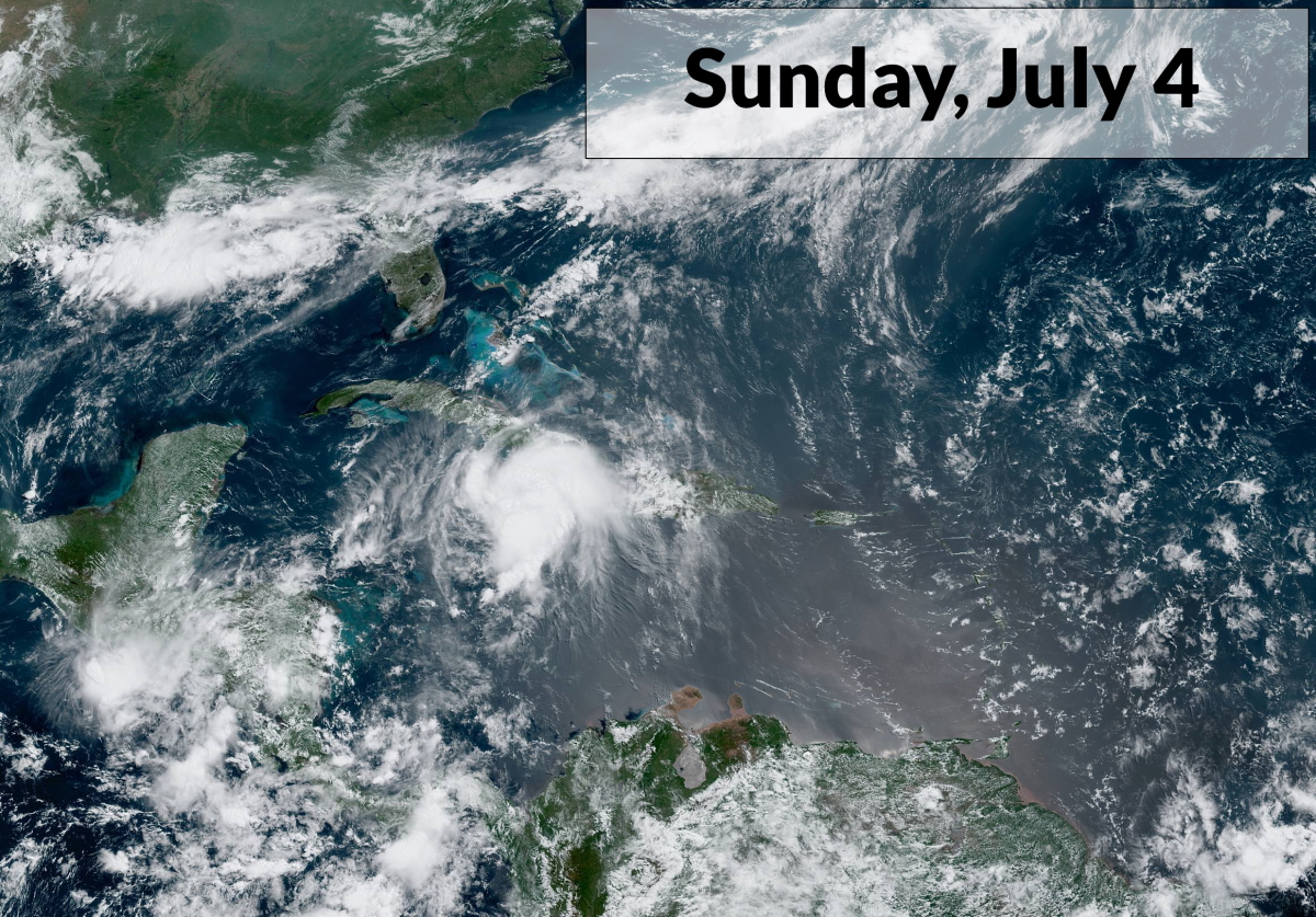
The National Hurricane Center found that Elsa had 60 MPH winds late Sunday morning as the core of the storm passed just north of Jamaica. The system will follow the western periphery of a strong Bermuda High parked over the western Atlantic Ocean, steering the storm over Cuba on Monday before entering the Gulf of Mexico on Tuesday.
If the system survives its trip over the mountains of Cuba, it’s likely that Elsa will reach Florida’s west coast as a strong tropical storm by Tuesday night or Wednesday morning. Depending on how quickly it recovers from its land interaction, there’s a chance it could become a minimal hurricane by the time it reaches Florida. However, there’s not much practical difference between a strong tropical storm and a minimal hurricane.
Elsa’s Impacts
The greatest impact from this storm will be its heavy rainfall.

The latest forecast from the Weather Prediction Center shows a swath of 2-4 inches of rain falling across the Florida Peninsula over the next couple of days. The agency shows a slight risk of flash flooding on Tuesday and Wednesday as the storm moves across the state.
A few inches of rain are possible across coastal communities in Georgia and the Carolinas by the middle of the week.
Some good news is that Elsa will keep moving and pick up speed as it curves to the north and northeast, limiting the amount of time it can produce drenching rains over one area. Tropical downpours are notorious for producing high rainfall rates, though, so it wouldn’t take much to lead to localized flash flooding.
There’s a risk of a storm surge along the Florida Keys and Florida’s west coast as the storm approaches landfall this week. The surge shouldn’t be too high—possibly a few feet above sea level in vulnerable spots—but any coastal flooding from a storm surge is dangerous for communities along the coast.
Winds of 60+ MPH could cause tree damage and power outages. Stay mindful of large trees and limbs that loom near your walls and roof, and, if possible, avoid those parts of the house during the highest winds. Many people are injured during landfalling storms when trees and tree limbs fall on homes.
The risk for tornadoes is an ever-present threat when tropical cyclones make landfall. Much of southern and central Florida will probably see a risk for tornadoes on Tuesday and Wednesday. Tropical tornadoes are fast and can touch down with reduced warning lead time. Make sure you have a way to receive warnings the moment they’re issued and you’re ready to take swift action to stay safe.
Elsa’s Unusual Journey
This has been a…strange…storm for early July.
The system became a tropical depression and a tropical storm while it was out in the tropical Atlantic, something you wouldn’t expect to see until August or September.
Elsa became the earliest fifth named (“E”) storm on record, beating Edouard last year.
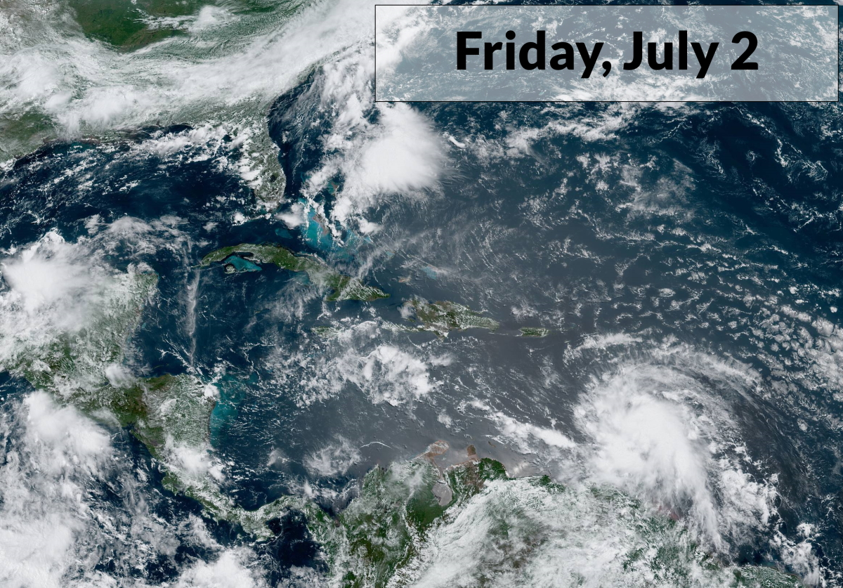
The storm unexpectedly intensified into a hurricane as it passed over Barbados on Friday, becoming the farthest east we’ve ever seen a hurricane so early in the year.
Elsa hauled tail across the Caribbean like it was trying to beat the yellow light. Strong easterly winds around the south side of the Bermuda High hustled the storm west toward the Greater Antilles. The system maintained hurricane strength for almost 24 hours despite a forward speed of about 30 MPH.
Storms usually don’t last long when they move that fast. A speedy storm will eventually outrun itself, so to speak, with the low-level circulation decoupling from the thunderstorms above. In addition to weakening, this internal disconnect can sometimes lead to the cute li’l naked swirl we see on satellite imagery.
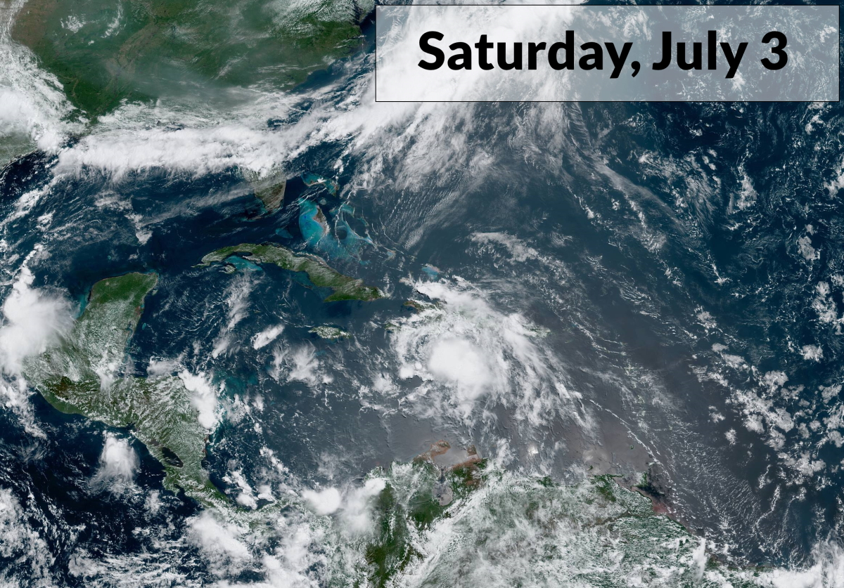
Elsa’s high-stakes lifestyle caught up with it Saturday morning. The relative wind shear caused by its speed started chipping away at the thunderstorms near the center of the hurricane. You can see its lopsided, slightly ragged appearance on the satellite image above. Elsa weakened slightly to a strong tropical storm as its wind and rain reached Hispaniola and Jamaica.
Sunday morning saw the storm slow down by about half, allowing the system to attempt to recuperate before it traverses central Cuba on Sunday night and Monday. Elsa looks much healthier on satellite imagery now than it did 24 hours ago. Storms are attempting to wrap around the center of circulation again, and we’re seeing that swirling, rippling upper-level outflow above the storm that’s indicative of intensifying thunderstorms.
[Satellite Images: NOAA]
You can follow me on Twitter or send me an email.
Please consider subscribing to my Patreon. Your support helps me write engaging, hype-free weather coverage—no fretting over ad revenue, no chasing viral clicks. Just the weather.

