Hurricane Ida’s Remnants Unleash Tornadoes, Flash Flood Emergencies In Northeast


Widespread Flash Flooding
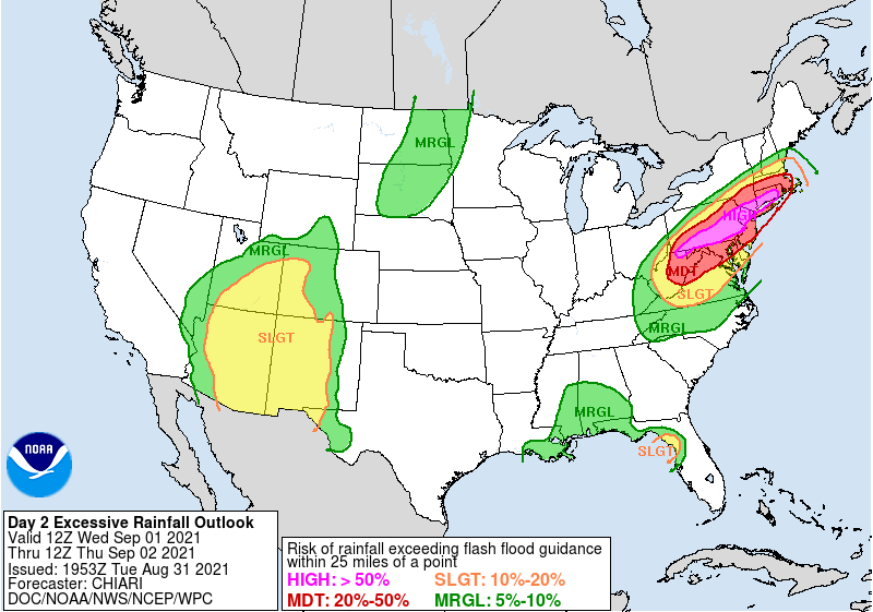 |
| The WPC’s excessive rainfall outlook for Wednesday, issued Tuesday afternoon. || SOURCE: WPC |

Flash Flood Emergency including New York NY, Brooklyn NY, Queens NY until 11:30 PM EDT pic.twitter.com/44k7Am5AyI
— @NWSFlashFlood (@NWSFlashFlood) September 2, 2021
Important update to the forecast for the Schuylkill River in Philadelphia. Major flooding now expected. Forecast crest is the second highest on record. Previous record was in 1869 (that is NOT a typo). This would be the worst flooding in over 150 years. pic.twitter.com/8gatO3f1ia
— Gary Szatkowski (@GarySzatkowski) September 2, 2021
Multiple Strong Tornadoes
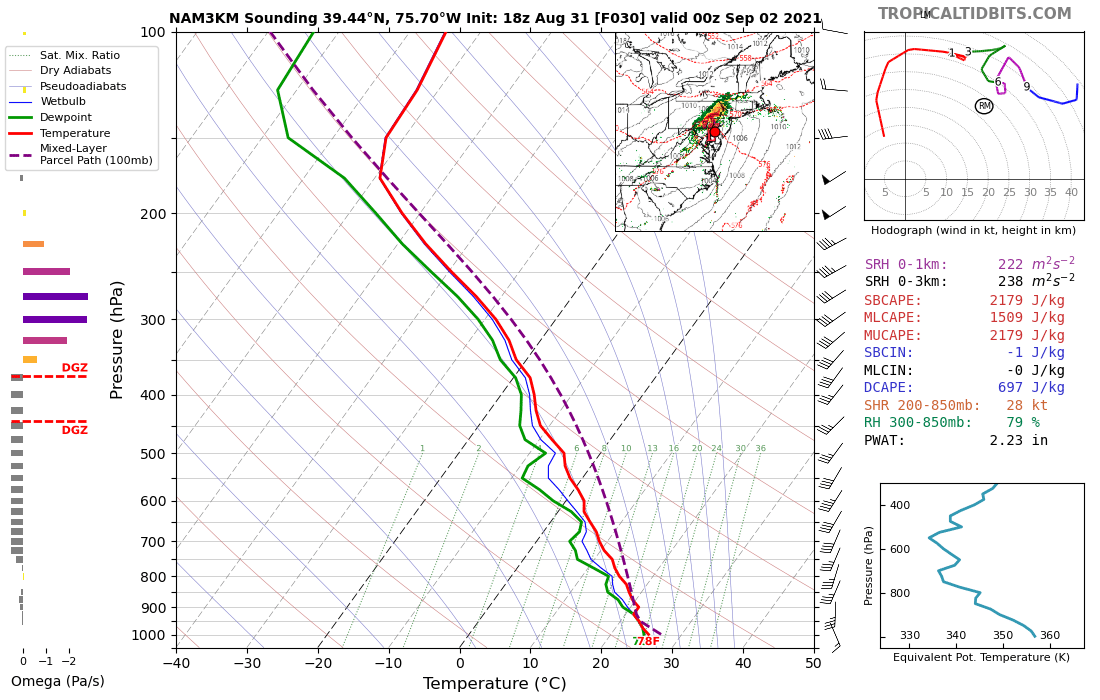 |
| A model-simulated sounding of the atmosphere near Wilmington, Delaware, on Wednesday afternoon. The clockwise line on the top-right graph shows strong vertical wind shear in the atmosphere, favorable for supercells that could produce tornadoes. || SOURCE: Tropical Tidbits |
West Street Damage. #AnnapolisTornado #Annapolis pic.twitter.com/pPfqxZRu89
— Eye On Annapolis (@eyeonannapolis) September 1, 2021
Mullica Hill, NJ #Tornado #njwx @6abcadamjoseph @6abc @CecilyTynan pic.twitter.com/Tx74Aq810X
— Zac (@_Zac13) September 1, 2021
Two more. Same tornado in burlington city #njwx pic.twitter.com/iiTtIrQzzz
— Neill Fowler (@fiveonfir3) September 1, 2021
Please consider subscribing to my Patreon. Your support helps me write engaging, hype-free weather coverage—no fretting over ad revenue, no chasing viral clicks. Just the weather.