
Surprise!
Tropical Storm Colin formed over coastal South Carolina early Saturday morning, becoming the third named storm of the 2022 Atlantic hurricane season.
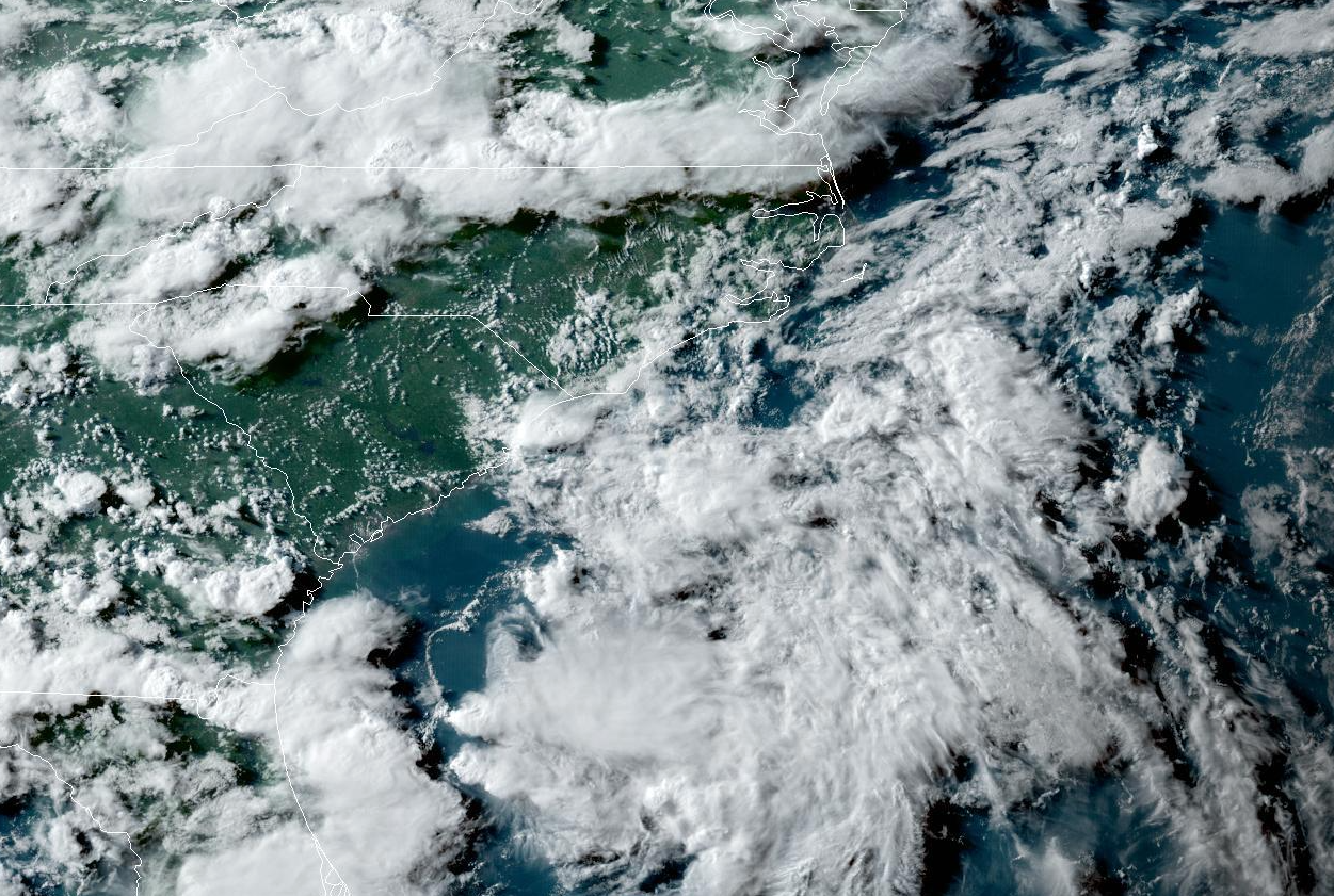
The storm is…somewhere…in that satellite image above. It takes a trained eye and some imagination to find it, but it’s there, according to the experts at the National Hurricane Center (NHC).
Where’d it come from? Who knows! The Carolinas are world-renowned for their barbecue, bad drivers, and spinning up tropical storms from seemingly nowhere.
A small low-pressure system developed off the Georgia coast early Friday afternoon. The NHC noted the system in its 2:00 p.m. tropical weather outlook and gave it a low chance of developing over the next couple of days.
Funny things happen close to the coast during the early summer, though, and the low-pressure system gradually became better organized. The NHC declared it Tropical Storm Colin at 5:00 a.m. on Saturday, saying in its first discussion:
A small area of low pressure formed along a surface trough just offshore of Savannah, Georgia, yesterday morning and moved inland across the Lowcountry of South Carolina by the evening. Deep convection formed near the low center as it was moving inland and has persisted and become better organized over the past 6 to 12 hours. In addition, surface observations and ASCAT data from 02-03 UTC indicated that an area of sustained 35-kt winds had developed offshore and near the coast of South Carolina. As a result, and rather unexpectedly, Tropical Storm Colin has formed near the South Carolina coast, centered just inland a bit to the northeast of Charleston.
Ain’t that somethin’?
Thankfully, Colin is relatively weak and folks getting rained on this long holiday weekend won’t notice much of a difference between this tropical storm and a typical dreary day.
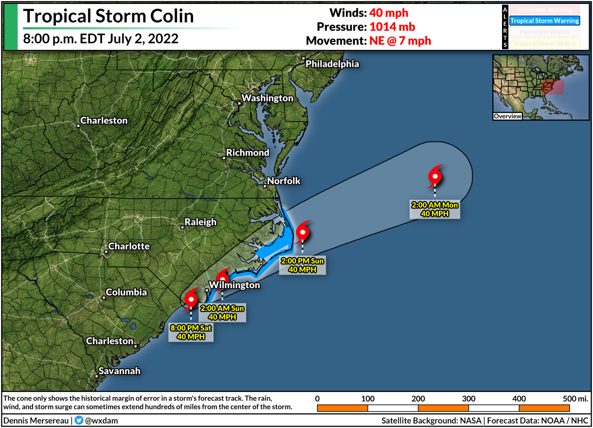
The latest forecast from the NHC shows Colin hanging around for another day, moseying over North Carolina’s Outer Banks before it loses tropical characteristics. Aside from rip currents at the coast, there’s not really much to worry about here—only an inch or two of rain with a low chance for flash flooding along the immediate coast.
There have been a decent number of short-lived tropical storms in recent years that spun-up just before they made landfall in the southeastern United States.
Last year’s Tropical Storm Mindy formed at 4:00 p.m. and made landfall on the Florida Panhandle four hours later. The year before that, Tropical Storm Bertha formed and hit Charleston, S.C., just an hour-and-a-half later.
Tropical Storm Colin also appears to be the third Atlantic storm in recent memory that strengthened into a tropical storm while the system’s center of circulation was over land.
Last year, forecasters upgraded Claudette into a tropical storm twice (!!) while it was over land. The system that became Tropical Storm Julia in September 2016 formed into both a tropical depression and a tropical storm while its center was inland over Florida’s East Coast.

You can follow me on Twitter or send me an email.
Please consider subscribing to my Patreon. Your support helps me write engaging, hype-free weather coverage—no fretting over ad revenue, no chasing viral clicks. Just the weather.