Quenching rains on the way to aid growing drought across the U.S.
Multiple systems sweeping across the United States this week will bring beneficial rains to areas of the Midwest and Gulf Coast that have been hit hard by drought in recent months.
Too much of a good thing is always a concern, of course, and some areas may face a flooding risk if rain falls too quickly on dry soil incapable of absorbing it all at once.
Widespread drought across the country
Drought conditions covered more than 40 percent of the United States heading into the beginning of October, and for the first time in more than three years, almost none of that drought—only 0.07 percent!—was found in California.
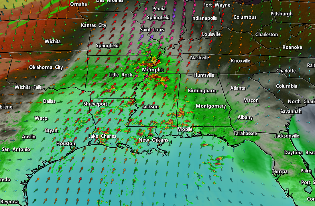
The driest conditions have taken a toll on the northern Gulf Coast, where the lack of precipitation has parched the land so much that many regions are in extreme to exceptional drought, the two highest levels on the United States Drought Monitor‘s scale.

Long spells of hot conditions, combined with a lack of tropical systems hitting the region, contributed to this summer’s building drought. In fact, the USDM’s change map shows that almost all of the drought east of the Rockies has built-in over the past eight weeks.
Some areas should see marked improvement over the next couple of days as two doses of rain sweep across the country.
Gulf downpours
A tropical disturbance in the southern Gulf of Mexico has a low chance of developing into an organized system as it slowly drifts north over the next couple of days.
Conditions aren’t all that conducive to development, though, so it’s more likely that this disturbance merges with a frontal system as it meanders toward the northern Gulf Coast.
Widespread steady rains will move over the northern Gulf Coast beginning Wednesday and lasting through Friday for spots.

We could see decent rainfall totals out of this event, with several inches likely from Louisiana into Florida. Given the potential for downpours and the region’s parched ground, a risk for flash flooding will develop, especially from New Orleans east toward Tallahassee.
This is a pretty classic setup for a strengthening El Niño during the cooler months. We should have more opportunities for widespread heavy rain in the coming weeks and months if past El Niño falls and winters hold true.
Midwest storm
Meanwhile, a low-pressure system developing over Colorado will bring several days of stormy and rainy weather to the Midwest as it slowly makes its way east through the remainder of the week.
Plenty of tropical moisture streaming north into the system, combined with the storm’s slow movement, will bring several inches of rain to most of the central U.S. Ongoing drought here could lead to the risk for flash flooding, as well, especially beneath any of the heavier thunderstorms that develop.

We could see some of those thunderstorms turn severe during the day Thursday as warm, unstable air streams over the central Plains ahead of an advancing cold front.
The Storm Prediction Center calls for risk for severe weather on Thursday across a chunk of the Plains that includes Kansas City and Omaha. Damaging winds and large hail will be the main threats with the strongest storms, and the SPC’s forecast points out there’s a non-zero risk for tornadoes.


