Tropical Storm Melissa may threaten the Greater Antilles as a hurricane
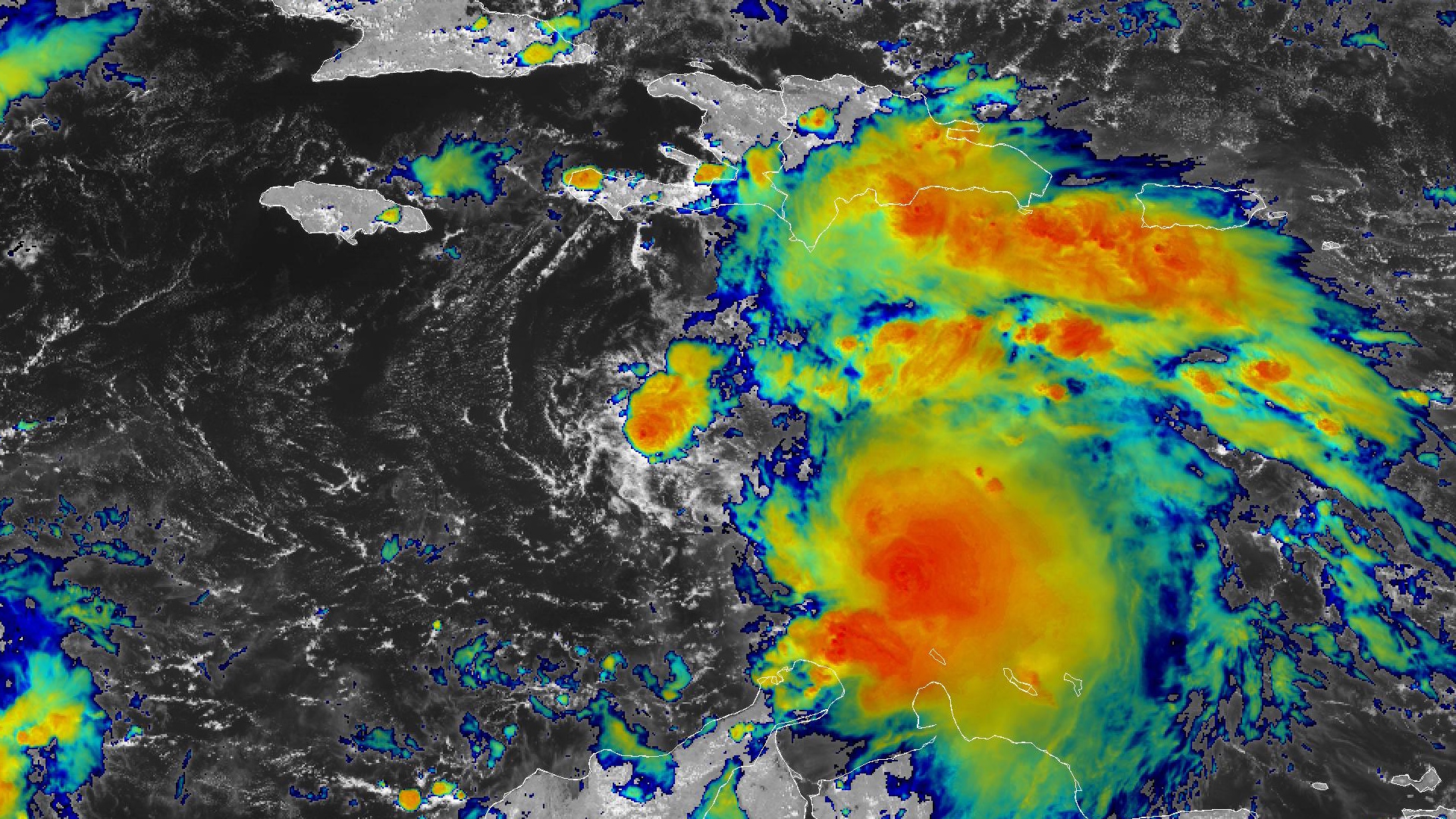
Tropical Storm Melissa formed in the Caribbean Sea on Tuesday morning. A weak pattern around the storm will force it to meander toward Haiti and Jamaica over the next few days, where it could pose a major threat for flash flooding and landslides.
Melissa developed from a vigorous tropical wave that took its time traversing the Atlantic Ocean over the past week or so.

It’s a disheveled storm this afternoon, with the low-level center of circulation displaced from its thunderstorm activity to the east. This disorganization will prevent it from strengthening much in the short term.
While the storm is facing some disruptive wind shear right now, steering currents around the storm will collapse later this week. As a result, Melissa will slow to a crawl as it approaches the Greater Antilles. This slow and somewhat erratic movement means that the storm’s future track is more uncertain than usual.
A hurricane watch is in effect for Haiti’s Tiburon Peninsula (full disclosure: I had to google the name for that), while a tropical storm watch is in effect for all of Jamaica.
Extensive flash flooding and landslides are possible on top of the gusty winds as the storm slowly moves through the region.

Water temperatures across the Caribbean are very warm for mid-October. Melissa is the region’s first tropical system this year, shutting out the possibility of no tropical systems in the Caribbean for the first time since 1997.
The strong winds of tropical storms and hurricanes churn up the ocean surface and induce upwelling of cold waters. Caribbean waters haven’t really had the opportunity to overturn, so to speak, given the lack of tropical systems so far this year.
It’s worth noting that a slow-moving storm getting its act together over steamy ocean waters can lead to more strengthening than anticipated.
[Satellite image courtesy of NOAA.]
Follow me on Facebook | Bluesky | Instagram
Get in touch! Send me an email.
Please consider subscribing to my Patreon. Your support helps me write engaging, hype-free weather coverage—no fretting over ad revenue, no chasing viral clicks. Just the weather.


