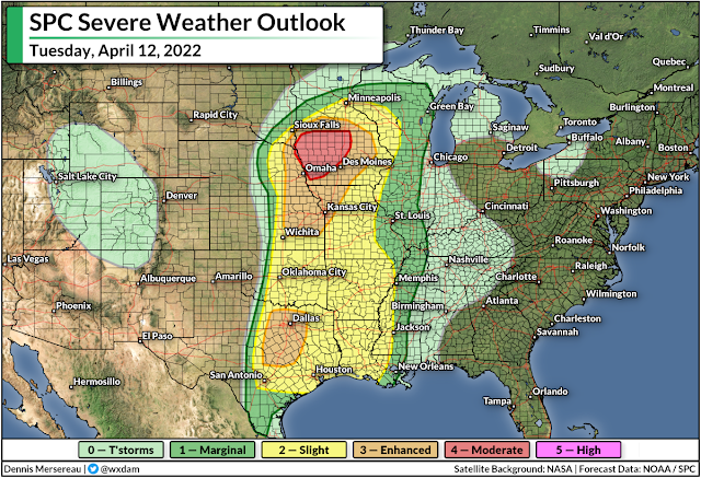
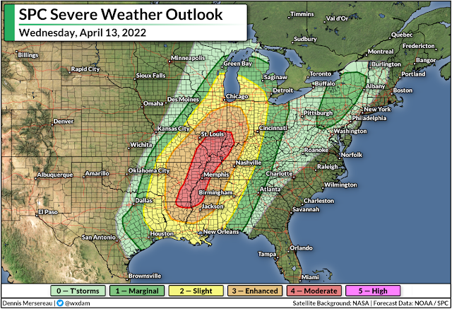
An increasing threat for severe thunderstorms will target parts of the central and southern United States over the next couple of days. The Storm Prediction Center issued a moderate risk—a four out of five on the scale measuring the threat for severe thunderstorms—for a large chunk of Iowa on Tuesday and for much of the Lower Mississippi Valley on Wednesday.
Tuesday's Storm Risk
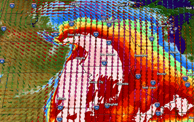
A dynamic storm system developing over the central United States will bring a huge variety of dangerous conditions from border to border this week, ranging from a serious blizzard in the Dakotas to an 'extremely critical' fire weather risk on the southern Plains.
Warm, unstable air surging north ahead of the low-pressure system will provide plenty of fuel for thunderstorms to bubble up across the middle of the country as we head into Tuesday evening. Strong wind shear throughout the atmosphere will allow these storms to turn severe in a hurry, bringing a risk for damaging winds, large hail, and tornadoes.
The most significant risk will follow near the center of the low-pressure system itself as it rolls across the Upper Mississippi Valley. Forecasters at the Storm Prediction Center issued a moderate risk for severe weather covering much of northern and western Iowa for the late afternoon and evening hours on Tuesday.
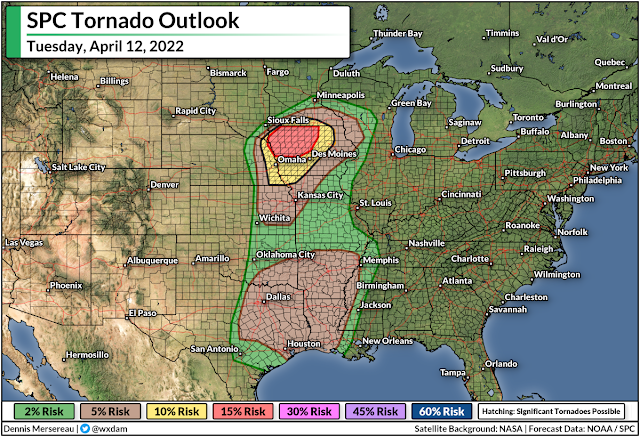
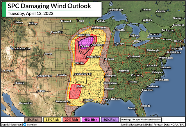
Things will unfold here in a hurry. Communities in and around the moderate and enhanced risk areas could see supercells that produce strong, long-lived tornadoes, hail the size of golf balls or larger, and wind gusts of 70+ mph.
Storms will coalesce into squall line(s) as the evening progresses, at which point the predominant threat will switch over to widespread damaging wind gusts with the chance for embedded tornadoes.
This is especially dangerous because many of the severe storms will occur around and after sunset. Make sure you have a way to receive severe thunderstorm and tornado warnings if you're asleep or otherwise tuned out. Check your phone and ensure that emergency alerts are activated for tornado warnings. Always trust the warnings and never wait to see danger for yourself before you act.
Wednesday's Storm Risk
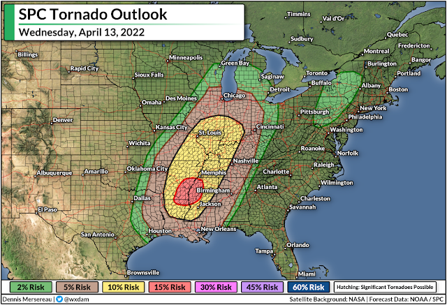
The threat for dangerous thunderstorms will shift east on Wednesday as the low gradually makes its way into the Great Lakes region. The greatest threat for severe thunderstorms will cover the Lower Mississippi Valley during the afternoon and evening hours.
Similar to Tuesday, communities in and around the moderate and enhanced risk areas could see strong, long-lived tornadoes, as well as a risk for damaging wind gusts of 70+ mph.
The threat for significant severe weather covers some high-density population centers, including Jackson, Mississippi; Little Rock, Arkansas; Memphis and Nashville; St. Louis; and a wide swath of Illinois and Indiana.
A more diffuse risk for severe thunderstorms will head toward the eastern states by Thursday, with the risk for isolated damaging wind gusts in thunderstorms that form along the cold front as it pushes through the region. These strong wind gusts are possible in storms that form from the Florida Panhandle all the way up the coast to southeastern New England.
Beyond, we should get a much-needed break from organized severe weather until next week.
[Top image made using WSV3]
You can follow me on Twitter or send me an email.
Please consider subscribing to my Patreon. Your support helps me write engaging, hype-free weather coverage—no fretting over ad revenue, no chasing viral clicks. Just the weather.
Please consider subscribing to my Patreon. Your support helps me write engaging, hype-free weather coverage—no fretting over ad revenue, no chasing viral clicks. Just the weather.




0 comments: