Flooding risk as atmospheric river fuels rainy, windy storm sweeping into California
A series of systems rolling through the eastern Pacific will wash ashore in California over the next couple of days, fueling a spell of foul weather across the state.
Heavy rains are likely up and down the coast, with southern California facing the greatest risk for flooding and landslides. Prolific mountain snows are likely across higher elevations throughout the Sierra. Gusty winds are likely across the state early into the workweek, which may lead to tree damage and power outages.
A quick look at the pattern across the country this weekend almost looks like an image you’d see in the El Niño chapter of a meteorology textbook. A strong jet stream draped across the entire southern half of the U.S. is exactly what you’d expect to see during an El Niño winter.
 |
| A model image of the jet stream on Saturday afternoon. (Tropical Tidbits) |
An upper-level trough digging into the West Coast will drive the active weather over the next couple of days. The most impactful conditions will arrive courtesy of a low-pressure system hitting the coast late Saturday through Sunday, though heavy rains will continue Monday and Tuesday across the southern half of the state.
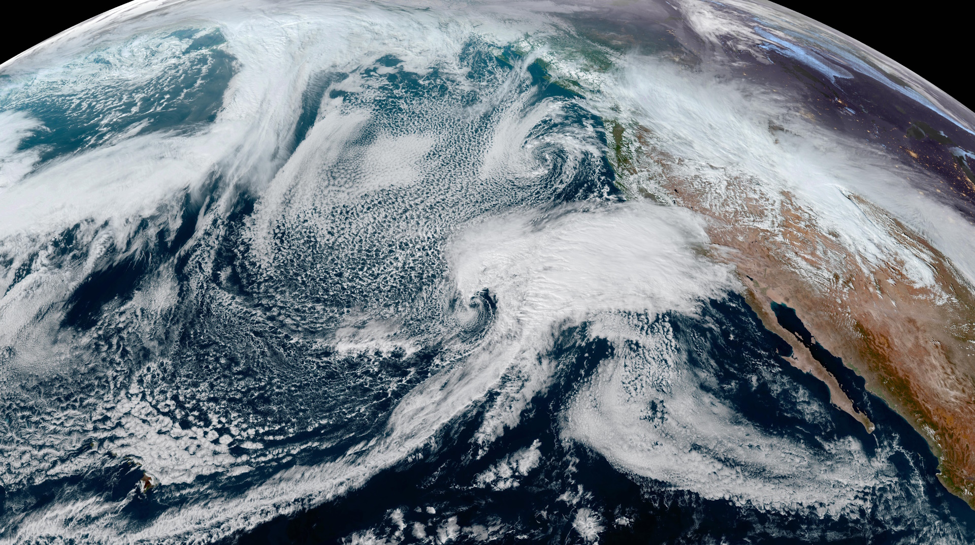
Powerful southwesterly winds hauling tail into the California coast is dragging a plume of tropical moisture straight from Hawaii. This ribbon of elevated moisture—called an atmospheric river—will fuel the drenching rains we’ll see across California over the next few days. Atmospheric rivers provide a vast reserve of moisture for storms to tap into to create excessive rainfall rates.
 |
| A model animation showing the atmospheric river moving into California through Tuesday, Feb. 6. (PolarWx/Tomer Burg) |
Rain is already starting to come ashore in California on Saturday afternoon, and we’ll see the rain increase in coverage and intensity through the overnight hours and into the day Sunday.
We’ll see the rain slacken a bit for the northern half of the state as this initial system moves east. However, the heart of the atmospheric river will continue streaming over southern California through at least Tuesday, providing ample opportunity for bouts of heavy rain to continue throughout the area.
The Weather Prediction Center’s latest forecast calls for 3-5 inches of rain for just about the entire California coast from San Diego all the way up to near Eureka. It’s going to be a soggy couple of days for San Diego, Los Angeles, and San Francisco.

Higher terrain will enhance rainfall totals up and down the coast—especially along the Transverse Ranges, where 5-7 inches of rain is in the forecast with the potential for some areas to see locally higher rainfall totals.
Folks in the Central Valley will benefit (or suffer, depending on your point of view) from the rain shadow effect, with less than an inch of rain over the next week for communities like Bakersfield and Fresno.
Much of #SantaBarbara and #Ventura Counties are at a "High" risk for excessive rainfall @NWSWPC — this mean there is a 70% risk of meeting flash flood rainfall conditions
❗️80% of flood-related DAMAGES and 40% of flood related FATALITIES occur during high risk days❗️ pic.twitter.com/dSrraYwv0l
— NWS Los Angeles (@NWSLosAngeles) February 3, 2024
As usual, a glut of torrential rain heading for California is a recipe for widespread flash flooding and landslides. The greatest risk for flooding exists across southern California.
The usual safety spiel is extra important this time around: Never attempt to drive across a flooded roadway. It’s impossible to tell how deep the water is until it’s too late, and California’s rugged terrain makes it more likely that the road is washed-out beneath the water.
Precipitation will fall as heavy snow across the Sierra above 3,000 feet. Freezing levels will rise to 4,000 to 6,000 feet as mild air flows inland with the surge of subtropical moisture. Several feet of snow and whiteout conditions are likely in areas expecting all snow, which will force some road closures through the mountains as the heavy, blowing snow will be extremely difficult or downright impossible.

Widespread gusty winds are likely as this initial storm rolls across the state Saturday night through Sunday. High wind warnings and wind advisories are in place for most of California. Gusts of 40+ mph are possible in areas under a wind advisory, while gusts of 60+ mph are expected for communities under high wind warnings.
The combination of strong winds and heavy rainfall will lead to a risk for tree damage and power outages. Avoid rooms where trees or tree limbs may fall through the walls or roof during high winds, and try not to park beneath trees if you can help it.
[Satellite image courtesy of NOAA]


