

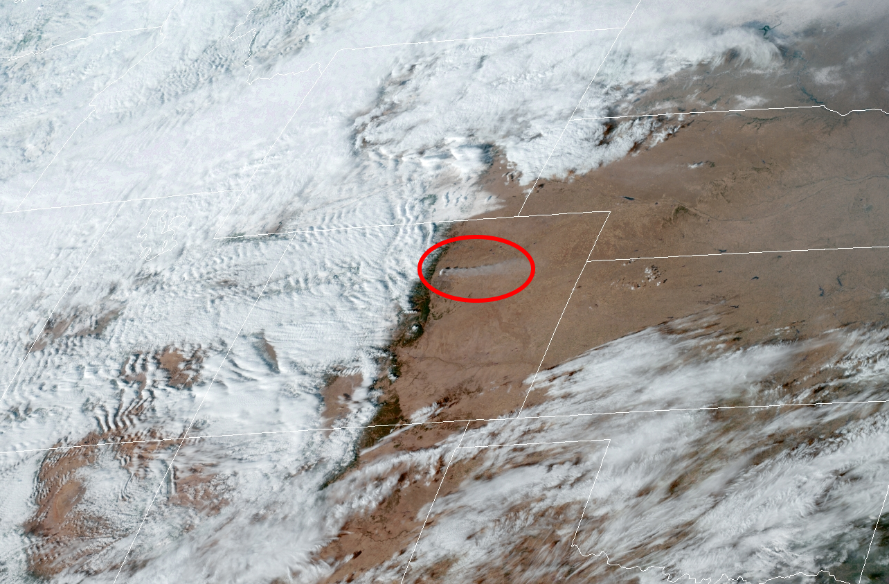
The intense wildfire that exploded near Boulder, Colorado, on Thursday afternoon was months in the making.
Social media pictures relayed a small sample of the nightmarish conditions residents, workers, and shoppers faced when fast-moving flames rapidly engulfed communities southeast of Boulder.
From our photog @dave_wille near the Flatirons. These fires continue to take out entire neighborhoods. @CBSDenver #MarshallFire pic.twitter.com/UMViz2reI6
— Ryan Greene 📷 (@RyanCBS4) December 31, 2021
We are at McCaslin and Washington in Louisville. Winds are gusting 50mph+ and there’s no stopping the Marshall Fire as it moves from one home to the next. pic.twitter.com/RkqBOjPSWN
— Kyle Clark (@KyleClark) December 30, 2021
#marshallfire views from Avista Hospital in Louisville today. pic.twitter.com/pkKlyfURTM
— BrianOnTheNet (@OriginalStalkie) December 30, 2021
Flames forced residents to flee their homes in the towns of Superior and Louisville, both situated about six miles southeast of Boulder. As of 9:15 p.m. EST, news reports indicated that hundreds of homes and businesses were destroyed by the fire, including a shopping center and a hotel.
There's no word if anyone was injured or killed in the disaster, though sadly it wouldn't be a surprise if there were folks who couldn't evacuate before the fast-moving flames arrived.
This kind of firestorm is one of the most horrifying natural disasters possible, and the region has been inching toward this kind of eruption for a long time.
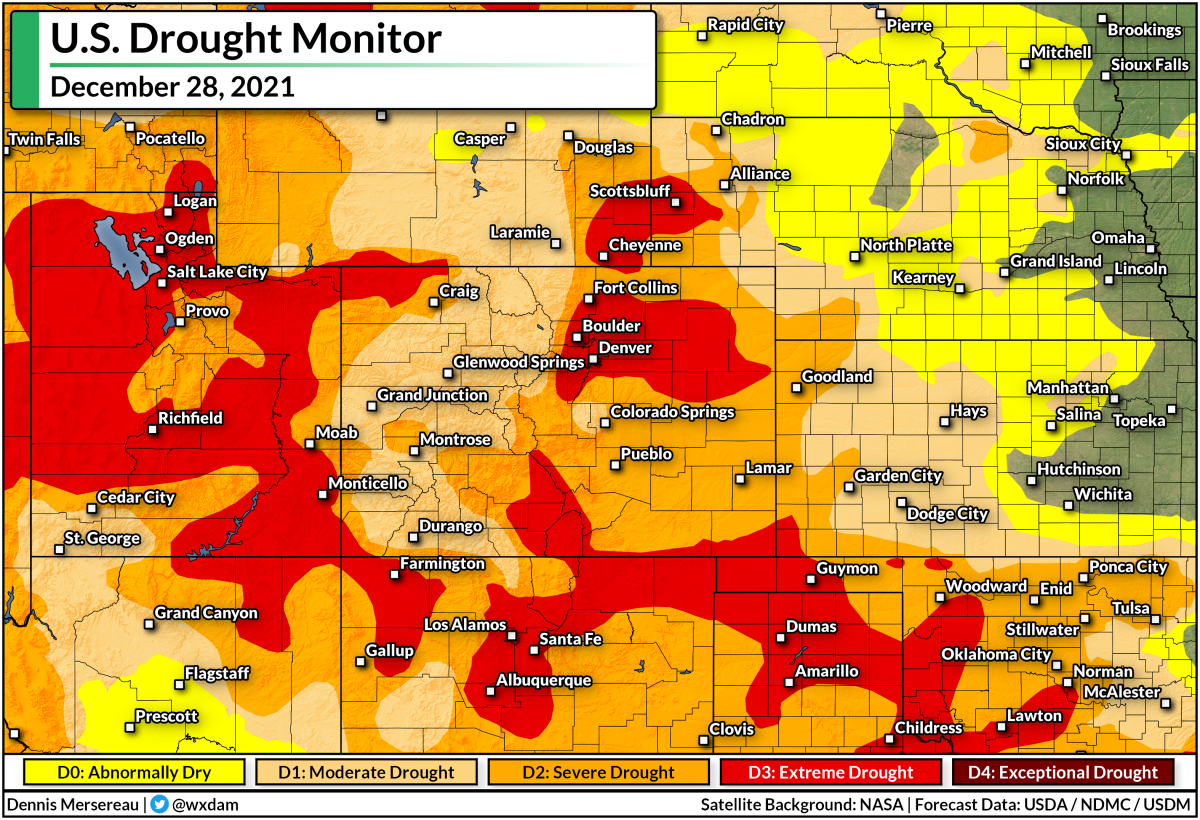
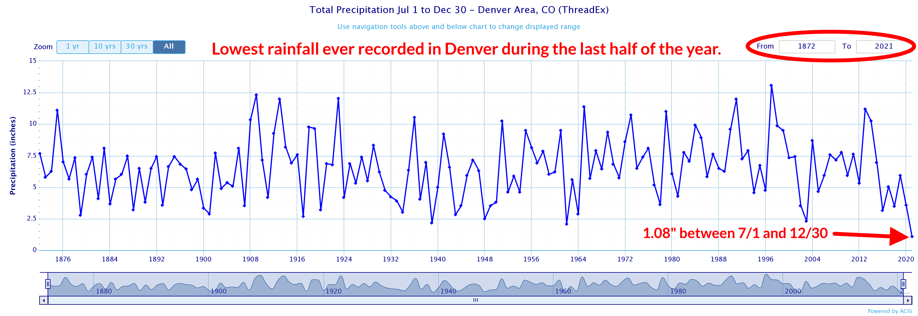
This week's update of the U.S. Drought Monitor found much of northeastern Colorado mired in an extreme drought. "Extreme" feels like an understatement. Denver International Airport has only seen 1.08" of rain since July 1st, making this the driest last-half of the year ever recorded.
Such a deep and prolonged drought desiccated vegetation, leaving woodlands and grasslands susceptible to the tiniest spark. Add in the fact that this has been one of the warmest Decembers on record in the region—Boulder's average high so far this month is 54.5°F, the fourth-warmest on record since the late 1800s—and you have the background ingredients for fires to spark and spread.
Then there was the wind. It was incredibly windy along the Front Range today. Downsloping winds screamed across the area on Thursday afternoon, with 80-100+ mph gusts recorded in and around Boulder for the bulk of the day. The combination of exceptional dryness, unusual warmth, and powerful winds allowed this fire to ignite without issue and spread with frightening speed.
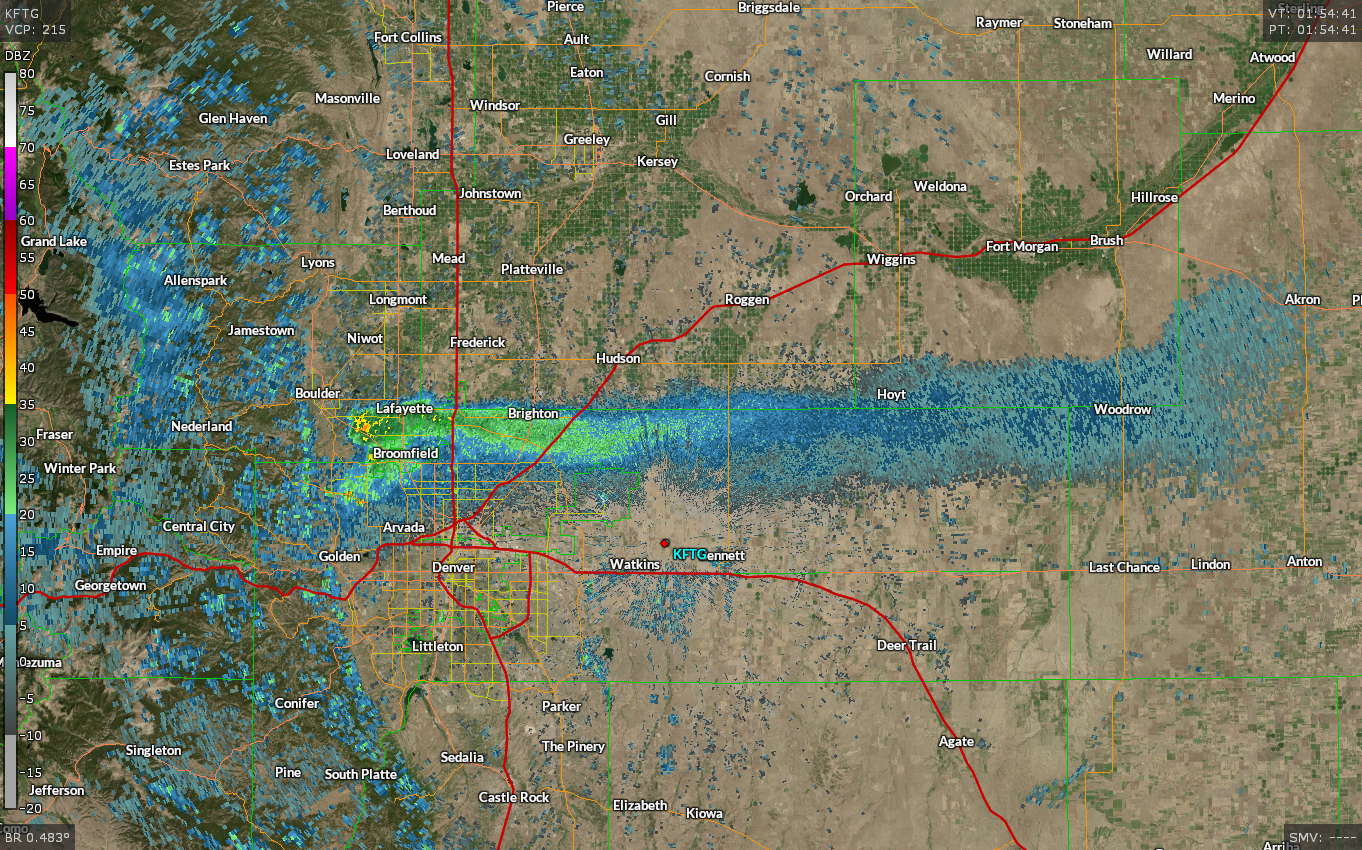
The fire is so intense that the smoke plume is more than 100 miles long on radar.
Winds started to die down on Thursday evening, which should help crews get a handle on the flames and stop the inferno's progression into neighborhoods and business districts.
The kicker is that a winter storm warning is in effect for the affected areas.
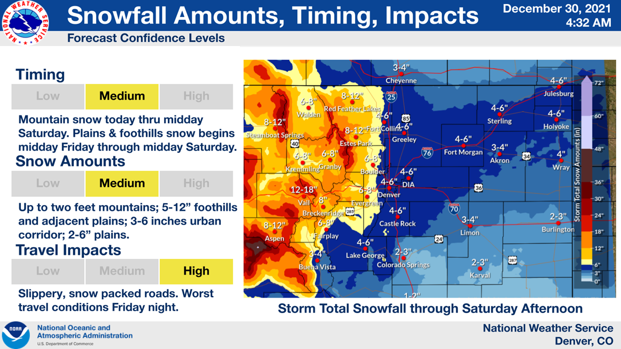
Beginning on Friday, the National Weather Service expects 6-8 inches of snow to fall across the Boulder area through Saturday afternoon, which should help to put out any hotspots that remain.
You can follow me on Twitter or send me an email.
Please consider subscribing to my Patreon. Your support helps me write engaging, hype-free weather coverage—no fretting over ad revenue, no chasing viral clicks. Just the weather.
Please consider subscribing to my Patreon. Your support helps me write engaging, hype-free weather coverage—no fretting over ad revenue, no chasing viral clicks. Just the weather.


0 comments: