A robust low-pressure system developing over the center of the United States on Friday will push east through New Year's Day, bringing a widespread risk for severe thunderstorms to the southeastern states. As always, a midwinter risk for severe weather is especially risky because the sun sets early and folks aren't tuned in to the threat for bad storms this time of year.
The low, developing over the southern Plains on Friday afternoon, will start to push into the Midwest overnight Friday into Saturday. If you live just about anywhere in the southern United States, you know that it's been unusually warm and humid for a while now. Southerly flow pulled north by the low will accentuate that spring-like warmth, providing the instability and lift needed to trigger thunderstorms.
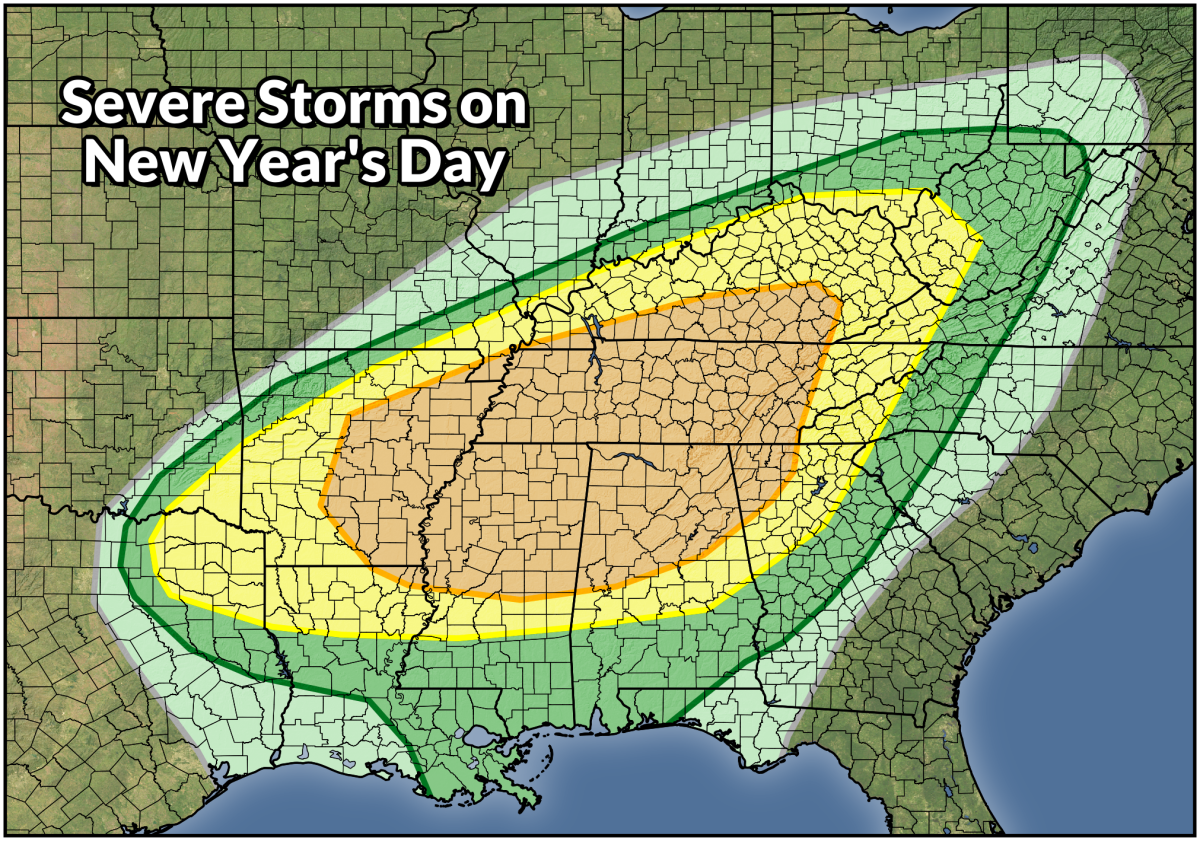
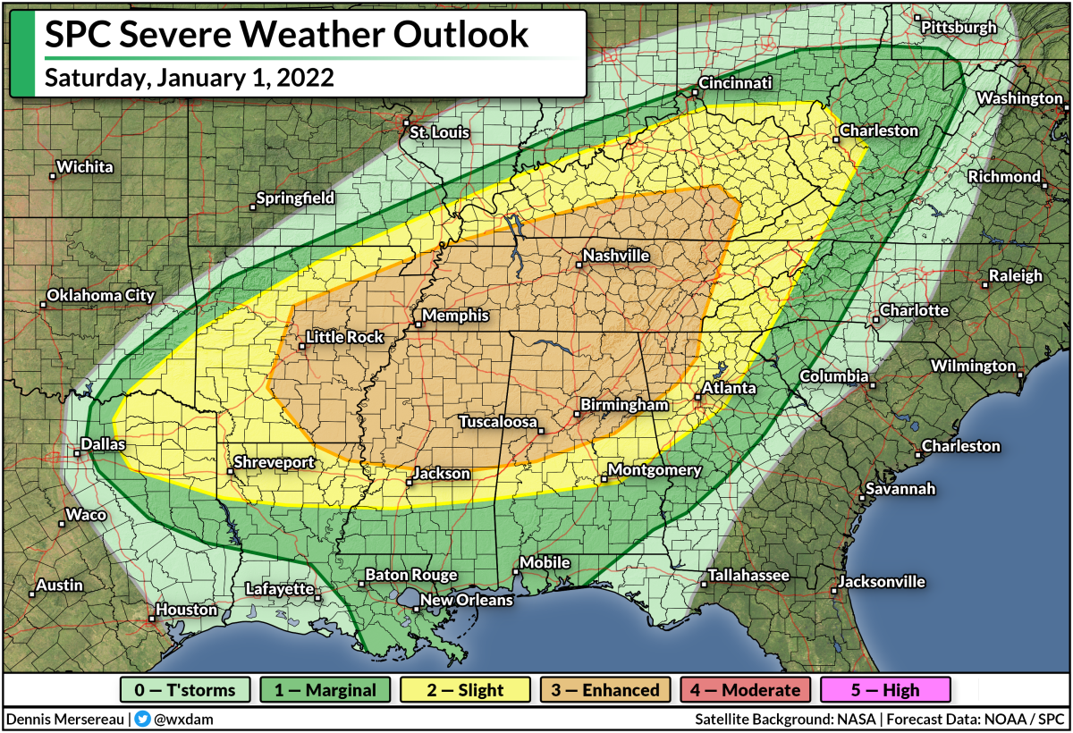
The latest forecast from the Storm Prediction Center (SPC) paints a widespread risk for severe thunderstorms on Saturday that spans south as far west as Dallas, as far south as New Orleans, and as far north as the Mason-Dixon line in the Appalachians. The greatest threat for dangerous thunderstorms lies within the enhanced risk (orange) area, which covers Little Rock, Memphis, Nashville, Tuscaloosa, Huntsville, and Birmingham.
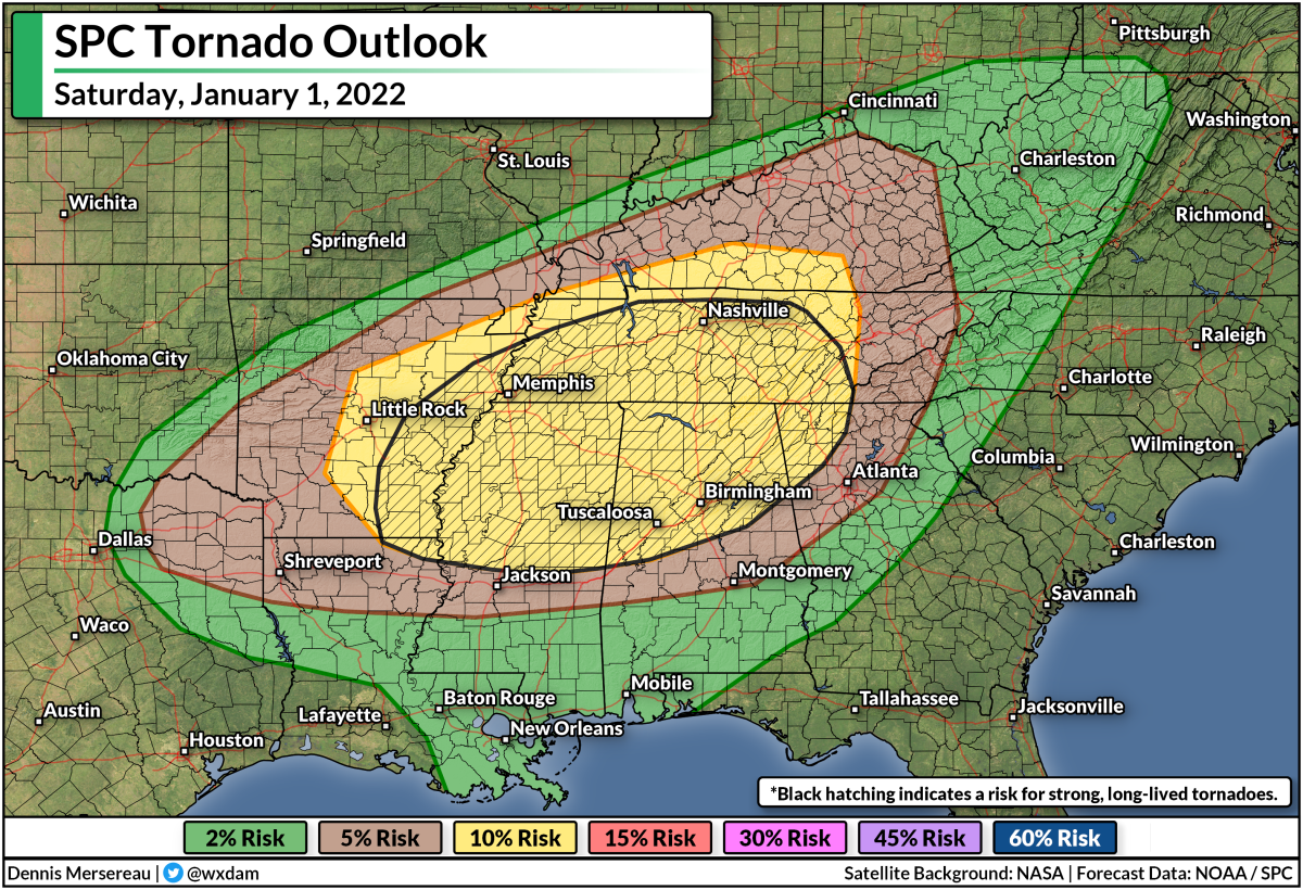
Forecasters issued the enhanced risk for an elevated threat for tornadoes from any thunderstorms that form in the region.
There is some uncertainty around the tornado risk on Saturday. The SPC's forecast discussion on Friday notes that the environment will be very favorable for supercells to develop, but limited instability may inhibit the development of thunderstorms in the area. Later in the evening, a squall line following the cold front will bring another chance for spin-up tornadoes along the leading edge of the line.
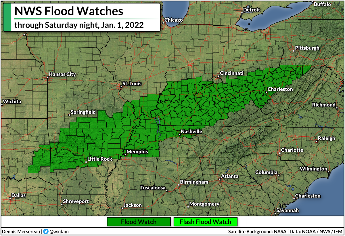
There's also a risk for flash flooding this weekend, mostly across the Ohio River Valley. Steady rain and thunderstorms will produce several inches of rain along and just south of the Ohio River. The rain will fall fast enough that it could lead to flooding.
Severe storms are bad, but flooding kills more people every year than winds and tornadoes. It's impossible to tell how deep the water is until it's too late, and it only takes a few inches of moving water to lift a vehicle and carry it downstream.
The risk for severe weather will follow the cold front as we head into Sunday, bringing a risk for damaging winds and possibly a few tornadoes to the rest of the southeast through the evening hours.
If you live in or anywhere near the risk for storms this weekend, please make sure you have a way to receive severe thunderstorm and tornado warnings the moment they're issued. Many of the storms on Saturday will occur after sunset. Nighttime severe weather is especially dangerous because you can't see what's coming your way (which is why you should always seek shelter if there's a warning!), and because people tune out and go to sleep. Make sure you have a way to receive severe weather warnings even if you're asleep.
Here's a bit I wrote on making sure you're prepared for severe storms from earlier in December after the horrible tornadoes in Kentucky:
Please get a weather radio and check your cell phone's emergency alert settings.
Smartphones are the most common way we receive tornado warnings these days. Modern technology geotargets warnings to your location, sending you a noisy push alert the moment your location is placed within a tornado warning polygon. Wireless emergency alerts have been credited with saving countless lives over the past decade.
The only problem is that people tend to switch these alerts off after one or two ill-timed notifications, usually for routine tests or child abduction alerts. Please take a minute today to go into your smartphone's settings and ensure these alerts are activated for tornado warnings. It could very well wake you up and save your life when you're least expecting it.
What if your device's battery dies, you don't have good reception, or you simply can't hear your phone while you're asleep or in the other room? That's when a NOAA Weather Radio can come in handy.
NOAA Weather Radios are like smoke detectors for the weather. You can program these devices to sound a loud tone and automatically read a warning out loud when your county goes under a severe weather watch or warning. They can provide you ample warning when severe weather is on the way even if your electricity and internet go out.
You can follow me on Twitter or send me an email.
Please consider subscribing to my Patreon. Your support helps me write engaging, hype-free weather coverage—no fretting over ad revenue, no chasing viral clicks. Just the weather.
Please consider subscribing to my Patreon. Your support helps me write engaging, hype-free weather coverage—no fretting over ad revenue, no chasing viral clicks. Just the weather.


0 comments: