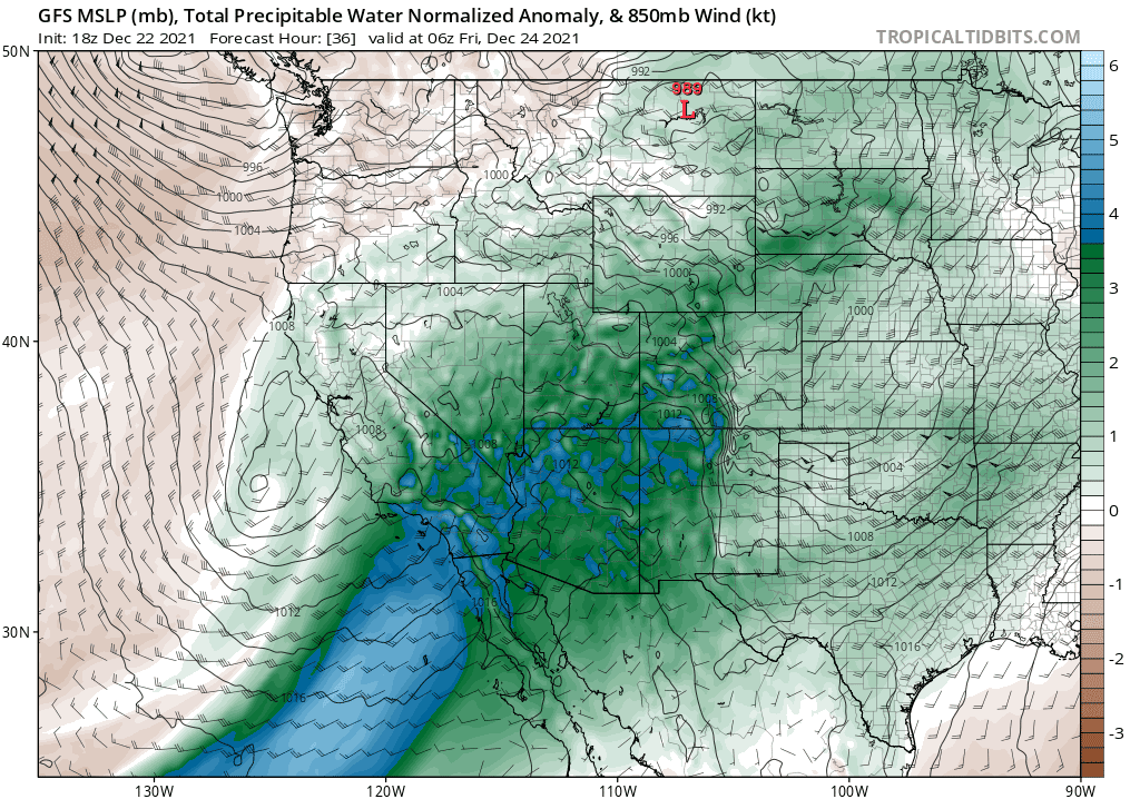
It sure seems like the West Coast has gotten a decade's share of interesting weather over the past year. The active pattern will continue over the next couple of days as California and Oregon are socked with heavy rain and high-elevation snows. Meanwhile, a lobe of the polar vortex dipping into Western Canada will send bitterly cold air into the Pacific Northwest. Some spots could even see snow around Christmas.
Heavy Rain and Snow
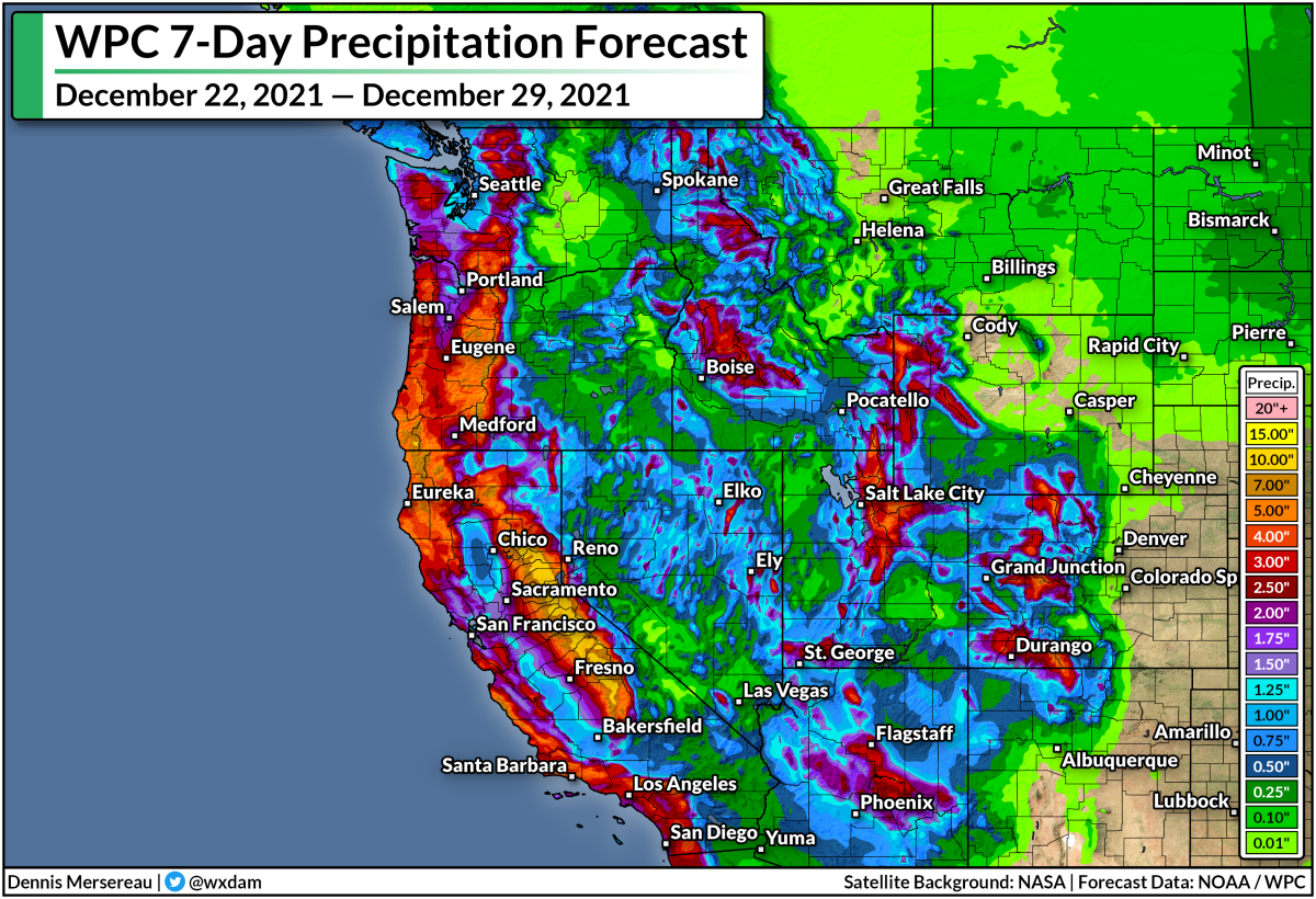
Several surges of moisture will wash over the West Coast through the end of the week, bringing heavy rain to lower elevations and blockbuster snowfall to the mountain ranges. The National Weather Service says that 6-8 feet of snow is possible across California's mountains, with totals up to 10 feet possible in the highest peaks.
The precipitation forecast above (from the Weather Prediction Center) shows liquid precipitation totals from both rainfall and snowfall. That huge splotch of 10"+ of rain over the Sierra Nevada is entirely snow, showing how well the mountains will wring out every juicy drop of moisture heading their way.
Hefty rainfall totals are likely at lower elevations. All the major cities along the coast can expect several inches of rain over the next couple of days. This includes Los Angeles and San Diego, where rain is uncommon enough these days that a simple rain shower gets the breaking news treatment.
Watch out for the potential for flooding issues in vulnerable areas during heavy rainfall, especially areas that recently experienced wildfires. Burn scars make the ground impermeable, forcing rainwater to simply run off instead of absorbing into the ground.
A Cold Pattern Into 2022
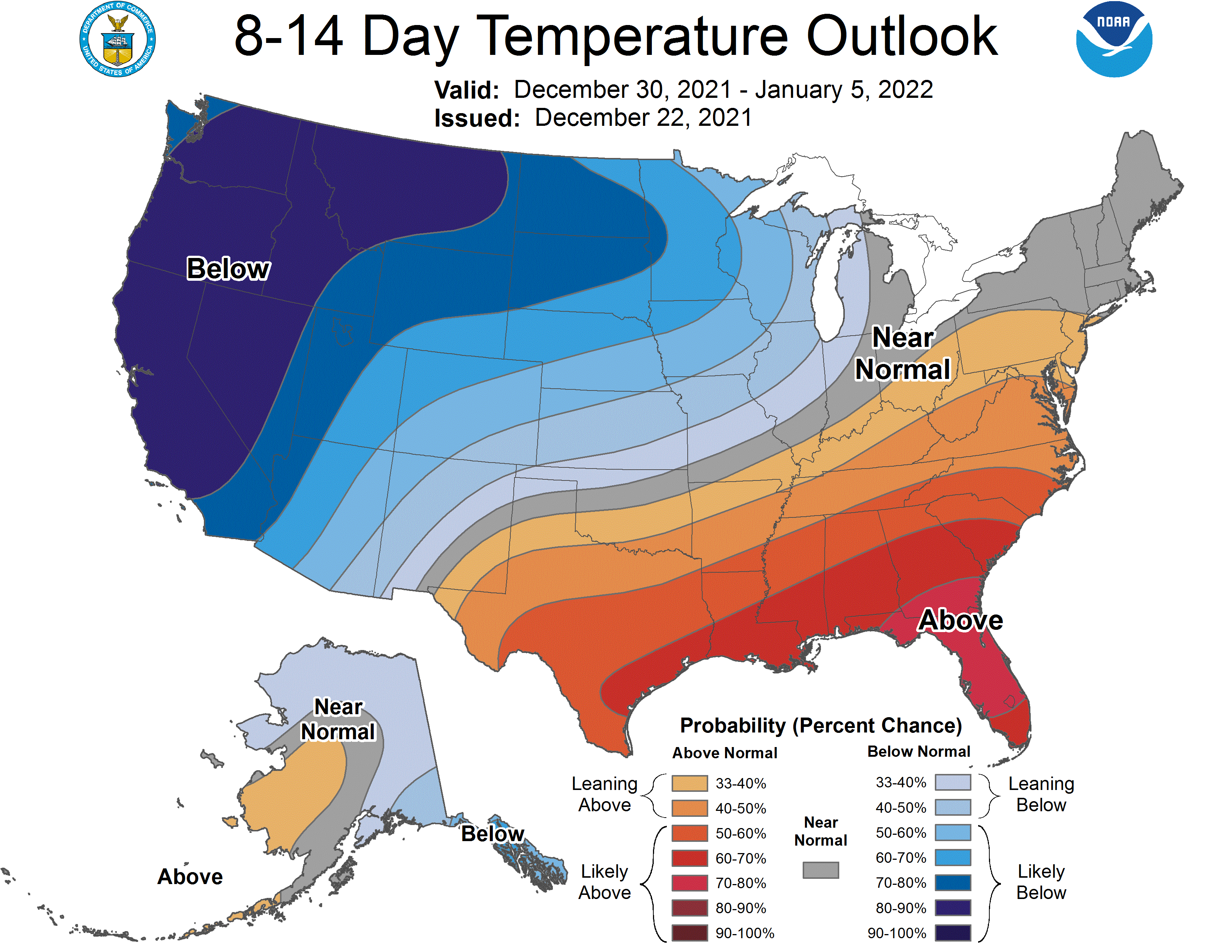
Temperatures are set to dive across much of the Pacific Northwest heading into Christmas and likely lasting straight into the first week of January. Here's what the Climate Prediction Center's temperature outlook looks like for the next two weeks:
It's pretty rare to see that kind of confidence in below-normal temperatures in this part of the country!
It's about to get super cold on the Canadian Prairies. Temperatures will dive far below zero for the foreseeable future, with wind chill readings pushing -40°F at times by early next week. That surge of Arctic air isn't going to stop at the Rockies.
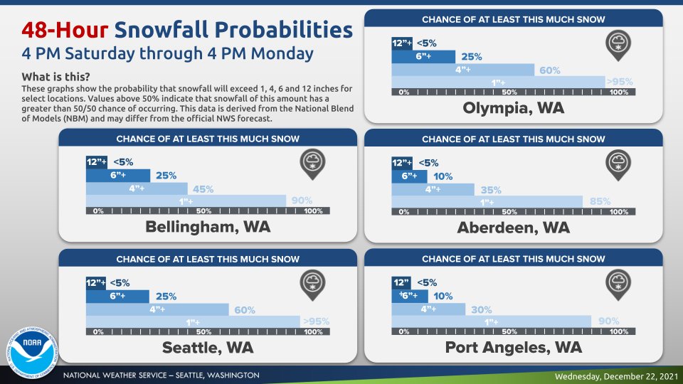
Frigid temperatures will spill down to sea level across the Pacific Northwest, where even Vancouver, B.C., is looking at the potential for significant snowfall heading into this weekend. Snow is possible even at lower elevations throughout western Washington, which is great news for Seattle-area snow lovers.
The National Weather Service in Seattle issued this graphic on Wednesday, highlighting their confidence in accumulating snow across lower elevations (including Seattle!) this weekend:
The real story here is the staying power of the cold air. It's going to get cold and stay cold for a long time. It's likely that Seattle will fall below freezing this weekend and not climb back above freezing for a week or longer. That's going to be rough on folks who don't have proper heating, proper warm clothes, or even adequate housing. Typical warming methods like public libraries, stores, and designated heating centers are going to be tricky with the latest coronavirus surge sweeping the country.
Remain mindful of the threat that extended exposure to cold weather can pose, and please check in on loved ones and neighbors you know or even suspect might not have adequate means of staying warm during this long winter chill.
[Model Graphic: Tropical Tidbits]
You can follow me on Twitter or send me an email.
Please consider subscribing to my Patreon. Your support helps me write engaging, hype-free weather coverage—no fretting over ad revenue, no chasing viral clicks. Just the weather.
Please consider subscribing to my Patreon. Your support helps me write engaging, hype-free weather coverage—no fretting over ad revenue, no chasing viral clicks. Just the weather.


0 comments: