The Mid-Atlantic And Northeast Should Keep An Eye On Henri Over The Next Few Days
It’s a good idea to keep Tropical Storm Henri in the back of your mind over the next couple of days if you live in the Mid-Atlantic or northeastern United States. There’s a chance—a chance—that the storm could affect land late this weekend or early next week.
There have been a lot of vague social media posts about this storm over the last 24 hours. Meteorologists are starting to worry about it, but it’s tough to say “hey, this is a possibility” on Twitter or Facebook without it being taken as a blaring alarm bell.
Nuance is poison on social media. It doesn’t have to be, but we’ve trained ourselves not to pay attention beyond 280 characters. I’m guilty of it, you probably are too. But some things just can’t be condensed into a tweet.
And that’s where we are today.
There’s a small but nonzero chance this storm might be a headache in a few days, so here’s what you need to know and what you can do now in the off-chance that the storm turns toward land later on.

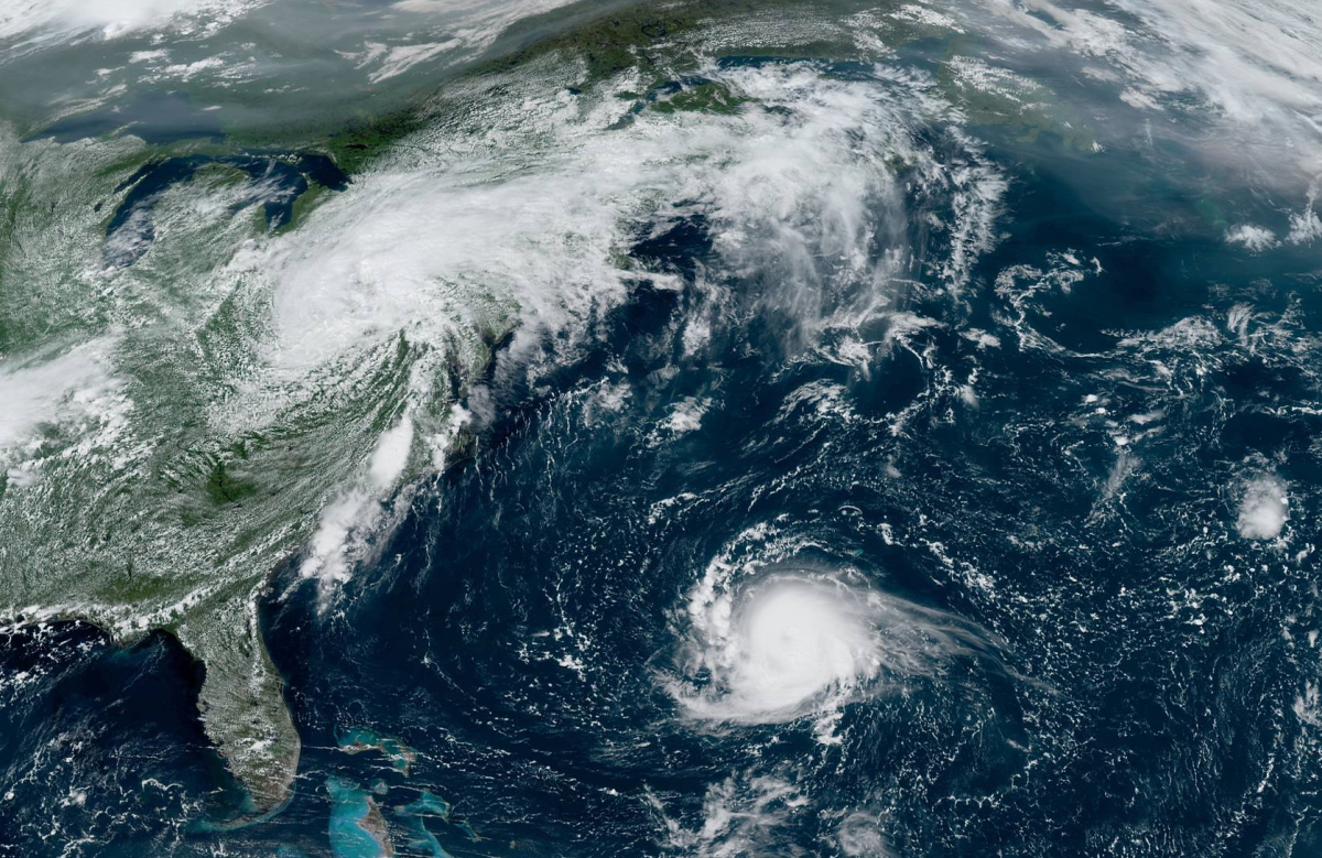
The latest advisory from the National Hurricane Center shows Henri approaching hurricane strength as it swirls south of Bermuda. The storm has been traveling south and west this week, but it’ll start to curve to the north over the next few days as the Bermuda High catches the storm and starts steering it along.
That’s where forecast confidence in Henri’s future track starts to fall off. Many models show Henri simply turning northeast and heading out to sea. But several weather models show the possibility that a ridge of high pressure over Eastern Canada could block the storm and essentially force it into the U.S. East Coast.
Here’s what the NHC said about the storm’s track at their 11:00 a.m. discussion on Wednesday:
One complicating factor is that several of the models show a ridge building over the northwestern Atlantic and Atlantic Canada, which could cause the storm to stay on a more northward track closer to New England than currently forecast.The spread in the models for Henri’s future track is quite large, with some guidance as far west as Long Island and as far east as 62W longitude. Overall, the models continue to walk left each cycle, and the NHC track forecast has again been shifted in that direction.NOAA Gulfstream IV missions and special weather balloon soundings have been scheduled, and it is hoped that this additional data will help the models handle the evolving steering pattern.Given the uncertainty in the longer range track forecasts, users should be prepared for additional adjustments to the NHC track forecast in future forecast cycles.
(I edited the formatting a bit so it’s readable here.)
Lots can and will change between now and this weekend, but it never hurts to keep the storm in the back of your mind if you live in the Northeast or Mid-Atlantic.
Do you have flashlights and batteries? How about non-perishable food that doesn’t need to be cooked? Ravioli is good straight out of the can, especially when the power is out and you’re tired of potato chips.
Don’t forget all the things we don’t think about until we need them, like personal hygiene supplies, medicines, cash if you can afford it (cards don’t work if the power’s out), and battery backups for your cell phone.
If the forecast doesn’t change and the storm winds up going out to sea—which happens more often than not!—then hey, you’ll be prepared for the next time a bird pecks through a power line. But if not, you’ll be thankful you thought ahead.
We’ll all know more over the next couple of days. Make the National Hurricane Center a frequent stop on your browsing rounds over the next few days.
Henri is nothing to worry about yet. It’s just something to keep on your radar.
You can follow me on Twitter or send me an email.
Please consider subscribing to my Patreon. Your support helps me write engaging, hype-free weather coverage—no fretting over ad revenue, no chasing viral clicks. Just the weather.

