
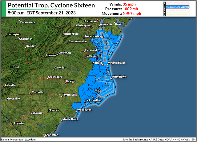
A system brewing in the southwestern Atlantic Ocean will bring heavy rain and gusty winds to a big chunk of North Carolina and the Mid-Atlantic states beginning Friday and lasting through the weekend.
Localized flooding is possible in areas that see the heaviest rainfall totals, while some areas may deal with power outages as gusts exceed 45 mph in spots. Storm surge flooding is also likely along the coasts of North Carolina and Virginia, which will inundate roads and low-lying communities close to the shore.
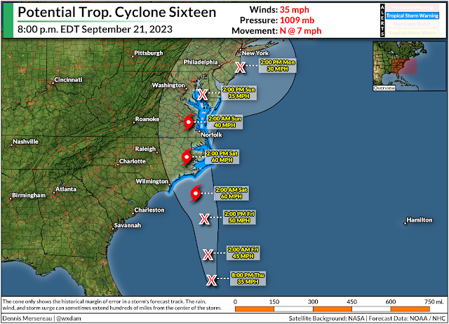
An area of disturbed weather just off the southeast coast is likely going to develop into a short-lived tropical storm over the next couple of days.
The National Hurricane Center dubbed the system “Potential Tropical Cyclone Sixteen,” a purely bureaucratic title that allows them to issue tropical storm watches and warnings when a disturbance is close to land, but hasn’t developed into an actual tropical system yet.
This disturbance will likely become Tropical Storm Ophelia by Friday night as it approaches a Saturday morning landfall in eastern North Carolina. It’ll continue moving north through the weekend, losing organization as quickly as it developed, but still producing rainy and breezy conditions as it scoots north along the coast.
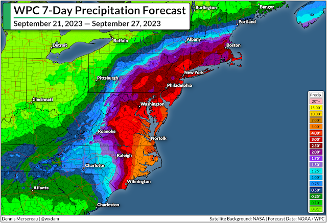
Regardless of its title or development, we’re in for a solid stretch of soaking rains and gusty winds for much of the eastern seaboard between South Carolina and Massachusetts. The latest forecast from the Weather Prediction Center paints 2-4 inches of rain from Myrtle Beach to Boston, with the potential for 5+ inches of rain over eastern North Carolina and southeastern Virginia.
The combination of rain-soaked soil and gusty winds could lead to power outages in some areas.
 |
| Source: National Hurricane Center |
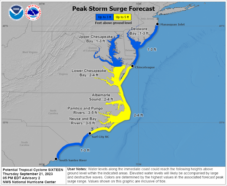
We’re also on the lookout for a not-insignificant storm surge for the North Carolina and Virginia coasts. The latest NHC forecast calls for the potential for 2-4 feet of storm surge along the Outer Banks if the surge coincides with high tide. That’s more than enough to inundate coastal roads and potentially flood nearby communities.
