
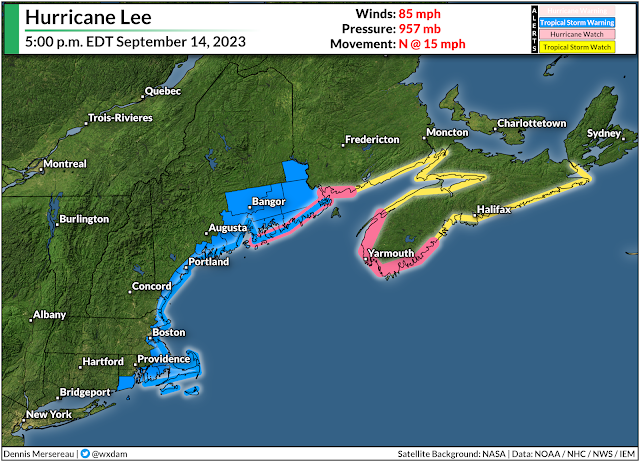
A tropical storm warning is in effect for much of coastal New England as Hurricane Lee continues to grow and pick up speed on its final approach to the region.
High winds, heavy rain, and coastal flooding are all likely as the storm pushes into the region. This isn’t going to be a blockbuster storm by any means—more like a spicy nor’easter by the time it arrives—but that doesn’t diminish the hazards posed by its high winds, heavy rains, and coastal flooding.
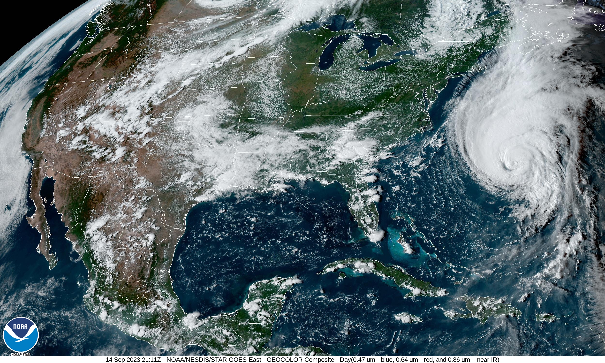
Hurricane Lee has grown into quite the sprawling storm in its ripe old age, with tropical storm force winds extending more than 345 miles from the center of the storm. This will give the system a far reach as it begins its final approach toward New England and the Canadian Maritimes heading into this weekend.
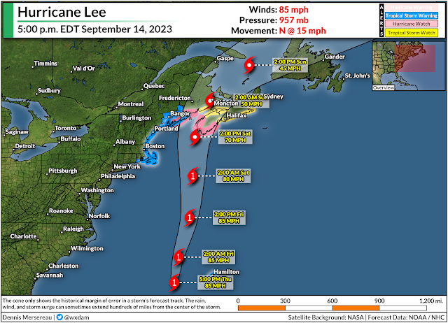
The National Hurricane Center‘s latest forecast brings the storm’s outer fringes into coastal New England and the Canadian Maritimes by Saturday morning, with conditions quickly deteriorating through the day as the center of the storm arrives. The system could make landfall on the southern tip of Nova Scotia by Saturday afternoon.
It’s not going to stick around for long. Lee will slowly pick up speed as it heads north, so we’re looking at the worst impacts stateside through the day Saturday, lingering into Sunday for portions of Atlantic Canada.
A tropical storm warning is in effect for coastal New England from Westport, Massachusetts north toward the Canadian border, including the cities of Boston, Portland, Bangor, as well as Nantucket, Martha’s Vineyard, and Cape Cod.
These areas could see a period of sustained 40-50 mph winds through the day Saturday, with higher gusts possible. We routinely have winds that strong with wintertime nor’easters, but all the trees still have their leaves, so they’ll endure more stress now than they would in a comparable storm in, say, January. This could lead to tree damage and power outages throughout the region, especially near the coast where the highest winds are likely.
Lee’s immense size will also push water into the coast through a storm surge and dangerously rough surf. Forecasters expect a 1-3 foot storm surge along the coast from Martha’s Vineyard north toward New Brunswick. This will lead to flooding in some communities along the coast, as well as the risk for road washouts and beach erosion.
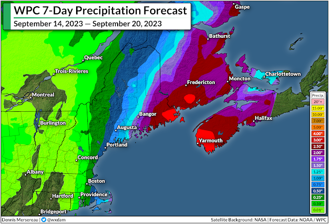
The storm will also arrive with plenty of tropical rain. Widespread rainfall totals of 1-2 inches are likely throughout coastal New England, with eastern Maine potentially picking up 3-4+ inches of rain by the end of the storm.
Flash flooding from heavy rainfall is the greatest threat with any tropical system, with drivers drowning in their vehicles accounting for most flood-related fatalities. Never try to drive across a flooded roadway. It’s impossible to tell how deep the water is until it’s too late, and the road may be washed out beneath the floodwaters. It only takes about six inches of water for a vehicle to lose traction.
[Satellite image via NOAA]
