Keep your guard up: A powerful Atlantic hurricane is a misinformation magnet
Tropical Storm Lee is gathering steam in a hurry as it swirls to life the heart of the tropical Atlantic Ocean, and the storm will have free rein to grow into a powerful hurricane over the next few days as it putters west across the open waters.
The prospect of a large category four hurricane entering the western Atlantic Ocean is frightening, especially after the hectic pace of destructive storms we’ve seen over the past seven years.
It’s been a long while since we’ve had a weeks-long run-up to a major hurricane in the Atlantic. Many of our most powerful storms in recent seasons developed and made landfall in just a couple of days. It took only 70 hours for Idalia to grow from a newborn tropical storm to a major hurricane making landfall in Florida.
The long wait for a slow-growing storm to do something—anything—is a breeding ground for both the misinformed and the malicious to spread false information or downright lies about a system’s potential impacts.
Predicting the future is messy—and there are limits to accuracy
Lee is a young system that’s more than a week away from entering the western Atlantic Ocean. As of this post’s publication, we don’t know where it’s ultimately going to go, or how strong it will be when it gets there.
 |
| Source: NOAA/NHC |
“We don’t know” is a powerful statement. Meteorology is a humbling field. Folks driven by their big egos don’t make it very far without looking like total heels and losing respect in the process.
The science of meteorology has advanced by leaps and bounds in the tech age. A three-day and even five-day forecast today is lightyears more accurate than it was just 30 years ago.
Heck, the National Hurricane Center (NHC) keeps a record of its forecast track errors all the way back to the 1970s. Their forecast accuracy today is a thing of marvel compared to when music videos were must-see TV.
Look at this cone of uncertainty for Rita back in 2005:

The NHC’s cone (a margin of error based on past forecast track errors) stretches from northern Mexico to northern Louisiana five days out—closing in on something like 1.5x to 2x the margin of error of today’s five-day forecast.
But the science is still painfully reserved. There is a limit to how far out an accurate forecast can go even under the best circumstances.
Today, forecasters can tell you that it’ll be 92°F tomorrow with a chance of thunderstorms. Seven days from now, it’ll probably be in the mid-80s with a chance for showers or storms.
Forecasts over time shift from specifics to trends. You lose that precision because of the sheer number of variables that affect our day-to-day weather.
Tiny changes have a huge effect on a storm’s strength and track
Think about the game Plinko on The Price Is Right. The slot you drop the puck in will have a dramatic outcome on which pocket the puck lands in. Every time the puck hits a peg, it gets shunted to the right or to the left. You can have a general idea where the puck will land, but you can’t tell for sure until it’s near the bottom of the board.
The weather works in a similar way—without the potential to win $10,000, I guess.
Tweaking tiny details within the atmosphere can have a tremendous impact on the outcome of a storm. Move a ridge or a trough by 100 miles. Make the water one degree cooler. Crank up or weaken the storm’s winds by 20 mph. Put a little dry air in the storm’s path.
Any one of those factors can and will determine the ultimate intensity and path of a storm, and even seemingly small details can snowball into a large effect after a few days.
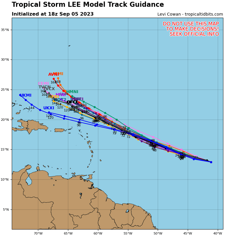
Dozens upon dozens of weather models take those changes into account
The advent of deeply nerdy weather broadcasts and countless weather pages on social media added terms like “GFS model” and “European model” to the average news consumer’s vocabulary.
 |
| Spaghetti plot. Source: Tropical Tidbits |
The GFS and the Euro are two major global models that meteorologists use while they’re forecasting, but the output generated by those two big names are only a piece of the overall puzzle. There are also other global models, as well as a whole arsenal of smaller-scale models and guidance built specifically to help with hurricane forecasting.
It’s rare for all those models to agree with one another. Much like humans, each model has its own biases and weaknesses that could affect its output. That’s why you’ll see “spaghetti plots” during hurricane season.
These composite graphics take all the major models tracking the progress of a tropical system and plot the output as a line. All the lines together look like spaghetti plopped onto a map, providing a great overview of how the models agree or disagree.
But those major models only scratch the surface. Almost all the big weather models you hear about, like the GFS and the Euro, also run alongside dozens of ensemble models.
Ensemble models account for the Plinko effect of tiny changes within the atmosphere. Each ensemble model slightly tweaks atmospheric conditions like temperature, wind, and air pressure. Dozens of these ensembles put together show a range of possibilities based on different starting conditions—sort of like a margin of error. If there’s a huge spread or disagreement in the ensemble run, it means there’s greater uncertainty in the final outcome.
 |
| Source: Pivotal Weather |
Here’s a GFS Ensemble run for Tropical Storm Lee in the system’s infancy on the afternoon of September 5, 2023. This image shows all the different ensemble runs showing where Lee’s center could be in 24 hours, accounting for all those slight tweaks to the atmosphere.
Each two-digit pink number near the center of the low shows a different individual ensemble run, while the large L averages out all the positions together.
They’re relatively close together, showing relatively good agreement on Tropical Storm Lee’s short-term movement.
But then you advance the same model two days into the future, then three, and they start to diverge from one another. Each individual run has its own idea of where Lee might trek based on all those small changes to factors like steering winds and the location of nearby ridges and troughs.
 |
| Source: Pivotal Weather |
By the time you’re out 168 hours, or seven full days, the ensemble members are all over the place. There’s a 300-400 mile spread in the ensembles, showing that Lee could be anywhere from the Turks and Caicos Islands to closing in on Bermuda.
That may not seem like too big of a difference, but a small nudge in the storm’s track can mean the difference between harmlessly swirling out to sea or coming close to densely populated areas.
Weather models are called “computer guidance” for a reason. Models are just some of the many tools that meteorologists use when they’re predicting the weather. But notice how you hardly ever see those ensemble runs show up on social media outside of a meteorologist talking about them when they’re nerding out with other meteorologists.
So when you’re scrolling through TikTok at night and you see a video that says “Major hurricane hitting North Carolina in two weeks” plastered over a loop of a weather model running 384 hours (16 days!) into the future…you can bet they’re just doing that for attention and clicks.
It’s not a new phenomenon. I’ve been railing against weather weenies on Facebook and Twitter for more than a decade. They’ve just migrated to other platforms with time, largely opting for the video route on YouTube—where the scariest, boldest thumbnail gets the click and the view—or TikTok, where you have to capture someone’s attention in a fraction of a second or they’ll ignore you and scroll on.
The open-source nature of weather data and weather models is a double-edged sword. A wealth of free and accessible resources is perfect for a freelance weather reporter like me. But it also puts this powerful tool in the hands of folks who can prey on those who don’t understand what they’re looking at.
“We don’t know” is strength, not stupidity
Uncertainty isn’t sexy. “We don’t know” doesn’t sell. But that single model run that shows a major hurricane ramming ashore in 13 days will get the clicks and the views and the ad revenue, so bad actors run with it to get attention.
Nuance is a good thing. There’s power in “we don’t know.” Discussing what we don’t know is a sign of a mind at work rather than a lack of knowledge. Admitting uncertainty shows integrity. It’s your fellow adults levelling with you as a peer who deserves the truth rather than talking down to you like a child who needs to hear a tall tale to feel better.
But uncertainty is also scary. It’s truly frightening to know that there will likely be a textbook hurricane with an ominous eye barreling west across the ocean before long. We want to know where it’s going. We want as much time as possible to prepare for potential danger—physically, mentally, and emotionally.
Those bad actors who knowingly pump out false information in the long leadup to an impactful storm are preying on that fear. They know that a huge number of people faced between choosing “we don’t know” or “look at this monster!” will choose the appearance of knowledge rather than the cold vacuum of uncertainty.
Seek out the experts and tune out the noise
That’s why—these days more than ever—it’s so important to analyze what you’re reading and watching to make sure you’re getting accurate information rather than bunk that’s twisted to manipulate your fears and emotions.
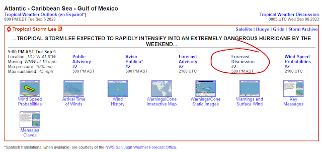
Seek out actual forecasts from the National Hurricane Center. Read the forecast discussions put out by the NHC’s experts every six hours. They go deep into the technical jargon, but much of it is accessible and gives you an inside look at their thought processes and uncertainty. They’re the ultimate experts and they’re not afraid to say “here’s what we know, and here’s what we don’t know.”
Read articles written by the big weather-focused outlets (full disclosure: in addition to this blog, I’m a part-time writer for The Weather Network) and smaller reputable sources like The Eyewall, headed up by Matt Lanza and Eric Berger, both of whom are revered by storm-smart folks throughout the Houston area and the weather industry at large.
Follow proven, knowledgeable folks on social media, keeping in mind that blue ‘verification’ badges are bought and paid for now and are no longer a sign of potential trustworthiness or news value.
Despite the site’s painful downturn, Twitter is still full of experts who discuss current storms in a way that anyone can understand and appreciate—Jacob Feuerstein, Philip Klotzbach, Tomer Burg, Eric Webb, and Philippe Papin are just a few of the dozens of fantastic meteorologists who could add so much value to your Twitter feed to drown out the noise.
We have to be our own digital advocates. Your screens are full of people trying to take advantage of you, trying to prey on your fears, trying to entice you with the false allure of certainty and comfort where none may exist. They can’t succeed.
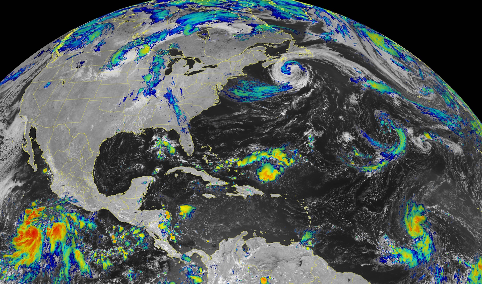
[Top satellite image via NOAA]


