December 16, 2023

Weekend deja vu as second powerful East Coast storm hits Sunday and Monday


Didn't we go through this last weekend?

A(nother) powerful storm developing near Florida will roll up the length of the East Coast beginning Saturday night and lasting into Monday, producing a large swath of heavy rains and very strong winds.

The worst conditions will occur at the coast where communities—especially the N.C. Outer Banks—may experience significant storm surge flooding.

Our storm is developing today in the eastern Gulf of Mexico as a steep trough digs over the eastern U.S. This low will strengthen in a hurry as it taps into strong upper-level winds and parallels the southeastern coast.

We'll see the storm move from Florida through Georgia and into the Carolinas on Sunday, bringing widespread heavy rains and very strong winds. Gusts of 50+ mph are likely at the coast, with gusts of 30-40+ mph reaching inland all the way to the mountains.


The low-pressure system will quickly track into the Northeast by Sunday night, heading into Atlantic Canada by Monday.

A deep plume of tropical moisture sourced from the Caribbean will draw into the system as it revs up, allowing for torrential downpours along its path. Widespread rainfall totals of 2-3 inches are likely from Florida to Maine, with locally higher totals possible. This could easily lead to flash flooding in some areas.

In addition to the potential for bad coastal flooding, the combination of strong, persistent winds and heavy rainfall will lead to a risk for power outages along the storm's track. There's also a high chance that we'll deal with flying Santas over the next couple of days. Secure or bring inside all of your outdoor Christmas decorations. Inflatables are notorious for getting loose in high winds. Any decorations or furniture that tumbles down the road could cause injuries, damage, or even car crashes.


This is an...unusual...storm in that we're not really expecting any snow—at least not initially. Temperatures are too warm for anyone on the East Coast to see frozen precipitation as the storm swings through the region. It is the middle of December. That isn't normal. (But nothing really is anymore.)

Cold air wrapping in behind the system will allow for lake-effect snow to develop across the Great Lakes, so a dose of snow in the usual areas is likely to begin the week. This cold air will reach all the way to the coast in northwest flow behind the storm, making for a pretty chilly Tuesday before temperatures turn mild again as the week wears on.

[Top image via Tropical Tidbits, showing modeled surface winds on Sunday evening.]


Follow me on Facebook | Bluesky | Threads | Instagram | Twitter

Get in touch! Send me an email.

Please consider subscribing to my Patreon. Your support helps me write engaging, hype-free weather coverage—no fretting over ad revenue, no chasing viral clicks. Just the weather.


December 9, 2023

East Coast in for a pressure washing as a powerful storm arrives Sunday


A feisty low-pressure system is gearing up to bring plenty of disruptive weather to the East Coast over the next couple of days. Widespread heavy rain could lead to flooding along the I-95 megalopolis while the storm produces snow near the Great Lakes and severe storms across the southeast.

Sunday/Monday's storm is part of a dynamic pattern that's gradually making its way across the eastern half of the country. A cold front extending off a low-pressure system moving through the Great Lakes is responsible for most of the active weather we're seeing on Saturday. A new storm will develop along this front on Sunday, becoming the dominant system that'll bring all the headaches to end the weekend.


Sharp wind shear through the atmosphere combined with a cold front running into a pool of warm, moist air is a recipe for severe thunderstorms. An expansive severe risk covers a chunk of the southern U.S. on Saturday, mainly focused on the lower Mississippi Valley east into Alabama and Tennessee.

Any severe thunderstorms that bubble up on Saturday could produce damaging winds, hail, and a few tornadoes. We already saw a couple of tornadoes touch down in north-central Tennessee early Saturday afternoon.


We'll see that storm threat shift east on Sunday as the cold front heads toward the Atlantic coast. Severe thunderstorms are possible from the D.C./Baltimore region down the I-95/I-85 corridor toward southeastern Alabama and the northern half of Florida. The main risk with Sunday's storms would be damaging wind gusts, but a few tornadoes are possible, especially in parts of eastern Virginia and North Carolina.

Farther north, this developing storm's main threats will be drenching rains, heavy snow, and blustery conditions.

Flood watches span the I-95 corridor from D.C. to Portland as forecasters anticipate several inches of rain falling through the day Sunday. Lots of rain falling in short order can overwhelm waterways and drainage systems, leading to pooling and possible street flooding.


It's not going to be a gentle downpour, either. Widespread wind gusts of 20-30+ mph will accompany the storm as it chugs through interior New England on Sunday. Much stronger winds are likely for coastal communities across the northeast, where a period of 50-60+ mph wind gusts will be possible into Monday.

Winds this strong combined with wet soils could lead to fallen trees and power lines. Make sure your holiday decorations are tied down or brought inside, as well. Those things will take flight in a hurry once the gusty winds start, and it could be dangerous if they blow into the road.

Cold air flooding in behind the system will allow for widespread snow across the Northeast interior and down the spine of the Appalachians. The heaviest totals are likely near the Canadian border, where higher elevations in New York and Vermont could see more than a foot of fresh snow by Monday.


If you have plans to travel late Sunday or early Monday, it's worth keeping in mind that some models are struggling a bit with the potential changeover from rain to snow across parts of Pennsylvania, the Mid-Atlantic, and even down into the North Carolina Piedmont.

Plan ahead for the potential for a burst of snow during the last few hours of precipitation overnight Sunday into Monday, with possible accumulation if temperatures are cold enough.

[Top model image generated using WSV3]


Follow me on Facebook | Bluesky | Threads | Instagram | Twitter

Get in touch! Send me an email.

Please consider subscribing to my Patreon. Your support helps me write engaging, hype-free weather coverage—no fretting over ad revenue, no chasing viral clicks. Just the weather.


November 24, 2023

Cold air damming brought Greensboro a wild one-hour temperature tango


The weather is pretty darn cool this time of year.

Huge storms romping across the U.S. drag down frigid air from Canada while sucking warm air up from the Gulf of Mexico. Fast-shifting winds spiraling around these sprawling lows can create huge temperature differences over short distances.

Not every sharp temperature gradient is a pure case of Canadian air spilling into the waning remnants of summer. Weather conditions in some parts of the U.S. can depend as much on topography as it does meteorology, and few areas set a better example than central North Carolina.

Greensboro, N.C., anchors the state's Piedmont region. Sitting nearly smack-dab in the center of North Carolina, conditions in the Piedmont are often influenced by the Appalachian Mountains that gently rise over the western third of our state.


We feel this influence the most during the cool season through cold air damming. Chilly winds blowing in from the east or northeast smack against the side of the Appalachians like water held back by a dam. Cold air is dense, so the air can't rise up and over to Tennessee even as warm southerly winds try to scour it out of the region. 

Cold air damming is conspicuous on temperature maps, and it's a major headache for forecasters during winter storms. Frigid air at the surface and warmer air a few thousand feet above ground level is a recipe for sleet and freezing rain—something we see in abundance around here.


But for as tricky as cold air damming can be for precipitation forecasting, just predicting the hourly temperature can prove challenging during one of these setups.

We didn't have to deal with any wintry weather on Tuesday, November 21, but a complex setup led to a wild temperature change in Greensboro over the course of just one hour.

A huge one-hour temperature bounce


Tuesday saw a robust low-pressure system moving into the Great Lakes while a center of high pressure lingered over New England. Northeasterly winds funneled down the coast locked-in a nasty bout of cold air damming in the Piedmont. 

Meanwhile, warm and humid southerly winds flowing into the region courtesy of that Great Lakes low tried their best to scour away the cold air at the surface. It didn't quite work, so that incoming air just rose up and over to fuel a day-long downpour.

The raw and rainy conditions on Tuesday brought the region our first substantial rain in months, which helped dent a growing drought and quench a bevy of wildfires burning throughout the region.


As the low over the Great Lakes dragged its cold front toward the Appalachians, a smaller center of low pressure developed on the eastern side of the Appalachians and tracked north into the N.C. Piedmont. 

Enhanced southerly winds following that budding li'l area of low pressure lent a hand in trying to scour away the dam of cold air that had built up over the region on Tuesday. Persistence pays off, and communities right near the center of the low did see a significant temperature rise as it passed overhead.

Only briefly, though.

Very briefly.


The temperature at Greensboro's Piedmont-Triad Int'l Airport slowly rose from the mid-40s to around 52°F by 7:50 p.m. on Tuesday.

Temperatures fluctuated very fast over the next hour. We saw temperatures warm by one or two degrees every couple of minutes until they peaked at 61°F at 8:35 p.m., remaining there for just ten minutes before the main cold front came in and caused temperatures to plummet even faster than they rose.

Behind the cold front, the temperature at PTI Airport tumbled from 61°F to 52°F in just ten minutes, soon sagging back to around 50°F for the remainder of the night.

It's not one of the more remarkable temperature swings we've ever seen—heck, there are towns on the Plains that can see a 40+ degree temperature drop in just an hour—but the complex circumstances that went into Greensboro's one-hour temperature tango is a fascinating peek at how our vast atmosphere can produce big changes over tiny areas.


Follow me on Facebook | Bluesky | Threads | Instagram | Twitter

Get in touch! Send me an email.

Please consider subscribing to my Patreon. Your support helps me write engaging, hype-free weather coverage—no fretting over ad revenue, no chasing viral clicks. Just the weather.


November 19, 2023

Classic fall storm could bring the southeast strong tornadoes, beneficial rains


A classic fall storm revving up across the central United States this week could bring severe thunderstorms to the southeast—along with beneficial rains for areas falling into a pretty serious drought over the past couple of months.

Some of the severe thunderstorms on Monday could grow quite strong across Louisiana and Mississippi, bringing a risk for a couple of strong, long-lived tornadoes.

Fall severe weather season ramps up

'Tis the season for severe weather in the south, and this looks to be our first real "second season" severe weather outbreak of the year. November and December see a noticeable uptick in severe weather across the southeast as powerful low-pressure systems develop over the Plains and roll north toward the Great Lakes.

Warm, humid air streaming north out of the Gulf of Mexico provides the instability, while the storm and its fronts provide the lift and wind shear needed to push the resulting thunderstorms beyond severe limits.

The Storm Prediction Center issued an enhanced risk for severe weather across northern Louisiana and much of southern and central Mississippi during the day Monday. Thunderstorms will develop during the afternoon and sweep across the region from west to east.


All modes of severe weather are possible, but the headline (as always) is the risk for tornadoes. Forecasters see enough instability and wind shear that a couple of those tornadoes could be strong or long-lived in and around the enhanced risk area.

Aside from the tornado risk, any of the thunderstorms that bubble over the region on Monday could produce strong wind gusts of 60+ mph, as well as a risk for large hail.

Make sure you have a way to get warnings

It's been a long while since we've had to contend with a risk for severe weather. Make sure emergency alerts are activated on your phone so you'll know the moment a tornado warning is issued for your location. Make a mental note of all the safe places at home, work, school, and various places you run errands in case dangerous weather strikes during the day.

Much of the severe weather threat on Monday and early Tuesday will unfold after sunset. Severe weather is especially dangerous after dark as people tune out and wind down for the evening. It's more important this time of year than ever to stay weather-aware, keeping up with storms nearby and having a way to receive warnings as soon as they're issued.

Remember—never rely on tornado sirens as your first line of defense. These sirens are outdoor warning systems not meant to be heard indoors, and they're prone to failure in bad weather.

A taste of beneficial rains on the way


Even with the threat for severe weather, the widespread rain we'll see over the next couple of days is welcome news for just about everyone in the region.

Much of the south has slipped into severe or extreme drought over the past couple of months as dry patterns prevailed and tropical systems largely avoided making landfall on the northern Gulf Coast.


Some areas have seen their annual rainfall totals fall more than a foot behind where they should be by the middle of November. It'll take a lot of rain to ameliorate the growing effects of this extended drought, but even an inch or two of rain is a welcome step in the right direction.

Another low-pressure system could develop in the western Gulf of Mexico late in the week around Thanksgiving, which could bring another quick hit of rain to areas that desperately need the water. Beyond that, we could be in for another dry pattern that'll likely last into the opening days of December.


Follow me on Facebook | Bluesky | Threads | Instagram | Twitter

Get in touch! Send me an email.

Please consider subscribing to my Patreon. Your support helps me write engaging, hype-free weather coverage—no fretting over ad revenue, no chasing viral clicks. Just the weather.


November 4, 2023

Rapidly intensifying hurricanes truly are the 'nightmare scenario'


Historic disasters have transitioned from a noteworthy abnormality to something that we've come to expect on a regular basis.

Unprecedented heat, devastating fires, destructive flash floods, and rapidly intensifying hurricanes are just the way things are. "Another billion-dollar flash flood? Add it to the two other we've seen this month."

This is going to be a more 'personal' post than I usually write for DAMWeather. I've covered a century's worth of unprecedented weather events in the past couple of years—almost all of it in a straight-news format.

I can't bring myself to do that for Hurricane Otis. I've spent almost two weeks trying (and failing) to write about the scale-topping hurricane that devastated Mexico's Acapulco region on October 24.

There are lots of worst-case scenarios when it comes to weather disasters. Hurricane Otis is one of the only storms in recent years that can legitimately claim the title of a worst-case scenario.

Hurricanes rapidly intensifying as they approach landfall is an alarmingly common disaster these days, and it's a horror that both people and governments still aren't prepared to confront.

Otis unexpected leapfrogged to a category five titan

Otis rapidly intensified from a 50 mph tropical storm to a category five hurricane with 160 mph winds in just 24 hours, and it slammed almost head-on into Acapulco and its 1,000,000+ residents at maximum strength.


Hurricane Otis' explosive growth is one of the most intense rapid intensification events ever observed—beaten only by Hurricane Patricia in 2015, which peaked as the strongest hurricane ever reliably observed when its maximum winds reached 215 mph.

"The National Hurricane Center didn't mince words" is a phrase uttered too many times in the past five years as one record-busting hurricane after another swirled into yet another vulnerable swath of coastline somewhere in North America.


But the experts who dedicate their professional lives to tracking and understanding these atmospheric behemoths were flabbergasted by the hurricane's rapid growth. No forecaster or their computer models foresaw the storm growing into a major hurricane before landfall. The official NHC forecast called for Otis to maybe just barely crack hurricane strength as it crossed the coastline.

So to watch this hurricane run away in the atmospheric chain reaction from hell as it closed in on a heavily populated metro area was truly the 'nightmare scenario,' as an NHC forecaster said in the agency's update declaring the storm a scale-topping category five.


The nightmare played out.  We may never know exactly how strong the winds got in the heart of the city of more than one million people, but precise wind speeds seem irrelevant given the widespread destruction across the region.

Ten storms in ten years

Otis joined a long list of recent hurricanes that rapidly intensified in the run-up to landfall.

Harvey grew from a tropical depression to a category four storm as it approached Texas in September 2017.

Irma, once a scale-topping category five, rapidly reintensified into a category four when it hit the Florida Keys just two weeks later, keeping most of its power as it hit the state head-on soon after.

Source: NOAA

Two weeks after that, Maria rapidly intensified into a category four hurricane as it slammed into Puerto Rico.

Hurricane Michael exploded into a category five with 160 mph winds as it hit the Florida Panhandle in October 2018.

During the historic 2020 hurricane season, Laura quickly intensified into a 150 mph hurricane as it walloped southwestern Louisiana, barely losing strength at first as it drew energy from the swampy, surge-covered land. Exactly one year later, Hurricane Ida did the exact same thing as it hit southeastern Louisiana.

A year after that, Hurricane Ian intensified into a category five storm just before making landfall in southwestern Florida. The storm's destructive wind and surge killed more than 100 people, making it Florida's deadliest hurricane in a century.

This past August, Hurricane Idalia rapidly intensified in the eastern Gulf of Mexico and hit the Florida Panhandle as a category three storm. It was the strongest storm ever recorded at landfall in this part of the state.

That's just Atlantic hurricanes that revved up as they closed in on shore. There have been plenty of storms that rapidly intensified out to sea, and it doesn't even cover the storms—like Otis and unparalleled Hurricane Patricia from 2015—we've seen follow this trend in the eastern Pacific Ocean, or in the world's other tropical basins.

Consistently warm waters fuel rapid intensification trends

We've seen a tremendous stretch of unprecedented warmth across almost the entire Atlantic basin this year. It's the reason we've seen 20 tropical storms and hurricanes this year despite a strong El Niño over in the eastern Pacific.

The destructive wind shear generated by El Niño typically shreds apart any attempted tropical cyclones over the Atlantic. But sea surface temperatures in the Atlantic are so warm that any disturbance had the opportunity to develop—and they took full advantage of that unusual environment.


We can even see the influence of freakishly warm water when it comes to these eastern Pacific storms. Water temperatures off the western coast of Mexico were unusually warm when Hurricane Otis tracked over the region. Overlay the storm's track on top of a map of sea surface temperatures and it's easy to see a major reason that storm surpassed the most aggressive forecasts.

Time and time again, exceptionally warm sea surface temperatures are the driving force behind these rapid intensification events. It's not the whole story—a nearby jet stream improved Otis' outflow, for example, helping the hurricane strengthen in hyperdrive—but the freakish warmth in the Atlantic in recent years, and this year in particular, is a worrisome data point when it comes to future storms.

As the planet and its oceans continue to warm, we may have to contend with more of these sudden rapid intensification events in the future, including as storms snake toward landfall. 

That's downright terrifying when so many communities seem incapable of preparing for a storm they have a week to see coming. I recently wrote about our "strained attention economy" as a major reason so many well-advertised disasters seem to hit people by complete surprise. I am not confident that most people or community leaders are prepared for 'average' hurricanes, let alone these monstrous storms that ramp up within hours of landfall.

We've seen an entire lifetime's worth of tropical devastation from a handful of storms in the past couple of years. This year's amped-up storms won't be the last ones we see. At the very least, it's a strong argument to pay incredibly close attention to the weather during hurricane season, as the storm you went to sleep watching might not be the same one staring you down when you wake up.


Follow me on Facebook | Bluesky | Threads | Instagram | Twitter

Get in touch! Send me an email.

Please consider subscribing to my Patreon. Your support helps me write engaging, hype-free weather coverage—no fretting over ad revenue, no chasing viral clicks. Just the weather.


October 21, 2023

Active 2023 Atlantic hurricane season lands in records despite a strong El Niño


Hurricane warnings are up for portions of the Lesser Antilles this weekend as an unlikely storm lashes the region with high winds and heavy rainfall.

Hurricane Tammy is our 20th named storm of this remarkable hurricane season. It's noteworthy to have that many named storms in any circumstances—2023 is now tied for fourth-most active Atlantic hurricane season on record—but we're in the midst of a strong El Niño, which typically stifles tropical cyclone activity across the Atlantic.

Tammy Makes Twenty

We've had 20 nameable storms across the Atlantic Ocean so far this season. The first system was an unnamed subtropical storm that forecasters added to the record in a reanalysis of the event a few months later.


Seven of the storms grew into hurricanes, and three of those storms—Franklin, Idalia, and Lee—managed to balloon into major hurricanes. Even more impressive is that Lee briefly grew into a category five storm, one of only a few dozen ever recorded over the ocean basin.

Tropical activity in the Atlantic typically slows down and moves closer to the Caribbean and Gulf as we head into October, but Tammy is especially unusual because it's a full-blown hurricane with roots in a tropical disturbance that originated over sub-Saharan Africa.

El Niño Strongly Influences Atlantic Hurricanes

The eastern Pacific Ocean around the equator is usually pretty chilly due to upwelling of frigid waters from deep within the ocean. Easterly winds blowing across the equatorial Pacific push warm surface waters toward Australia, strengthening the upwelling off South America as waters rise from below to fill the void.

When those easterly winds weaken or reverse direction, however, that warm surface water floods back toward South America. These warmer waters of an El Niño aren't much—just a couple of degrees—but it's enough to significantly affect the atmosphere in ways that have far-reaching effects from Asia to Africa.

Source: NOAA Data Snapshot

Even though El Niño's effects are most noticeable during the winter, these unusually warm waters can beef-up thunderstorm activity across the eastern Pacific—creating wind shear that blows east over the Atlantic Ocean. This wind shear is (usually) destructive to any budding tropical cyclones over the Atlantic, putting an end to them before they have a chance to flourish.

That's usually how things go. The 1991 and 1992 hurricane seasons were relatively quiet due to a lengthy El Niño. 1991 only saw eight named storms, while 1992's first named storm—the infamous Hurricane Andrew—didn't form until the end of August.

The last underactive hurricane season we saw in the Atlantic took place at the tail-end of a strong El Niño in 2015, when only 11 named storms managed to form.

2023 Breaks The Rules

This year should've followed suit. A strengthening El Niño over the eastern Pacific normally would've put a lid on the Atlantic Ocean this year, stifling most opportunities for storms to develop.

That very much didn't happen. But why?

Forecasters knew in advance that we might be in for a trend-bucking season before it even began.

"El Nino’s potential influence on storm development could be offset by favorable conditions local to the tropical Atlantic Basin," NOAA wrote in its initial seasonal outlook published back in May.


The factors they outlined in their forecast pretty much came to pass. Sub-Saharan Africa saw a fruitful monsoon season this summer and fall, which pumped one disturbance after another into the eastern Atlantic Ocean.

Sea surface temperatures across the Atlantic have been historically warm so far this year, as well. The increase in disturbances, combined with the mind-boggling heat across the entire basin, afforded more opportunities for systems to develop and thrive.

For all the activity we've seen, El Niño did still flex its muscles. Many of the storms we've seen this year were relatively weak, largely struggling with destructive wind shear that's characteristic of El Niño years.

But those favorable factors around the Atlantic basin combined to overpower El Niño and cement 2023's spot in the history books as one of the most productive hurricane seasons ever witnessed. And it's not quite over yet. It's not out of the question that we could see another couple of storms over the next month or so.


There are only two names left on this year's list. If we use those names and require a 23rd name, the National Hurricane Center would dive into the new supplemental list of names, beginning with Adria. This supplemental list replaced the use of Greek letters to name excess storms, a change made after the hyperactive (and at times confusing) 2020 hurricane season.

[Satellite image via NOAA]


Follow me on Facebook | Bluesky | Threads | Instagram | Twitter

Get in touch! Send me an email.

Please consider subscribing to my Patreon. Your support helps me write engaging, hype-free weather coverage—no fretting over ad revenue, no chasing viral clicks. Just the weather.


October 10, 2023

Quenching rains on the way to aid growing drought across the U.S.


Multiple systems sweeping across the United States this week will bring beneficial rains to areas of the Midwest and Gulf Coast that have been hit hard by drought in recent months.

Too much of a good thing is always a concern, of course, and some areas may face a flooding risk if rain falls too quickly on dry soil incapable of absorbing it all at once.

Widespread drought across the country

Drought conditions covered more than 40 percent of the United States heading into the beginning of October, and for the first time in more than three years, almost none of that drought—only 0.07 percent!—was found in California.

The driest conditions have taken a toll on the northern Gulf Coast, where the lack of precipitation has parched the land so much that many regions are in extreme to exceptional drought, the two highest levels on the United States Drought Monitor's scale.


Long spells of hot conditions, combined with a lack of tropical systems hitting the region, contributed to this summer's building drought. In fact, the USDM's change map shows that almost all of the drought east of the Rockies has built-in over the past eight weeks. 

Some areas should see marked improvement over the next couple of days as two doses of rain sweep across the country.

Gulf downpours

A tropical disturbance in the southern Gulf of Mexico has a low chance of developing into an organized system as it slowly drifts north over the next couple of days.

Conditions aren't all that conducive to development, though, so it's more likely that this disturbance merges with a frontal system as it meanders toward the northern Gulf Coast.

Widespread steady rains will move over the northern Gulf Coast beginning Wednesday and lasting through Friday for spots.


We could see decent rainfall totals out of this event, with several inches likely from Louisiana into Florida. Given the potential for downpours and the region's parched ground, a risk for flash flooding will develop, especially from New Orleans east toward Tallahassee.

This is a pretty classic setup for a strengthening El Niño during the cooler months. We should have more opportunities for widespread heavy rain in the coming weeks and months if past El Niño falls and winters hold true.

Midwest storm

Meanwhile, a low-pressure system developing over Colorado will bring several days of stormy and rainy weather to the Midwest as it slowly makes its way east through the remainder of the week.

Plenty of tropical moisture streaming north into the system, combined with the storm's slow movement, will bring several inches of rain to most of the central U.S. Ongoing drought here could lead to the risk for flash flooding, as well, especially beneath any of the heavier thunderstorms that develop.


We could see some of those thunderstorms turn severe during the day Thursday as warm, unstable air streams over the central Plains ahead of an advancing cold front.

The Storm Prediction Center calls for risk for severe weather on Thursday across a chunk of the Plains that includes Kansas City and Omaha. Damaging winds and large hail will be the main threats with the strongest storms, and the SPC's forecast points out there's a non-zero risk for tornadoes. 


Follow me on Facebook | Bluesky | Threads | Instagram | Twitter

Get in touch! Send me an email.

Please consider subscribing to my Patreon. Your support helps me write engaging, hype-free weather coverage—no fretting over ad revenue, no chasing viral clicks. Just the weather.


September 30, 2023

'We had no warning'—NYC flash floods test our strained attention economy


'We had no warning' is one of the most worrying and upsetting things anyone in the weather field can hear in the aftermath of an impactful storm. The latest wave of flash flooding that swamped much of New York City brought up the endless argument between 'we had no warning' and 'there was plenty of warning.'

The forecasts and warnings leading up to the storm were solid, with the risk for serious flash flooding in New York City appearing in forecasts well before the first downpours. But even so, the deluge seemed to arrive by surprise for countless folks across the city who voiced their displeasure over the apparent atmospheric broadside.

For years, folks in the weather field have personally shouldered the enormity of this problem. "It's our fault if people aren't getting the warnings," the conventional wisdom goes.

I'm not convinced anymore that it's entirely a problem on the communicators' side.

An overlooked issue seems to be that weather is taking up less space than ever in the attention economy. Warnings seem to be falling through the cracks because more folks are simply tuning them out—and I'm not sure that's something anyone can fix. 

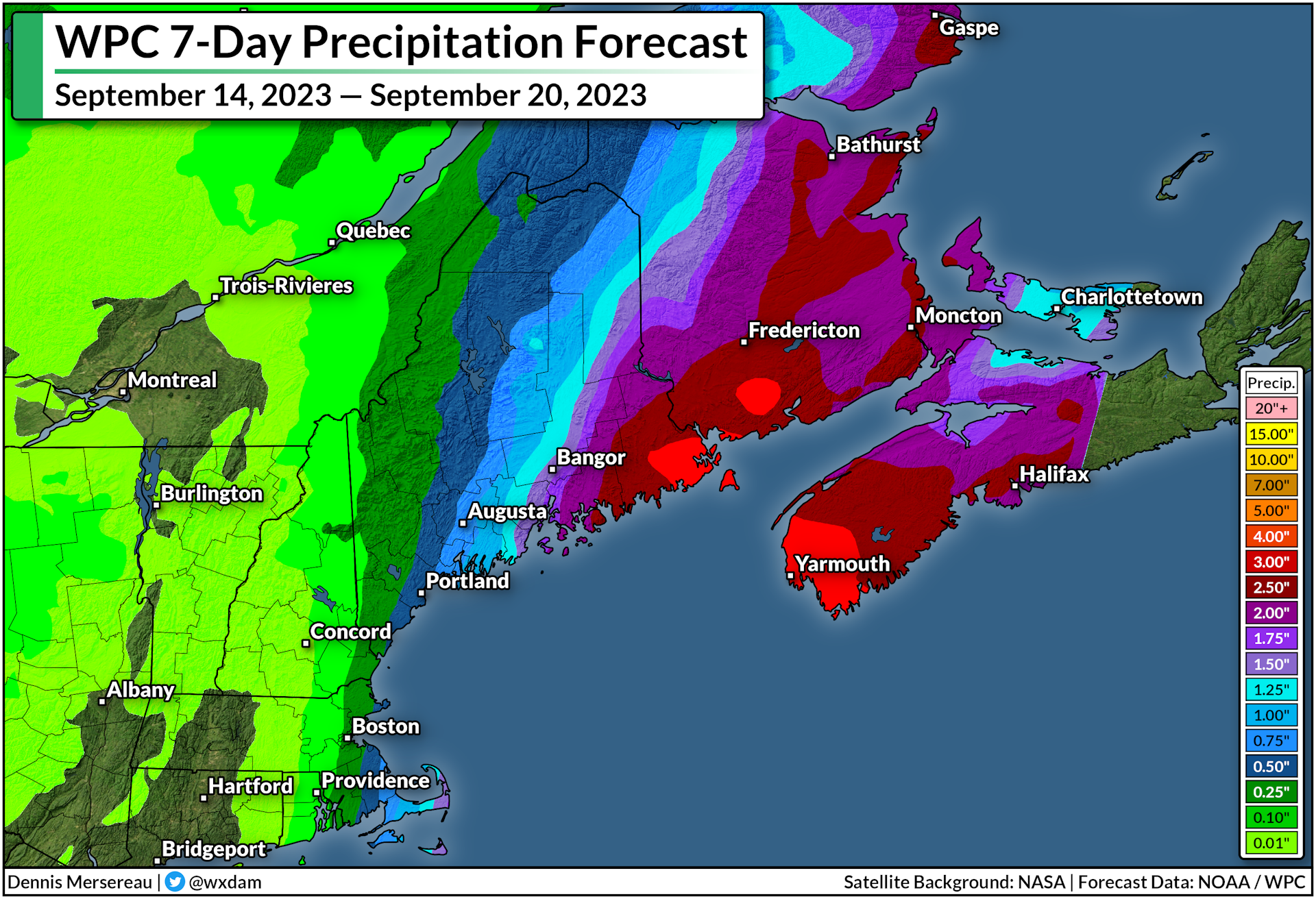
NYC encounters another historic downpour

New York City has suffered plenty of historic rainstorms in the past couple of years, but the deluge on on Friday, September 29, will go down in history as one of the city's worst on record.

Much of the densely populated metro area saw 5-8+ inches of rain in short order between Thursday and Friday. The onslaught of water quickly overwhelmed the network of storm sewers that funnel runoff away from the concrete jungle. cascades of water pouring through the streets, into basements, and into the tunnels of the city's vaunted subway network.


It was a well-predicted disaster. Meteorologists pointed out the potential for torrential rains several days in advance, and local forecasters communicated the risk or flash flooding long before the first rain started falling.

The Weather Prediction Center issued a moderate risk for flash flooding across the NYC metro area by the middle of Thursday afternoon, and flood watches and flash flood warnings were hoisted with plenty of lead time to reach people in harm's way.


JFK Airport recorded a total of 8.58 inches of rain during the ordeal, 7.97 inches of which fell on September 29th alone, making for the airport's wettest day since records began back in 1948. 

Unfortunately, there's a vast gulf between issuing great forecasts and those excellent lead times actually reaching people in harm's way.

Warnings only matter if they're heard

A quick scroll through social media shows how much folks in the region were taken by surprise once the waters started rising. 'We had no warning' was a common complaint, as was criticism of the city's own preparation for the widespread flooding issues.

The uproar was amplified after New York's mayor bluntly criticized his own critics in a radio interview, saying "if anyone was caught off guard, they had to be living under a rock."

It's admittedly tough for meteorologists to put out warning after warning—and for officials to put emergency preparations in place—only to catch flack after the storm from folks who never heard about the threat for imminent danger.


After all, what good is a warning if the people who need it don't hear it?

Meteorologists always strive to improve forecast and warning lead times, trying their best to communicate hazards as far in advance as science and confidence will allow. This week's deluge likely would've taken folks by near-complete surprise not long ago.

Forecasters and news outlets always need to improve communication efforts. But it's a tough process. Experimenting with language as simple as the difference between "warning" vs. "emergency" is a yearslong social science project. (Take a look at NWS HazSimp if you want an inside look at how tweaking basic terms is a major effort.)

But meteorologists and emergency managers and bloggers and politicians can only do so much. The best forecasts and loudest warnings are only good if they reach the people who need them.

Our attention is stretched dangerously thin

The concept of an "attention economy" is real. We only have so much attention to give, and every aspect of our lives is competing for a piece of that finite mental real estate.

Our forms of entertainment are much different today than they were just ten years ago. Emergency alerts on television and radio reach far fewer people now that the vast majority of folks use streaming apps for shows and music.  

Apps make our phones chirp at us non-stop. It's easy to miss a flash flood warning in between breaking news alerts, advertisements, friend requests, texts, emails, and endless push alerts from games and sports apps and shopping and on and on. That doesn't even begin to cover wireless emergency alerts, which folks often disable after one too many ill-timed tests or Amber Alerts.

And then there are weather apps. We've all got apps on our phone that give us a high, a low, a chance of rain, and a cute icon with the day's weather conditions. Unless you've got a really, really good app, though, you're missing context. Words matter. Nuance is important. But they require more attention than a simple number or icon.

Most of those apps will tell you the chance of rain is 100%. For the most part, those same apps won't fill you in on the potential for excessive rainfall that could lead to widespread street flooding. We're giving up nuance in the never-ending quest to ration our well-worn attention.

So I'll give you the answer that most meteorologists, emergency managers, news organizations, and responders either can't or won't give: Each of us is ultimately responsible for our own safety. Much as folks don't want to admit it, a huge part of emergency preparedness falls on each one of us simply staying aware of what's going on every day.

The potential for flooding in and around New York City was well-advertised well in advance. Flash flood warnings went out with plenty of lead time.

People who routinely follow the weather knew that the past 48 hours would be rough across the region. 

People who don't, largely didn't.

Seeking out detailed weather information beyond a sleek icon and two numbers should be a normal part of everyone's daily routine. The weather is fine most days. Some days, though, it's not, and a few of those days will see dangerous conditions that could threaten your safety.

It can feel like a chore to have to read weather forecasts if you're not already interested in the day-to-day happenings in our skies above. But for all the humdrum updates on clear skies or gusty winds, there will be days where tornadoes are possible or a hurricane is on an unsteady course or 8 inches of rain could fall on the streets of New York City.

It's rare that a truly devastating weather event takes weather forecasters by surprise anymore.

It shouldn't take the rest of us by surprise anymore, either.

[Satellite image via NOAA]


Follow me on Facebook | Bluesky | Threads | Instagram | Twitter

Get in touch! Send me an email.

Please consider subscribing to my Patreon. Your support helps me write engaging, hype-free weather coverage—no fretting over ad revenue, no chasing viral clicks. Just the weather.


September 21, 2023

Developing tropical system to drench N.C., Mid-Atlantic with soaking rains


A system brewing in the southwestern Atlantic Ocean will bring heavy rain and gusty winds to a big chunk of North Carolina and the Mid-Atlantic states beginning Friday and lasting through the weekend.

Localized flooding is possible in areas that see the heaviest rainfall totals, while some areas may deal with power outages as gusts exceed 45 mph in spots. Storm surge flooding is also likely along the coasts of North Carolina and Virginia, which will inundate roads and low-lying communities close to the shore.

An area of disturbed weather just off the southeast coast is likely going to develop into a short-lived tropical storm over the next couple of days.


The National Hurricane Center dubbed the system "Potential Tropical Cyclone Sixteen," a purely bureaucratic title that allows them to issue tropical storm watches and warnings when a disturbance is close to land, but hasn't developed into an actual tropical system yet.

This disturbance will likely become Tropical Storm Ophelia by Friday night as it approaches a Saturday morning landfall in eastern North Carolina. It'll continue moving north through the weekend, losing organization as quickly as it developed, but still producing rainy and breezy conditions as it scoots north along the coast.


Regardless of its title or development, we're in for a solid stretch of soaking rains and gusty winds for much of the eastern seaboard between South Carolina and Massachusetts. The latest forecast from the Weather Prediction Center paints 2-4 inches of rain from Myrtle Beach to Boston, with the potential for 5+ inches of rain over eastern North Carolina and southeastern Virginia.

The combination of rain-soaked soil and gusty winds could lead to power outages in some areas.

Source: National Hurricane Center

We're also on the lookout for a not-insignificant storm surge for the North Carolina and Virginia coasts. The latest NHC forecast calls for the potential for 2-4 feet of storm surge along the Outer Banks if the surge coincides with high tide. That's more than enough to inundate coastal roads and potentially flood nearby communities.


Follow me on Facebook | Bluesky | Threads | Instagram | Twitter

Get in touch! Send me an email.

Please consider subscribing to my Patreon. Your support helps me write engaging, hype-free weather coverage—no fretting over ad revenue, no chasing viral clicks. Just the weather.


September 14, 2023

Tropical storm warnings up for New England as Lee approaches this weekend


A tropical storm warning is in effect for much of coastal New England as Hurricane Lee continues to grow and pick up speed on its final approach to the region.

High winds, heavy rain, and coastal flooding are all likely as the storm pushes into the region. This isn't going to be a blockbuster storm by any means—more like a spicy nor'easter by the time it arrives—but that doesn't diminish the hazards posed by its high winds, heavy rains, and coastal flooding.


Hurricane Lee has grown into quite the sprawling storm in its ripe old age, with tropical storm force winds extending more than 345 miles from the center of the storm. This will give the system a far reach as it begins its final approach toward New England and the Canadian Maritimes heading into this weekend.


The National Hurricane Center's latest forecast brings the storm's outer fringes into coastal New England and the Canadian Maritimes by Saturday morning, with conditions quickly deteriorating through the day as the center of the storm arrives. The system could make landfall on the southern tip of Nova Scotia by Saturday afternoon.

It's not going to stick around for long. Lee will slowly pick up speed as it heads north, so we're looking at the worst impacts stateside through the day Saturday, lingering into Sunday for portions of Atlantic Canada.

A tropical storm warning is in effect for coastal New England from Westport, Massachusetts north toward the Canadian border, including the cities of Boston, Portland, Bangor, as well as Nantucket, Martha's Vineyard, and Cape Cod.


These areas could see a period of sustained 40-50 mph winds through the day Saturday, with higher gusts possible. We routinely have winds that strong with wintertime nor'easters, but all the trees still have their leaves, so they'll endure more stress now than they would in a comparable storm in, say, January. This could lead to tree damage and power outages throughout the region, especially near the coast where the highest winds are likely.

Lee's immense size will also push water into the coast through a storm surge and dangerously rough surf. Forecasters expect a 1-3 foot storm surge along the coast from Martha's Vineyard north toward New Brunswick. This will lead to flooding in some communities along the coast, as well as the risk for road washouts and beach erosion.


The storm will also arrive with plenty of tropical rain. Widespread rainfall totals of 1-2 inches are likely throughout coastal New England, with eastern Maine potentially picking up 3-4+ inches of rain by the end of the storm.

Flash flooding from heavy rainfall is the greatest threat with any tropical system, with drivers drowning in their vehicles accounting for most flood-related fatalities. Never try to drive across a flooded roadway. It's impossible to tell how deep the water is until it's too late, and the road may be washed out beneath the floodwaters. It only takes about six inches of water for a vehicle to lose traction.

[Satellite image via NOAA]


Follow me on Facebook | Bluesky | Threads | Instagram | Twitter

Get in touch! Send me an email.

Please consider subscribing to my Patreon. Your support helps me write engaging, hype-free weather coverage—no fretting over ad revenue, no chasing viral clicks. Just the weather.